- Trans Canada Trail
-
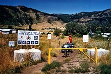 TCT bei Grandforks
Der Trans Canada Trail, gängige Abkürzung: TCT (auf Französisch sentier transcanadien), ist ein Radfern- und Wanderweg, der von der Ostküste zur Westküste Kanadas führt. Mitte 2004 sind etwa 62 Prozent der geplanten 18.078 km fertiggestellt. Die Vervollständigung war bis Ende 2005 geplant. Die gemeinnützige Trans Canada Trail Foundation koordiniert die Mitarbeit vieler Freiwilliger an dem Projekt, akquiriert öffentliche Mittel sowie Privatspenden. In den einzelnen Provinzen gibt es darüber hinaus weitere Organisationen, die sich um die Erweiterung und Instandhaltung von Teilstrecken kümmern.
Im Winter können einige Strecken des Trans Canada Trail auch als Skilanglaufloipe oder Schneemobilpiste genutzt werden.
Große Teile des Weges verlaufen über stillgelegte Bahntrassen.
Weblinks
Wikimedia Foundation.