Tumacacori-Carmen (Arizona)
- Tumacacori-Carmen (Arizona)
-
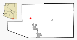
Tumacacori-Carmen ist ein Census-designated place im Santa Cruz County im US-Bundesstaat Arizona. Tumacacori-Carmen hat 569 Einwohner auf einer Fläche von 16,1 km². Das Dorf wird von der Interstate 19 tangiert und liegt am Santa Cruz River.
Geschichte
Tumacacori liegt am Ort, wo Ende 1700 ein Franziskaner-Mission errichtet wurde. Tumacacori bekam seinen Namen durch eine frühere Mission im Jahr 1691 von Missionar Eusebio Francisco Kino.
Wikimedia Foundation.
Schlagen Sie auch in anderen Wörterbüchern nach:
Tumacacori-Carmen, Arizona — Infobox Settlement official name = Tumacacori Carmen, Arizona settlement type = CDP imagesize = 300px image caption = Tumacacori mission, 1947. Photo: George A. Grant mapsize = 250px map caption = Location in Santa Cruz County and the state of… … Wikipedia
Tumacacori-Carmen — Lugar designado por el censo de los Estados Unidos … Wikipedia Español
Tumacacori-Carmen — Lage im County und in … Deutsch Wikipedia
Tumacacori-Carmen — Tumacacori Carmen, AZ U.S. Census Designated Place in Arizona Population (2000): 569 Housing Units (2000): 252 Land area (2000): 6.213475 sq. miles (16.092825 sq. km) Water area (2000): 0.000000 sq. miles (0.000000 sq. km) Total area (2000):… … StarDict's U.S. Gazetteer Places
Tumacacori-Carmen, AZ — U.S. Census Designated Place in Arizona Population (2000): 569 Housing Units (2000): 252 Land area (2000): 6.213475 sq. miles (16.092825 sq. km) Water area (2000): 0.000000 sq. miles (0.000000 sq. km) Total area (2000): 6.213475 sq. miles… … StarDict's U.S. Gazetteer Places
Tumacacori — Carmen, AZ U.S. Census Designated Place in Arizona Population (2000): 569 Housing Units (2000): 252 Land area (2000): 6.213475 sq. miles (16.092825 sq. km) Water area (2000): 0.000000 sq. miles (0.000000 sq. km) Total area (2000): 6.213475 sq.… … StarDict's U.S. Gazetteer Places
Tumacacori, AZ — Tumacacori Carmen, AZ U.S. Census Designated Place in Arizona Population (2000): 569 Housing Units (2000): 252 Land area (2000): 6.213475 sq. miles (16.092825 sq. km) Water area (2000): 0.000000 sq. miles (0.000000 sq. km) Total area (2000):… … StarDict's U.S. Gazetteer Places
Santa Cruz County, Arizona — Seal … Wikipedia
National Register of Historic Places listings in Santa Cruz County, Arizona — Location of Santa Cruz County in Arizona This is a list of the National Register of Historic Places listings in Santa Cruz County, Arizona. It is intended to be a complete list of the properties and districts on the National Register of Historic… … Wikipedia
Liste der National Historic Landmarks in Arizona — Die Liste der National Historic Landmarks in Arizona ist eine Denkmalliste von derzeit 41 vom US Innenministerium als National Historic Landmark (NHL) anerkannten Stätten und Denkmälern von nationaler Bedeutung im Bundesstaat Arizona. Sie werden… … Deutsch Wikipedia

