- Upper Lachlan Shire
-
Upper Lachlan Shire 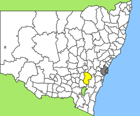
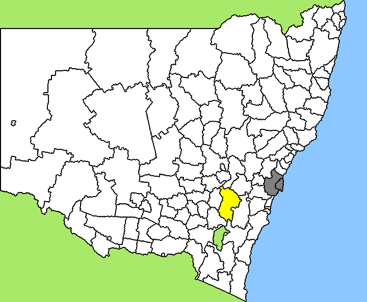
Lage des Upper Lachlan Shire in New South WalesGliederung Staat:  Australien
Bundesstaat:  New South Wales
Verwaltungssitz: Crookwell Daten und Zahlen Fläche: 7.102 km² Einwohner: 7.053 (2006) [1] Bevölkerungsdichte: 1 Einwohner je km² -34.45149.46666666667Koordinaten: 34° 27′ S, 149° 28′ ODas Upper Lachlan Shire ist ein lokales Verwaltungsgebiet (LGA) im australischen Bundesstaat New South Wales. Das Gebiet ist 7.102 km² groß und hat etwa 7.000 Einwohner.
Upper Lachlan liegt in der Süd-Ost-Region des Staates etwa 230 km südwestlich der Metropole Sydney und 130 km nordöstlich der australischen Hauptstadt Canberra. Das Gebiet umfasst 86 Ortsteile und Ortschaften, darunter Bannister, Bevendale, Biala, Bigga, Binda, Blakney Creek, Blanket Flat, Breadalbane, Broadway, Collector, Cottawalla, Crooked Corner, Crookwell, Cullerin, Dalton, Fish River, Fullerton, Glenerin, Golspie, Grabben Gullen, Gunning, Gurrundah, Hadley, Jerrawa, Kempton, Lade Vale, Laggan, Leighwood, Lerida, Limerick, Lost River, McAlister, Merrill, Mulgowrie, Oolong, Peelwood, Pejar, Roslyn, Taralga, Thalaba, Third Creek, Tuena, Wheeo, Wiarborough, Wowagin, Yalbraith sowie Teile von Middle Arm und Wayo. Der Sitz des Shire Councils befindet sich in der Stadt Crookwell im Zentrum der LGA, wo etwa 2.000 Einwohner leben.
Verwaltung
Der Upper Lachlan Shire Council hat neun Mitglieder, die von den Bewohnern der LGA gewählt werden. Upper Hunter ist nicht in Bezirke untergliedert. Aus dem Kreis der Councillor rekrutiert sich auch der Mayor (Bürgermeister) des Councils.
Weblinks
Einzelnachweise
- ↑ Australian Bureau of Statistics (25. Oktober 2007): Upper Lachlan (A) (Local Government Area) (Englisch). 2006 Census QuickStats. Abgerufen am 6. April 2010.
Kategorie:- Local Government Area in New South Wales
Wikimedia Foundation.