Ute Pass

Ute Pass

x

Ute Pass
UtePassSign.jpg
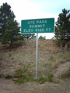
West Ost
Passhöhe 2.800 m
US-Bundesstaat Colorado (USA)
Talorte Florissant Woodland Park
Ausbau US 24.svg U.S. Highway 24
Gebirge Front Range (Rocky Mountains)
Karte
Ute Pass (Colorado)
Ute Pass
x x
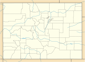
Koordinaten 38° 56′ 30″ N, 105° 9′ 25″ W38.941666666667-105.156944444442800Koordinaten: 38° 56′ 30″ N, 105° 9′ 25″ W

Der Ute Pass ist ein auf 2.800 m über dem Meeresspiegel gelegener Gebirgspass in der Front Range, einer Bergkette der Rocky Mountains.

Der Pass ist nach dem Indianerstamm der Ute benannt, der den Pass als Übergang in die östlich der Berge gelegenen Prärien nutzte.[1] 1887 erreichte der Bau der Colorado Midland Railroad den Pass; in unmittelbarer Nachbarschaft der Passhöhe wuchs in den folgenden Jahren die Stadt Divide heran.[2] Die Bahnstrecke wurde 1918 stillgelegt. Seit 1926 ist die Straße über den Pass als Teil des U.S. Highway 24 ausgewiesen und ist heute als vierspuriger Highway ausgebaut.

Literatur

  • Virginia McConnell, Ute Pass, Route of the Blue Sky People, Sage Books, Denver 1963.
  • Jan Petit, A Quick History of Ute Pass, Little London Press, Colorado Springs 1979.

Weblinks

Einzelnachweise

  1. Feature Detail Report for: Ute Pass (U. S. Board on Geographic Names)
  2. Ute Pass History (The Ute Pass Historical Society)

Wikimedia Foundation.

Игры ⚽ Поможем сделать НИР

Schlagen Sie auch in anderen Wörterbüchern nach:

  • Ute Pass — Infobox Mountain Pass Name = Ute Pass Photo = UtePassSign.jpg Caption = Ute Pass Elevation = 9165 ft./2793 m. Location = USA flag|Colorado Teller County Range = Front Range Coordinates = coord|38|56|30|N|105|09|25|W|type:pass Topographic… …   Wikipedia

  • Ute — NOTOC Ute may refer to: *Ute Tribe, an ethnically related group of American Indians now living primarily in Utah and Colorado **Ute Mountain Ute Tribe, descendants of the Weminuche band who moved to the western end of the Southern Ute Reservation …   Wikipedia

  • Cochetopa Pass — Just East of Cochetopa Pass Elevation 10,032 ft (3,058 m) …   Wikipedia

  • Kenosha Pass — Infobox Mountain Pass Name = Kenosha Pass Photo = Kenosha2.jpg Caption = East side of the pass Elevation = 3048 m./10,000 ft. Location = Colorado, USA Range = Front Range Coordinates = coord|39.413|N|105.758|W|type:pass… …   Wikipedia

  • Southern Rocky Mountains — Range Mount Elbert is the highest peak of the Southern Rocky Mountains …   Wikipedia

  • Mountain Metropolitan Transit — Headquarters 107 North Nevada Ave …   Wikipedia

  • Colorado Midland Railway — Le Colorado Midland Railway (sigle de l AAR: CM)[1], était un chemin de fer américain de classe I qui fut créé en 1883. Il fut le premier chemin de fer à écartement standard à franchir la ligne continentale de séparation des eaux dans le Colorado …   Wikipédia en Français

  • List of counties in Colorado — Adams Alam Arapahoe …   Wikipedia

  • Manitou Springs, Colorado — City of Manitou Springs, Colorado   City   Motto: At the foot of Pikes Peak …   Wikipedia

  • List of Colorado county name etymologies — This is a list of Colorado county name etymologies.cite web | date = 2001 04 18 | url = http://www.colorado.gov/dpa/doit/archives/arcgov.html | title = Colorado Government History | format = HTML | publisher = State of Colorado, Department of… …   Wikipedia

Share the article and excerpts

Direct link
Do a right-click on the link above
and select “Copy Link”