Vioolsdrif

Vioolsdrif
Vioolsdrift
Vioolsdrift (Südafrika)
DEC
Vioolsdrift
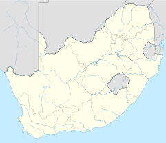
Vioolsdrift
Staat: Südafrika
Provinz: Nordkap
Distrikt: Namaqua
Gemeinde: Nama Khoi
Nächste Stadt: Noordoewer (Namibia)
Höhe: 300 m

-28.76888888888917.624444444444300Koordinaten: 28° 46′ S, 17° 37′ O

Vioolsdrift (afrikaans: Vioolsdrif) ist ein kleiner Ort und Grenzübergang nach Namibia in der Gemeinde Nama Khoi, Distrikt Namaqua, Provinz Nordkap in Südafrika.[1] Vioolsdrift liegt etwa 300 Meter über dem Meeresspiegel auf der Südseite des Oranje und ist mit dem gegenüberliegenden namibischen Grenzort Noordoewer auf der nördlichen Flussseite durch eine Straßenbrücke verbunden. Der Ort liegt etwa 350 Kilometer von der Mündung des Oranje in den Atlantik entfernt; bis nach Springbok ist es 110 Kilometer.

Der Hauptwirtschaftsfaktor ist die Landwirtschaft. Für die Bewässerung werden dem Fluss jährlich rund 15 Millionen Kubikmeter Wasser entnommen. Luzerne und Gemüse sind die Hauptprodukte. Der Bewässerungskanal wird vom Vioolsdrift-Wehr gespeist, das einige Kilometer stromaufwärts vom Grenzübergang liegt. Es bestehen Pläne, vor Vioolsdrift als Gemeinschaftsprojekt von Namibia und Südafrika einen Staudamm zu errichten. Zurzeit gibt es keine Möglichkeit das Wasser des Oranje und seiner Zuflüsse für Trockenzeiten aufzustauenM; der nächste Staudamm liegt 1.400 Kilometer stromaufwärts bei Vanderkloof.

Vioolsdrift ist über die südafrikanische Nationalstraße N7 mit Kapstadt verbunden.

Weblinks

Quellen

  1. Gemeindegrenzen Südafrika

Wikimedia Foundation.

Игры ⚽ Нужна курсовая?

Schlagen Sie auch in anderen Wörterbüchern nach:

  • Vioolsdrif — is a village on the Orange River in the north western part of South Africa. Origin of name The name in Afrikaans means the ford (shallow river crossing) of the violin . It is reportedly named after Jan Viool ( John Violin ), who is said to have… …   Wikipedia

  • Vioolsdrif — es un pueblo sobre el Río Orange en la parte noroeste de Sudáfrica. Contenido 1 Origen de nombre 2 Geografía 3 Turismo 4 Clima …   Wikipedia Español

  • Orange River — For other uses, see Orange River (disambiguation). Orange Gariep, Oranje, Senqu River …   Wikipedia

  • N7 road (South Africa) — National Route N7 Route information …   Wikipedia

  • Noordoewer — The Orange River on the border bridge between Noordoewer and Vioolsdrif. Extreme heat and sunlight cause visible evaporation …   Wikipedia

  • N7 (Afrique du Sud) — 31°18′47″S 18°34′55″E / 31.31306, 18.58194 …   Wikipédia en Français

  • Northern Cape — For other uses, see North Cape (disambiguation). Northern Cape Noord Kaap (Afrikaans) Kapa Bokone(Tswana) Mntla Koloni (Xhosa) …   Wikipedia

  • Namaqualand — A waterfall situated a few miles north of Nieuwoudtville on the road to Loeriesfontein, in the Northern Cape (Namaqualand region) …   Wikipedia

  • National Roads in South Africa — The National Road System is a network of highways that links all the major population centers in South Africa. The system was mostly built by the Apartheid government during the 1970s, although construction of new roads and repairs of existing… …   Wikipedia

  • Nama Khoi Local Municipality —   Local municipality   Seal …   Wikipedia

Share the article and excerpts

Direct link
Do a right-click on the link above
and select “Copy Link”