Vrmac

Vrmac
42.4518.72
Vrmac (Montenegro)
Vrmac
Vrmac
Die Halbinsel Vrmac vom Lovćen aus

Vrmac (Serbisch: Врмац) ist eine auf 710 m aufragende Halbinsel in der Bucht von Kotor in Montenegro.

Relief

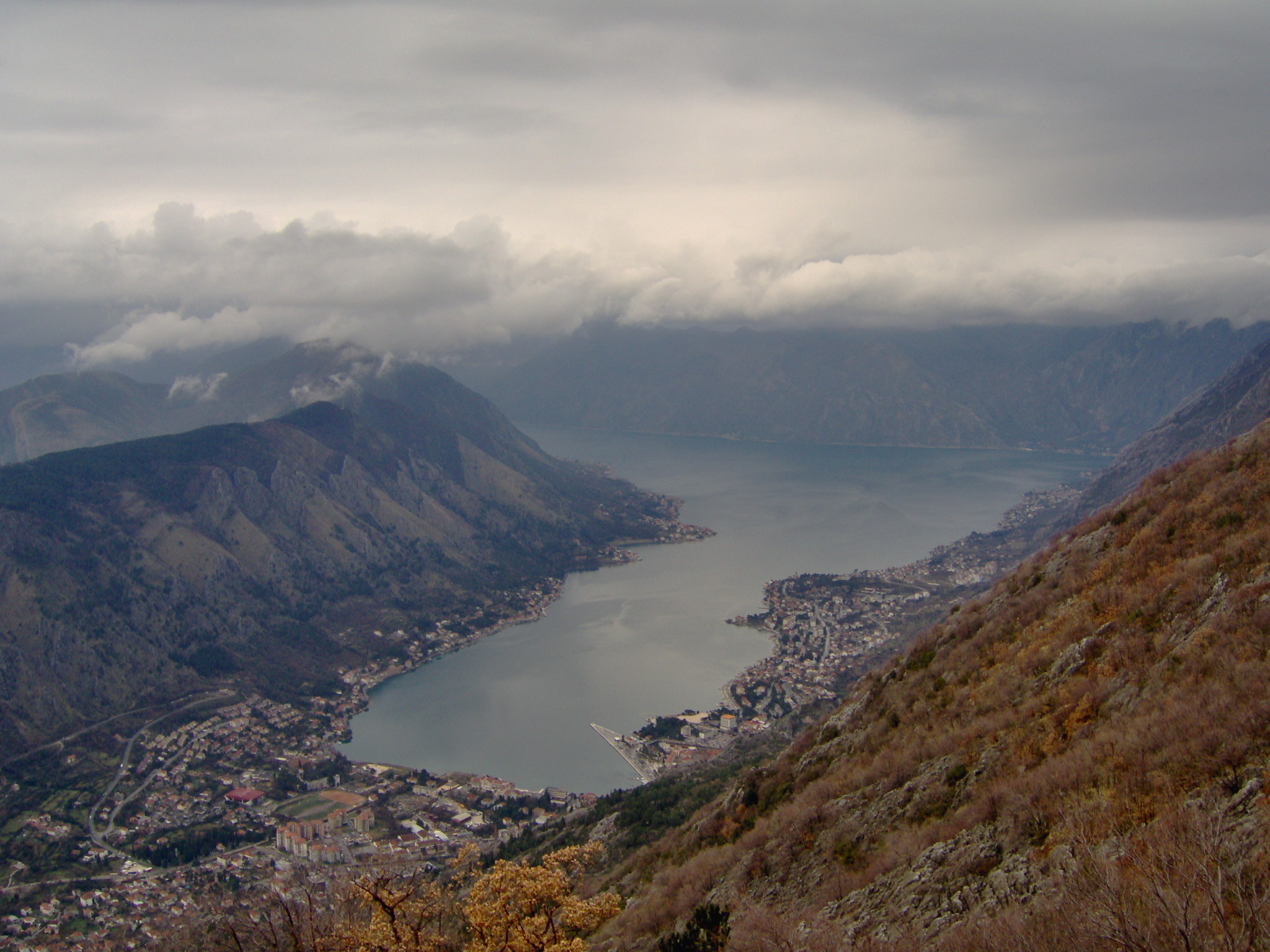
Die Halbinsel Vrmac liegt keilförmig zwischen den Becken von Kotor und Tivat und verschließt mit der schmalen und an der engsten Stelle nur 330 Meter breiten Meerenge Verige die inneren Buchten von Risan und Kotor. Die Halbinsel ist aus Flysch aufgebaut und zeigt daher interessante Fazien die durch kleine erosive Täler insbesondere von Kotor aus einen besonderen Kontrast zum gegenüberliegenden Hochkarst stellt. Das steile Relief verhindert eine stärkere Besiedlung. Die Niederwälder sind insbesondere durch Macchien geprägt.

Besiedlung

Die Halbinsel Vrmac ist heute nur noch wenig besiedelt. Am Ufer liegen die Städte Tivat, Lepetane, Stoliv, Prčanj und im Inneren die Dörfer Gornja Lastva und Donja Lastva.


Wikimedia Foundation.

Игры ⚽ Нужно решить контрольную?

Schlagen Sie auch in anderen Wörterbüchern nach:

  • Vrmac — ( sr. Врмац) is a mountain in southern Montenegro.It is an extension of Mount Lovćen, and is 710 m high. It is located north of town of Tivat, and encloses town of Kotor from the south. Vrmac Tunnel, which connects Kotor with the rest of… …   Wikipedia

  • Vrmac-Tunnel — Südportal des Vrmac Tunnel Offizieller Name Tunel Vrmac Nutzung Straßentunnel Verkehrsverbindung …   Deutsch Wikipedia

  • Vrmac Tunnel — ( sr. Тунел Врмац) is a vehicular tunnel in southern Montenegro.The tunnel, which is 1,637 m long, connects town of Kotor with Adriatic Motorway and the rest of Montenegro. It passes under the Mount Vrmac, thus eliminating the need to via the old …   Wikipedia

  • Bocche di Cattaro — Bucht von Kotor IRS Liss Satelitenkarte Geographische Lage: Montenegro Zuflüsse …   Deutsch Wikipedia

  • Boka Kotorska — Bucht von Kotor IRS Liss Satelitenkarte Geographische Lage: Montenegro Zuflüsse …   Deutsch Wikipedia

  • Boka kotorska — Bucht von Kotor IRS Liss Satelitenkarte Geographische Lage: Montenegro Zuflüsse …   Deutsch Wikipedia

  • Boka kotorská — Bucht von Kotor IRS Liss Satelitenkarte Geographische Lage: Montenegro Zuflüsse …   Deutsch Wikipedia

  • Verige — 42.47777777777818.687777777778 Koordinaten: 42° 28′ 40″ N, 18° 41′ 16″ O …   Deutsch Wikipedia

  • Tivat — Infobox Montenegro city name=Tivat city name cyr=Тиват mayor=Dragan Kankaraš (DPS SDP) area=46 population=9,467 municipality=13,630 Time zone=UTC+1 founded=19th century latitude=42.43 longitude=18.70 area code=82 car plates=TV postal=85320… …   Wikipedia

  • Bucht von Kotor — IRS Liss Satellitenkarte Geographische Lage Montenegro Zuflüsse (Unterseeische) Karstquelle …   Deutsch Wikipedia

Share the article and excerpts

Direct link
Do a right-click on the link above
and select “Copy Link”