- Wakefield Peace Dale
-
Wakefield-Peacedale 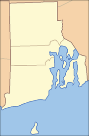

Wakefield-Peacedale Lage in Rhode IslandBasisdaten Staat: Vereinigte Staaten Bundesstaat: Rhode Island County: Washington County Koordinaten: 41° 26′ N, 71° 30′ W41.441111111111-71.499166666667Koordinaten: 41° 26′ N, 71° 30′ W Zeitzone: Eastern Standard Time (UTC−5) Einwohner: 8468 (Stand: 2000) Bevölkerungsdichte: 672,1 Einwohner je km² Fläche: 13,2 km²
davon 12,6 km² LandFIPS: 44-73130 Wakefield-Peacedale ist ein Census-designated place (CDP) in South Kingstown im Washington County, Rhode Island, Vereinigte Staaten.
Inhaltsverzeichnis
Bevölkerung
Wakefield-Peacedale zählte bei der Volkszählung 2000 8.468 Einwohner. Etwas mehr als 90 % der Einwohner waren Weiße, etwa 3 % amerikanische Indianer und knapp 2 % Afro-Amerikaner sowie 1,2 % Asiaten. Der restliche Anteil verteilte sich auf verschiedene Volksgruppen. Das Pro-Kopf-Einkommen betrug 24.191 US-Dollar; 5,4 % der Bevölkerung lebte unter der Armutsgrenze.
Geschichte
Peace Dale (auch Peacedale) wurde um 1800 von dem Industriellen Rowland Hazard (1763–1835) aus South Kingstown gegründet, der die Siedlung nach seiner Frau Mary Peace benannte. Auf Hazard soll die Verbreitung von Krempelmaschinen in Rhode Island zurückgehen, die er 1805 zum ersten Mal bei der Wollverarbeitung einsetzte, und damit seine Narragansett Cotton Manufacturing Company begründete, die bis 1918 unter verschiedenen Namen im Familienbesitz blieb. 1814 verwendete Hazard als Erster in Rhode Island schmale Kraftwebstühle – die Firma rühmte sich später, diese zum ersten Mal überhaupt erfolgreich eingesetzt zu haben –,[1] und vereinigte alle Abläufe bei der Wollverarbeitung unter einem Dach.
Die nahe gelegene Ortschaft Wakefield hieß ursprünglich McCoon's Mill nach einer dort installierten Tabakmühle. 1820 benannte Hazard die Ortschaft nach dem englischen Ort Wakefield, da er dort Freunde besaß.
Das Zentrum von Wakefield ist seit 1996 unter der Nummer 87000493 als Wakefield Historic District im National Register of Historic Places verzeichnet.[2]
Weblinks
- Wakefield, RI. Community Profile. National Marine Fisheries Service, Northeast Fisheries Science Center (pdf, 128 kB)
- Rick Stattler und Steve Dalpe: Peace Dale Manufacturing Company Records. Rhode Island Historical Society Manuscripts Division, 1999
Einzelnachweise
- ↑ Stattler & Dalpe 1999
- ↑ National Register of Historic Places

Wikimedia Foundation.