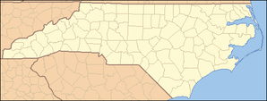
- Wilson's Mills
-
Wilson’s Mills Lage in North CarolinaBasisdaten Staat: Vereinigte Staaten Bundesstaat: North Carolina County: Johnston County Koordinaten: 35° 35′ N, 78° 21′ W35.577777777778-78.35583333333370Koordinaten: 35° 35′ N, 78° 21′ W Zeitzone: Eastern Standard Time (UTC−5) Einwohner: 1504 (Stand: 2006) Bevölkerungsdichte: 158,3 Einwohner je km² Fläche: 9,5 km²
davon 9,5 km² LandHöhe: 70 m Postleitzahl: 27593 Vorwahl: +1 919 FIPS: 37-74580 GNIS-ID: 0997462 Wilson’s Mills ist eine Kleinstadt und County Seat des Johnston Countys in North Carolina in den Vereinigten Staaten mit 1.291 Einwohnern (Stand: 2000).
Geographie
Das Gemeindegebiet umfasst 29,6 km².
Demographie
In der Stadt leben 1.291 Menschen in 465 Haushalten, davon sind 357 Familien (Stand: 2000).
Orte: Benson | Clayton | Four Oaks | Kenly | Micro | Pine Level | Princeton | Selma | Smithfield | Wilson's Mills | Zebulon (North Carolina)
CDP: West Smithfield
Wikimedia Foundation.

