- Wollongong City
-
City of Wollongong 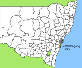
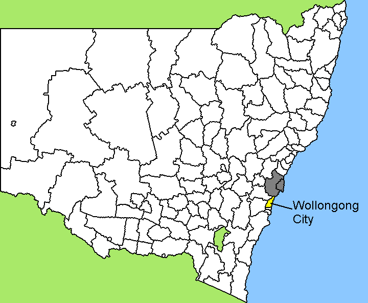
Lage von Wollongong City in New South WalesGliederung Staat:  Australien
Bundesstaat:  New South Wales
Verwaltungssitz: Wollongong Daten und Zahlen Fläche: 684 km² Einwohner: 184.212 (2006) [1] Bevölkerungsdichte: 269 Einwohner je km² Wards: 6 -34.416666666667150.88333333333Koordinaten: 34° 25′ S, 150° 53′ ODie City of Wollongong ist ein lokales Verwaltungsgebiet (LGA) im australischen Bundesstaat New South Wales. Das Gebiet ist 684 km² groß und hat etwa 184.000 Einwohner.
Wollongong liegt an der Pazifikküste des Staates in der Region Illawarra etwa 80 km südlich der Metropole Sydney. Das Gebiet umfasst 138 Ortsteile und Ortschaften, darunter Austinmer, Balgownie, Bellambi, Berkeley, Brownsville, Bulli, Clifton, Coalcliff, Coledale, Coniston, Cordeaux Heights, Corrimal, Cringila, Dapto, Fairy Meadow, Farmborough Heights, Figtree, Gwynneville, Horsley, Kanahooka, Keiraville, Kemblawarra, Koonawarra, Lake Heights, Mangerton, Mount Keira, Mount Kembla, Mount Ousley, Mount Pleasant, Mount Saint Thomas, Penrose, Port Kembla, Primbee, Scarborough, Stanwell Park, Thirroul, Towradgi, Unanderra, Warrawong, Windang, Wollongong, North Wollongong, West Wollongong, Wombarra, Woonona und Yallah. Der Sitz des City Councils befindet sich im Stadtteil Wollongong.
Verwaltung
Der Wollongong City Council hat 13 Mitglieder, die von den Bewohnern der LGA gewählt werden. Je zwei Mitglieder kommen aus den Wards 1 bis 6, der Vorsitzende und Mayor (Bürgermeister) wird zusätzlich von allen Bewohnern der LGA gewählt. Die sechs Wahlbezirke sind unabhängig von den Ortschaften festgelegt.
Weblinks
Einzelnachweise
- ↑ Australian Bureau of Statistics (25. Oktober 2007): Wollongong (C) (Local Government Area) (Englisch). 2006 Census QuickStats. Abgerufen am 6. April 2010.
Wikimedia Foundation.