Bengtskär

Bengtskär

Vorlage:Infobox Insel/Wartung/Bild fehltVorlage:Infobox Insel/Wartung/Höhe fehlt

Bengtskär
Gewässer Ostsee
Geographische Lage 59° 43′ 22″ N, 22° 29′ 56″ O59.72277777777822.498888888889Koordinaten: 59° 43′ 22″ N, 22° 29′ 56″ O
Bengtskär (Finnland)
Bengtskär
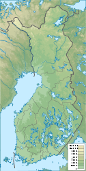
Länge 250 m
Breite 160 m
Fläche 2,5 ha

Bengtskär [ˈbɛŋtʃæːr] ist die südlichste bewohnte finnische Insel. Sie liegt in der Ostsee am Eingang zum Finnischen Meerbusen, etwa 25 km südwestlich von Hanko, 200 km von Helsinki und 100 km südöstlich von Turku im schwedischsprachigen Teil Finnlands. Daher hat auch der Name seinen Ursprung. Bengt ist ein schwedischer Männername, skär bedeutet schwedisch eine kleine Felseninsel (Schäre).

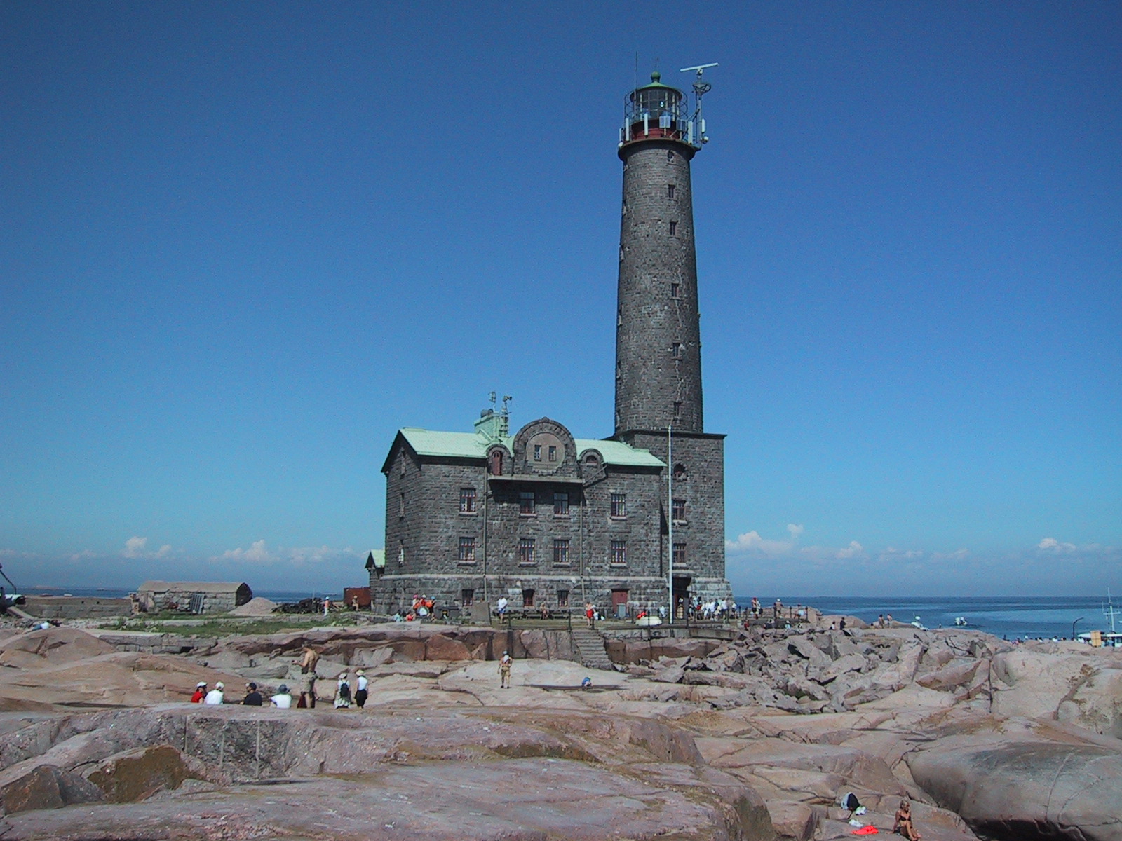
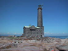
Leuchtturm auf Bengtskär

Der Leuchtturm Bengtskär ist mit 52 m über dem Meer der höchste Leuchtturm in den Nordischen Ländern. Das Haus beherbergt im Sommer ein kleines Hotel.

Weblinks

 Commons: Leuchtturm von Bengtskär – Sammlung von Bildern, Videos und Audiodateien

Wikimedia Foundation.

Игры ⚽ Поможем написать курсовую

Schlagen Sie auch in anderen Wörterbüchern nach:

  • Bengtskär — Le Phare de Bengtskär en 1992. Géographie Pays …   Wikipédia en Français

  • Bengtskär — is a skerry 25 kilometers southwest of Hanko, and part of the municipality of Dragsfjärd. This rocky skerry is the southern most inhabited place in Finland, and is reached by ferry from the village of KasnäsThe lighthouse on the skerry is the… …   Wikipedia

  • Bengtskar — Bengtskär Géographie Pays  Finlande Archipel Archipel finlandais Localisation Golfe de Finlande ( …   Wikipédia en Français

  • Battle of Hanko (1941) — Battle of Hanko Part of Continuation War Map showing the borders of the leased area …   Wikipedia

  • Hanko — (pronounced|ˈhɑŋko) in Finnish, Hangö in Swedish, and Гангут in Russian), is a bilingual port town on the south coast of Finland, 130 km west of Helsinki. Its current population is 9,905 (2004 12 31), with a majority being Finnish speakers and a… …   Wikipedia

  • Märket — Localización País …   Wikipedia Español

  • HNoMS Olav Tryggvason — The minelayer HNoMS Olav Tryggvason was built for the Royal Norwegian Navy by the naval shipyard at Horten in the early 1930s and had build number 119. [Horten municipal archive of local history: [http://www.lokalhistoriskarkiv.no/arkivet/historis… …   Wikipedia

  • VMV class patrol boat — ( fi. Vartiomoottorivene) was a series of Finnish patrol boats, which served with the Finnish Coast Guard and the Finnish Navy during World War II.DevelopmentThe VMV boats were designed by dipl.eng. Jaakko Rahola of the Finnish Navy. The design… …   Wikipedia

  • Kemiönsaari — Kimitoön kommun Kemiönsaaren kunta Wappen Karte Basisdaten …   Deutsch Wikipedia

  • Liste deutscher Leuchttürme — In diesem Artikel oder Abschnitt fehlen folgende wichtige Informationen: Es fehlen beispielsweise noch dänische Leuchttürme Du kannst Wikipedia helfen, indem du sie recherchierst und einfügst …   Deutsch Wikipedia

Share the article and excerpts

Direct link
Do a right-click on the link above
and select “Copy Link”