- Blackwood River
-
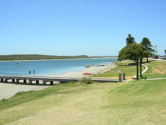
Blackwood River Colour Patch an der Mündung des Blackwood River und östlicher Teil des Ästuars
Daten Lage Western Australia Flusssystem Blackwood River Abfluss über Blackwood River → Indischer Ozean Ursprung Zusammenfluss von Arthur River und Balgarup River
33° 41′ 0″ S, 116° 43′ 57″ O-33.683282116.732397215Quellhöhe 215 m[1] Mündung Flinders Bay, Indischer Ozean -34.323333333333115.171111111110Koordinaten: 34° 19′ 24″ S, 115° 10′ 16″ O
34° 19′ 24″ S, 115° 10′ 16″ O-34.323333333333115.171111111110Mündungshöhe 0 m[1] Höhenunterschied 215 m Länge 383 km[1] Einzugsgebiet 28.100 km²[2] Abflussmenge[3] MQ: 29,8 m³/s Rechte Nebenflüsse Arthur River, Haddleton Gully, Eulin Brook, Kitchanning Brook, Four Mile Gully, Boyup Brook, Bull Creek, Waterhole Gully, Savages Creek, Ti Tree Gully, Geegelup Brook, Hester Brook, Woljenup Creek, Maranup Brook, Norilup Brook, Balingup Brook, Pinch Gully, St. John Brook, McAtee Brook, Rosa Brook, Adelaide Brook, Chapman Brook, McLeod Creek Linke Nebenflüsse Balgarup River, Boree Gully, Dinninup Brook, Gnowergerup Brook, Tweed River, Ballajup Brook, Gregory Brook, Camp Brook, Running Brook, Quongup Brook, Post and Rail Gully, Ellis Creek, Christmas Creek, Tanjannerup Creek, The Dry Brook, Long Gully, Milyeannup Brook, Scott River Mittelstädte Bojup Brook, Bridgetown, Nannup, Augusta Kleinstädte Lewana, Jalbaragup, Darradup Barrabup Pool im Blackwood River bei Nannup
Der Blackwood River ist ein größerer Fluss im Südwesten des australischen Bundesstaates Western Australia.
Inhaltsverzeichnis
Geografie
Er entsteht in der Darling Range aus dem Zusammenfluss von Arthur River und Balgarup River, fließt in nordwestlicher Richtung zum Kap Leeuwin und mündet dort in den Indischen Ozean, nachdem er die Stadt Augusta passiert hat. Der Fluss erreicht eine Länge von ca. 380 Kilometern.
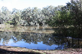
Am Oberlauf fließt der Fluss durch landwirtschaftlich genutztes Gebiet, während der Mittellauf vorwiegend durch Wald verläuft. Am Unterlauf finden sich sowohl Landwirtschaft als auch Wälder, aber auch dichter besiedelte Gebiete.
Das Hardy Inlet, in das der Blackwood River mündet, besitzt eine Reihe von Inseln, darunter Molloy Island und Thomas Island. Die Mündung in den südlichen Ozean bei Augusta hat sich in den vergangenen 100 Jahren mehrfach geschlossen und wieder geöffnet. Der Duke Head an ihrer Westseite kann als Bezugspunkt für diese Veränderungen dienen.
Nebenflüsse[1] mit Mündungshöhen
- Balgarup River – 215 m
- Arthur River – 215 m
- Haddleton Gully – 211 m
- Eulin Brook – 210 m
- Kitchanning Brook – 202 m
- Boree Gully – 200 m
- Four Mile Gully – 196 m
- Dinninup Brook – 196 m
- Boyup Brook – 190 m
- Gnowergerup Brook – 182 m
- Tweed River – 181 m
- Bull Creek – 165 m
- Ballajup Brook – 161 m
- Waterhole Gully – 160 m
- Savages Creek – 150 m
- Ti Tree Gully – 148 m
- Geegelup Brook – 139 m
- Hester Brook – 113 m
- Woljenup Creek – 113 m
- Maranup Brook –113 m
- Gregory Brook – 110 m
- Camp Brook – 103 m
- Norilup Brook – 101 m
- Balingup Brook – 96 m
- Running Brook – 94 m
- Quonup Brook – 94 m
- Post and Rail Gully – 86 m
- Ellis Creek – 85 m
- Christmas Creek –80 m
- Tanjannerup Creek – 76 m
- The Dry Brook – 74 m
- Pinch Gully – 73 m
- Long Gully – 72 m
- St. John Brook – 56 m
- McAtee Brook – 53 m
- Milyeannup Brook – 42 m
- Rosa Brook – 33 m
- Adelaide Brook – 24 m
- Chapman Brook – 13 m
- McLeod Creek – 8 m
- Scott River – 0 m
Geschichte
Der Blackwood River wurde von Captain (später: Admiral Sir) James Stirling als erstem Europäer 1827 entdeckt und nach Henry Blackwood benannt, unter dem Stirling in seiner Jugend zwei Jahre lang gedient hatte.
Historisch war der Fluss in den ersten Tagen der Swan River Colony sehr wichtig. In der letzten Zeit machte er eher im Konflikt der Ökologie der Augusta-Margaret-River-Region mit der Landnutzungsstrategie von sich reden.
Einzelnachweise
- ↑ a b c d Map of Blackwood River, WA. Bonzle.com
- ↑ Ribbons of Blue – Blackwood Region. Waters and Rivers Commission
- ↑ Ecological Water Requirements of Blackwood River an Tributaries. Water Coeporation (2007)
Literatur
- Anne Brearley: Ernest Hodgkin's Swanland : estuaries and coastal lagoons of South-western Australia. University of Western Australia Press for the Ernest Hodgkin Trust for Estuary Education and Research and National Trust of Australia. Crawley WA (2005). ISBN 1-920694-38-2
- Peter Muirden, Luke Pen & Marnie Leybourne: Stream and catchment hydrology in South West Western Australia. Department of Environment River Restoration, 1442-6919. Report Nr. RR19. Perth WA (2003). ISBN 1920849246
- Luke J. Pen (Herausgeber: June Hutchison): Managing our rivers: a guide to the nature and management of the streams of south-west Western Australia. Water and Rivers Commission. East Perth WA (1999). ISBN 0730974502
Wikimedia Foundation.


