- Brentwood (New Hampshire)
-
Brentwood 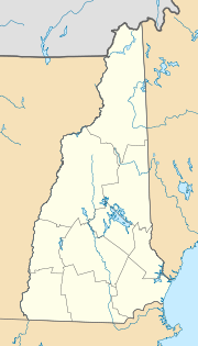

Brentwood Lage in New HampshireBasisdaten Staat: Vereinigte Staaten Bundesstaat: New Hampshire County: Koordinaten: 42° 59′ N, 71° 4′ W42.978611111111-71.07277777777835Koordinaten: 42° 59′ N, 71° 4′ W Zeitzone: Eastern Standard Time (UTC−5) Einwohner: 3197 (Stand: 2000) Bevölkerungsdichte: 73,3 Einwohner je km² Fläche: 44,0 km² (ca. 17 mi²)
davon 43,6 km² (ca. 17 mi²) LandHöhe: 35 m Postleitzahl: 03833 Vorwahl: +1 603 FIPS: 33-07220 GNIS-ID: 0873550 Webpräsenz: brentwood.town-center.org Brentwood ist eine Stadt (town) in New Hampshire und Sitz von Teilen der Verwaltung von Rockingham County. Brentwood hat 3.197 Einwohner (Volkszählung 2000). In Brentwood liegt der Rockingham County Botanic Garden
Geographie
Brentwood wird durch die Flüsse Piscassic, Little und Exeter entwässert. Der Ort hat eine Fläche von 44 km², davon sind 43,6 km² Land und 0,4 km² (0,94 %) Wasserfläche. Der höchste Punkt in Brentwood ist Great Hill (Großer Hügel) 84 m über dem Meeresspiegel, gelegen im südöstlichen Gemeindegebiet.
Geschichte
Bevor Europäer in Brentwood siedelten, waren die Gebiete um Brentwood vom Abenaki-Stamm Pennacook. Als die Engländer nach New Hampshire kamen, war Brentwood ein Teil des Ortes Exeter und als Brentwood Parish bekannt, benannt nach dem Ort Brentwood in der englischen Grafschaft Essex, dessen Name sich von Burnt Wood (verbranntes Holz) herleitet.
Kategorien:- Ort in New Hampshire
- County Seat in New Hampshire

Wikimedia Foundation.