- Amorim (Póvoa de Varzim)
-
Amorim Wappen Karte 
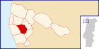
Basisdaten Region: Norte Unterregion: Grande Porto Distrikt: Porto Concelho: Póvoa de Varzim Koordinaten: 41° 24′ N, 8° 45′ W41.405497-8.746948Koordinaten: 41° 24′ N, 8° 45′ W Einwohner: 2.856 (Stand: 2001) Fläche: 4,8 km² Bevölkerungsdichte: 595 Einwohner pro km² Postleitzahl: 4495-140 Politik Adresse der Gemeindeverwaltung: Junta de Freguesia de Amorim
Rua Padre Alexandre Faria Barros 3
4495-140 AmorimAmorim ist eine Gemeinde im Norden Portugals.
Amorim gehört zum Kreis Póvoa de Varzim im Distrikt Porto, besitzt eine Fläche von 4,8 km² und hat 2.856 Einwohner (Stand: 2001).[1]
Einzelnachweise
- ↑ Daten zu Amorim. alea.pt, abgerufen am 5. Juni 2011 (englisch).
Weblinks
- Karte der Freguesia Amorim beim Instituto Geográfico do Exército
- Information zu Amorim. cm-pvarzim.pt, abgerufen am 5. Juni 2011 (portugiesisch).
 Freguesias im Concelho Póvoa de Varzim
A Ver-o-Mar | Aguçadoura | Amorim | Argivai | Balasar | Beiriz | Estela | Laundos | Navais | Póvoa de Varzim | Rates | Terroso
Wikimedia Foundation.
Schlagen Sie auch in anderen Wörterbüchern nach:
Amorim, Póvoa de Varzim — Infobox Parish pt official name = Amorim image coat of arms = PVZ amorim.png Municipality = Póvoa de Varzim area total = 5.65 population total = 2,856 (2001) population density = 397.9 website = none footnotes =Amorim is a Portuguese parish,… … Wikipedia
Póvoa de Varzim — Saltar a navegación, búsqueda Póvoa de Varzim … Wikipedia Español
Póvoa de Varzim — Wappen Karte … Deutsch Wikipedia
Póvoa de Varzim — ] Culture and contemporary lifeJunqueira is Póvoa de Varzim s busiest and most traditional shopping district, the main street opened in the 18th century and is a pedestrian area since 1955. Currently, it has about 1 km (or 0.62 mi) of pedestrian… … Wikipedia
Póvoa de Varzim neighbourhoods — The Póvoa de Varzim City Planning Commission divided the city into 11 districts ( partes , lit. parts ), each with distinctive zones ( zonas ).While most of these assigned boundaries match with traditional local designations, some others differ… … Wikipedia
Geography of Póvoa de Varzim — Póvoa de Varzimcoord|41|22|59|N|8|46|00|W|display=title, with an area of 82.06 square kilometres, lies between the Cávado and Ave rivers, or, from a wider perspective, halfway between the Minho and Douro rivers on the northern coast of Portugal… … Wikipedia
Civil Parishes of Póvoa de Varzim — Map with the 12 civil parishes of Póvoa de Varzim Póvoa de Varzim is divided into twelve civil parishes. These are grouped in two areas: urban (city) and rural. Between 1308 and 1836, the municipality was made up of a single parish territory of… … Wikipedia
Transport in Póvoa de Varzim — The city of Póvoa de Varzim is served by a developed transportation network that employs maritime, aerial and terrestrial travel. The terrestrial access infrastructure is composed of national motorways (freeways), the national roads system, and… … Wikipedia
Sports in Póvoa de Varzim — The city has developed a number of sporting venues and because of that it has hosted several national, European and world championships in different sports. 38% of the population practise sport, a high rate when compared to the national… … Wikipedia
Demographics of Póvoa de Varzim — As of 2004, there were 65452 inhabitants in the whole of Póvoa de Varzim. According to the 2001 Census, there were 63470 inhabitants that year, 61.2% of which lived in the city (composed of three civil parishes). In comparison to 1991, the urban… … Wikipedia
Amorim (Póvoa de Varzim)


18+
© Academic, 2000-2026
- Kontaktieren Sie uns: Unterstützung, Werbung
Wörterbücher Export, schritte mit PHP, Joomla, Drupal, WordPress, MODx.