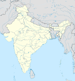
Bardhaman (Division)

Bardhaman (Division)

Vorlage:Infobox Division in Indien/Wartung/Einwohner

Bardhaman Division
Bardhaman (Division) (Indien)
Reddot.svg
Bundesstaat: Westbengalen
Koordinaten 23° 14′ N, 87° 52′ O23.23833333333387.860833333333Koordinaten: 23° 14′ N, 87° 52′ O
Verwaltungssitz:
Fläche: 37.154 km²
Distrikte: 7

Bardhaman (auch Burdwan genannt) ist eine Division im indischen Bundesstaat Westbengalen.

Geschichte

Am 1. Januar 2002 wurde das Distrikt Medinipur in die beiden Distrikte Paschim Medinipur und Purba Medinipur aufgeteilt.

Distrikte

Die Division Burdwan besteht aus sieben Distrikten:

Distrikt Hauptstadt Fläche in km² Einwohner (Stand: 2001) Bev.-Dichte in E/km²
Bankura Bankura 6.882 3.191.822 464
Bardhaman Bardhaman 7.024 6.895.514 974
Birbhum Suri 4.545 3.015.422 663
Hugli Chunchura 3.149 5.040.047 1.601
Pashchim Medinipur Medinipur 5.335 *
Purba Medinipur Tamluk 3.960 *
Purulia Purulia 6.259 2.536.516 405

* Die letzten Daten der letzten Volkszählung stammen von 2001, sodass es im Moment (noch) keine Daten für die beiden Distrikte gibt, da sie erst 2002 gebildet wurden.


Wikimedia Foundation.

Игры ⚽ Нужна курсовая?

Schlagen Sie auch in anderen Wörterbüchern nach:

  • Bardhaman — Infobox Indian Jurisdiction native name=Bardhaman latd=23|latm=14|lats=18|longd=87|longm=51|longs=39 state name=West Bengal district=Bardhaman District leader title=Municipality Chairman leader name=Abhijit Karmakar altitude=30 population as of …   Wikipedia

  • Dwariapur, Bardhaman — Dwariapur   village   …   Wikipedia

  • Nabagram, Bardhaman — For other towns with same name, see Nabagram. Nabagram, Shyamsunderbati   village   …   Wikipedia

  • Andal, Bardhaman — Ondal redirects here. For Goguryeo s general, see Ondal (Goguryeo). For the Tamil saint, see Aandaal. Andal   city   …   Wikipedia

  • Burdwan Division — is a division of West Bengal. It consists of 7 districts: * Bankura district * Bardhaman district * Birbhum district * East Midnapore (Purba Medinipur) * Hooghly district * Purulia district * West Midnapore (Paschim Medinipur)References …   Wikipedia

  • Geography of West Bengal — West Bengal audio|West Bengal.ogg|pronunciation (Bengali: পশ্চিমবঙ্গ, Poshchimbôŋgo ) is a state in eastern India. Geography of West Bengal is diverse, consisting of high peaks of Himalaya in the northern extremes to coastal regions down south,… …   Wikipedia

  • Bankura district — Infobox Indian Jurisdiction native name = Bankura map caption = Map of West Bengal showing Bankura district type = district hq = Bankura latd=23 |latm=14 |lats=04 | longd=87 |longm=04 |longs=21 state name = West Bengal abbreviation = IN WB BN… …   Wikipedia

  • Bankura — Infobox Indian Jurisdiction native name = Bankura | type = city | latd = 23.25 | longd = 87.07 locator position = right | state name = West Bengal district = Bankura leader title = leader name = altitude = 78 population as of = 2001 population… …   Wikipedia

  • Durgapur subdivision —   subdistrict   …   Wikipedia

  • Mongalkote (community development block) — Mongalkote   Community development block   …   Wikipedia

Share the article and excerpts

Direct link
Do a right-click on the link above
and select “Copy Link”