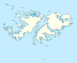
Bleaker Island

Bleaker Island

Vorlage:Infobox Insel/Wartung/Bild fehlt

Bleaker Island
Gewässer Südatlantik
Inselgruppe Falklandinseln
Geographische Lage 52° 12′ S, 58° 51′ W-52.2-58.8527Koordinaten: 52° 12′ S, 58° 51′ W
Bleaker Island (Falklandinseln)
Bleaker Island
Länge 19 km
Breite 2,5 km
Fläche 20,7 km²
Höchste Erhebung Semaphore Hill
27 m

Bleaker Island (spanisch Isla María) ist eine Insel der Falklandinseln im Südatlantik. Bleaker Island befindet sich südöstlich von Ostfalkland. Der Name ist eine Verballhornung von der vorherigen Bezeichnung "Breaker Island" (Brecher Insel), da die Wellen an der Insel brechen.

Inhaltsverzeichnis

Geographie

Bleaker Island ist eine lange schmale Insel etwa 2070 ha groß, 19 km lang und 2,5 km breit. Der längste und schönste Strand ist der 2 km lange Sandy Bay.[1] Die Küsten sind von kleinen Klippen und verschiedenen Strandarten geprägt.

Flora und Fauna

Die Nordhälfte der Insel ist ein offiziell ausgezeichnetes Naturreservat. Bleaker Island bietet vielen Tierarten einen geschützten Lebensraum. 49 Vogelarten wurden bisher katalogisiert, von denen 37 auf der Insel brüten, darunter auch Magellan- und Esels-Pinguine.[1] Des Weiteren findet man auch viele Blauaugenscharben und Felsenpinguine.

Es wurden auch insgesamt 79 Pflanzenarten erfasst, unter anderem Cypripedioideae und weitere Orchideen und Tussockgras.[2]

Quellen

  1. a b [1]
  2. Falklands wichtige Vogelgebiete

Siehe auch

Weblinks


Wikimedia Foundation.

Игры ⚽ Нужен реферат?

Schlagen Sie auch in anderen Wörterbüchern nach:

  • Bleaker Island — Infobox Falkland island MapCaption= latitude= 52.2067 longitude= 58.8506 coordinates= coord|52|12|24|S|58|51|02|W|display=inline,title island group= english name= Bleaker Island former name= Long Island/Breaker Island spanish name= Isla Maria… …   Wikipedia

  • Long Island (disambiguation) — Long Island may refer to one of the following:PlacesAntigua and Barbuda* Long Island, Antigua, a small island off the coast of AntiguaAustralia* Long Island (New South Wales) * Long Island, New South Wales, locality in Sydney * Long Island… …   Wikipedia

  • Long Island, Falkland Islands — Infobox Falkland island MapCaption=Early mapping of Long Island (Dom Pernety, 1769) latitude= 51.55 longitude= 58.06667 coordinates= island group= english name= Long Island former name=Isle Brûlée spanish name=Isla Larga meaning of name= area=… …   Wikipedia

  • New Island — Location …   Wikipedia

  • Craggy Island — is a fictional island off the west coast of Ireland and is the primary setting for the comedy television series Father Ted .Wholly bleak, desolate and otherwise unpleasant, Craggy Island is not found on any map and contains no places anyone would …   Wikipedia

  • Dunbar Island — Coordinates: 51°21′00″S 60°22′00″W / 51.35°S 60.36667°W / 51.35; 60.36667 …   Wikipedia

  • Dyke Island — Location …   Wikipedia

  • List of islands in the Atlantic Ocean — This is a list of islands in the Atlantic Ocean.*Azores ** São Miguel ** Santa Maria ** Terceira ** Graciosa ** São Jorge ** Pico ** Faial Island ** Flores ** Corvo *Barbados *Bermuda *Bouvet Island *Canary Islands **Lanzarote **Fuerteventura… …   Wikipedia

  • Liste der Falklandinseln — Die Falklandinseln (auch Malwinen, englisch Falkland Islands, spanisch Islas Malvinas) werden sowohl von Großbritannien als auch von Argentinien beansprucht, und für die meisten Orts und Flurnamen gibt es sowohl eine englische als auch eine… …   Deutsch Wikipedia

  • Toponimia de las islas Malvinas — Mapa de las Islas Malvinas, con la toponimia argentina (clicar en la imagen para agrandarla) …   Wikipedia Español

Share the article and excerpts

Direct link
Do a right-click on the link above
and select “Copy Link”