Bondali

Bondali
Bondali
13.234593928056-15.914114{{{elevation_save}}}Koordinaten: 13° 14′ N, 15° 55′ W
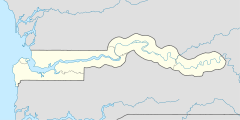
Karte: Gambia
marker
Region: West Coast
Distrikt: Foni Bondali
Einwohner: 1.095 (2011)

EW3

Bondali (Schreibvariante: Bondali Jola) ist eine Ortschaft im westafrikanischen Staat Gambia.

Nach einer Berechnung für das Jahr 2011 leben dort etwa 1095 Einwohner, das Ergebnis der letzten veröffentlichten Volkszählung von 1993 betrug 681.[1]

Inhaltsverzeichnis

Geographie

Bondali liegt in der West Coast Region, Distrikt Foni Bondali. Der Ort liegt an der South Bank Road, zwischen Sanajor und Kalagi.

Kultur und Sehenswürdigkeiten

Bei Bondali ist ein heiliger Baum als Kultstätte unter den Namen Kang Jiramba/Kang Tate und zwischen Bondali und Bwiam ein heiliger Baum unter den Namen Kanjendi bekannt.[2]

Siehe auch

Einzelnachweise

  1. Bondali in World Gazetteer, Zugriff Juli 2011
  2. Allen Meagher, Andrew Samuel, Baba Ceesay, National Council for the Arts and Culture (Gambia) et al: Historic sites of The Gambia : an official guide to the monuments and sites of The Gambia. National Council for the Arts and Culture, Banjul, The Gambia 1998, ISBN 9983-80-011-014 (formal falsche ISBN)

Wikimedia Foundation.

Игры ⚽ Поможем сделать НИР

Schlagen Sie auch in anderen Wörterbüchern nach:

  • Foni Bondali — Lage des Distrikts in der West Coast Region …   Deutsch Wikipedia

  • Foni Bondali — is one of the nine districts of The Gambia s Western Division, which is located to the south of the Gambia River in the southwest of the country. Foni Bondali is in the southeast of the division, between Foni Kansala and Foni Jarrol …   Wikipedia

  • Foni Bondali — Admin ASC 2 Code Orig. name Foni Bondali Country and Admin Code GM.05.2413480 GM …   World countries Adminstrative division ASC I-II

  • Liste von Kultplätzen in Gambia — Die Liste von Kultplätzen in Gambia listet Kultstätten oder Kultplätze im westafrikanischen Staat Gambia auf. Die Auflistung wurde vom National Centre for Arts Culture 1998 veröffentlicht. Die Kultstätten sind näher klassifiziert als „heilig“… …   Deutsch Wikipedia

  • Kanfenkeng — 13.179059030833 15.9340041{{{elevation save}}}Koordinaten: 13°  …   Deutsch Wikipedia

  • Kanjending — 13.179059030833 15.9340041{{{elevation save}}}Koordinaten: 13°  …   Deutsch Wikipedia

  • Kalang — 13.255774828056 15.9589716{{{elevation save}}}Koordinaten: 13° 15′  …   Deutsch Wikipedia

  • Kanilai — Infobox Settlement official name =PAGENAME other name = native name = nickname = settlement type = motto = imagesize = image caption = flag size = image seal size = image shield = shield size = image blank emblem = blank emblem type = blank… …   Wikipedia

  • North Bank Division — Location of North Bank Division in The Gambia North Bank is one of the five administrative divisions of The Gambia. Its capital is Kerewan …   Wikipedia

  • Western Division (The Gambia) — Western Division is one of the five administrative divisions of The Gambia. Its capital is Brikama.Western Division is divided into 9 districts: *Foni Bintang Karenai *Foni Bondali *Foni Brefet *Foni Jarrol *Foni Kansala *Kombo Central *Kombo… …   Wikipedia

Share the article and excerpts

Direct link
Do a right-click on the link above
and select “Copy Link”