Brefet

Brefet
Brefet
13.243245662222-16.380244071944{{{elevation_save}}}Koordinaten: 13° 15′ N, 16° 23′ W
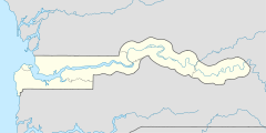
Karte: Gambia
marker
Region: West Coast
Distrikt: Foni Brefet
Einwohner: 612 (2011)

EW3

Brefet ist eine Ortschaft im westafrikanischen Staat Gambia.

Nach einer Berechnung für das Jahr 2011 leben dort etwa 612 Einwohner, das Ergebnis der letzten veröffentlichten Volkszählung von 1993 betrug 370.[1]

Geographie

Brefet liegt in der West Coast Region, Distrikt Foni Brefet. Der Ort liegt sechs Kilometer nördlich von Bessi, das an der South Bank Road liegt, entfernt.

In der Nähe des Orts befand sich in den 1780ern ein britischer Handelsposten, von denen noch Ruinen erhalten sind.

Siehe auch

Einzelnachweise

  1. Brefet in World Gazetteer, Zugriff Juli 2011

Wikimedia Foundation.

Игры ⚽ Нужна курсовая?

Schlagen Sie auch in anderen Wörterbüchern nach:

  • Foni Brefet — Lage des Distrikts in der West Coast Region …   Deutsch Wikipedia

  • Foni Brefet — is one of the nine districts of The Gambia s Western Division, which is located to the south of the Gambia River in the southwest of the country. Foni Brefet is in the center of the division, between Kombo East and Foni Bintang Karenai …   Wikipedia

  • Foni Brefet — Admin ASC 2 Code Orig. name Foni Brefet Country and Admin Code GM.05.2413479 GM …   World countries Adminstrative division ASC I-II

  • Liste von Kultplätzen in Gambia — Die Liste von Kultplätzen in Gambia listet Kultstätten oder Kultplätze im westafrikanischen Staat Gambia auf. Die Auflistung wurde vom National Centre for Arts Culture 1998 veröffentlicht. Die Kultstätten sind näher klassifiziert als „heilig“… …   Deutsch Wikipedia

  • Bessi (Gambia) — Bessi 13.176718057778 16.414660441111{{{elevation save}}}Koordinaten …   Deutsch Wikipedia

  • Sansankoto Island — Vorlage:Infobox Insel/Wartung/Fläche fehltVorlage:Infobox Insel/Wartung/Höhe fehlt Sansankoto Island …   Deutsch Wikipedia

  • Somita — 13.205555555556 16.305555555556{{{elevation save}}}Koordinaten: 13° …   Deutsch Wikipedia

  • Bulok — 13.176718057778 16.414660441111{{{elevation save}}}Koordinaten: 13°  …   Deutsch Wikipedia

  • Sutusinjang — 13.186929089722 16.385263246944{{{elevation save}}}Koordinaten …   Deutsch Wikipedia

  • North Bank Division — Location of North Bank Division in The Gambia North Bank is one of the five administrative divisions of The Gambia. Its capital is Kerewan …   Wikipedia

Share the article and excerpts

Direct link
Do a right-click on the link above
and select “Copy Link”