Bukit Timah Expressway

Bukit Timah Expressway

Vorlage:Infobox hochrangige Straße/Wartung/SG-E

Bukit Timah Expressway in Singapur
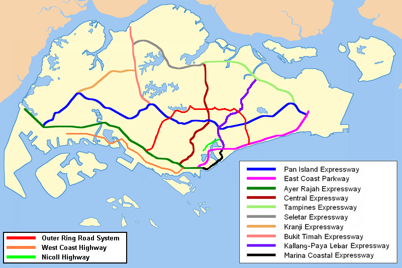
Bukit Timah Expressway
Tabliczka AH2.svg
Karte
Verlauf der BK
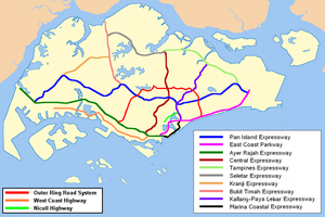
Basisdaten
Betreiber: Land Transport Authority
Gesamtlänge: 10 km

CDC-Distrikte:

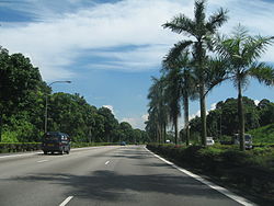
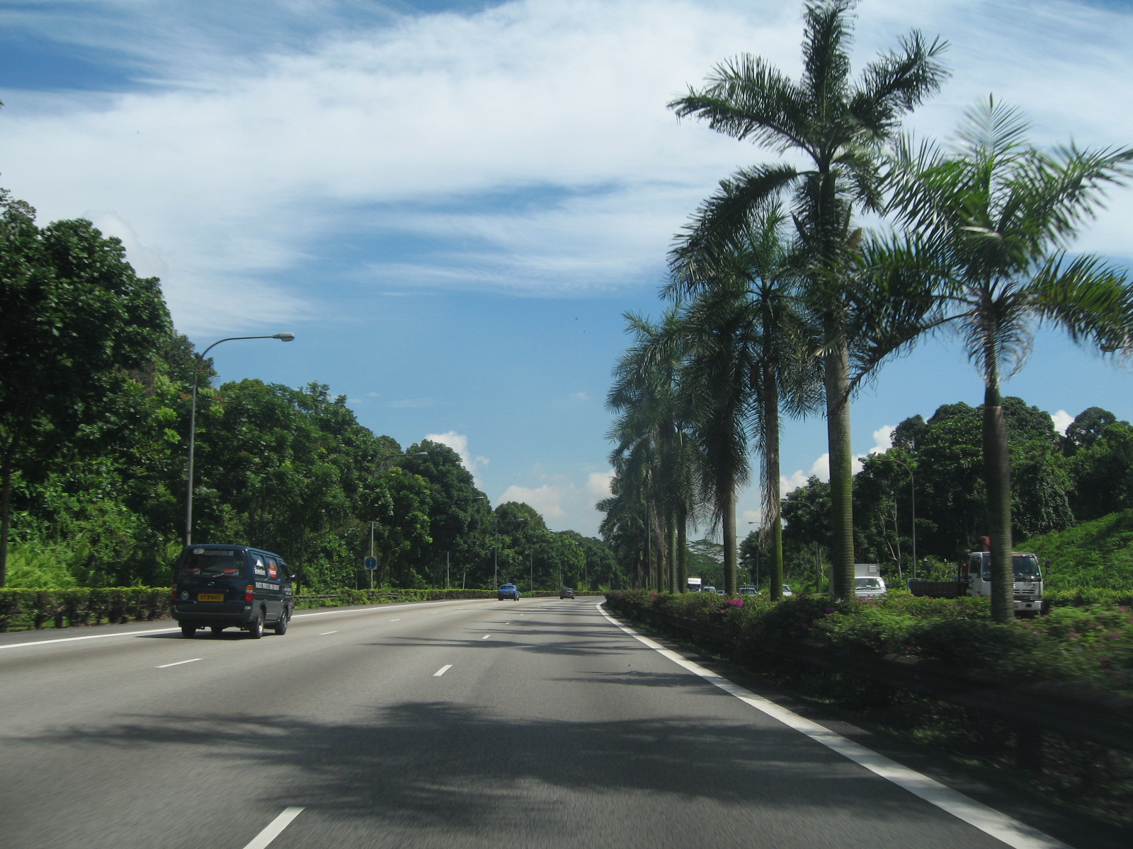
BKE in nördlicher Richtung bei Johor Bahru.

Der Bukit Timah Expressway AH2 (Abkürzung: BKE, chin.: 武吉 知 马 高速公路; Pinyin: Wǔjízhīmǎ Gāosù Gōnglù; Tamil: புக்கிட் தீமா விரைவுச்சாலை); malay: Lebuhraya Bukit Timah) ist eine Autobahn in Singapur. Mit beginn an der PIE in Bukit Timah und verläuft nach Norden bis zum Woodlands Checkpoint und den Johor-Singapore Causeway, der Grenze zu Malaysia

Vor Fertigstellung KJE war die BKE die kürzeste Autobahn in Singapur, bei etwa 10 km. Diese Schnellstraße ist eine sechsspurige Schnellstraße, mit drei Fahrspuren in beiden Richtungen.

Stadtteile entlang der Autobahn


Wikimedia Foundation.

Игры ⚽ Поможем написать курсовую

Schlagen Sie auch in anderen Wörterbüchern nach:

  • Bukit Timah Expressway — Infobox Singapore Expressway routebox length km = km to mi|num=10|abbr=no|spell=Commonwealth|precision=2|wiki=yes direction = North South start/end1 = Woodlands start/end2 = Bukit Timah (PIE) area = Woodlands Bukit Panjang Bukit Timah construct… …   Wikipedia

  • Bukit Timah Satellite Earth Station — The Bukit Timah Satellite Earth Station (Chinese: 武吉知马卫星地面站; Malay: Stesen Satelit Bumi Bukit Timah ) is Singapore s first satellite earth station. The station is located in Bukit Timah near Chantek flyover between Bukit Timah Expressway (BKE)… …   Wikipedia

  • Bukit Timah Road — Bukit Timah Road, eastbound towards the city. Bukit Timah Road (Chinese: 武吉知马路; Malay: Jalan Bukit Timah) is a major road in Singapore extending from the city centre to Woodlands Road on the way to Johor Bahru in Malaysia. The road has a distance …   Wikipedia

  • Bukit Panjang New Town — is new town located in the west of Singapore bounded by Bukit Timah Road, Dairy Farm Road, the Bukit Timah Expressway, and the Kranji Expressway. With its entirety only a portion of this town is situated on a low lying and elongated hill, with… …   Wikipedia

  • Holland-Bukit Timah Group Representation Constituency — (Traditional Chinese: 荷蘭 武吉知馬集選區;Simplified Chinese: 荷兰 武吉知马集选区) is a five member Group Representation Constituency located in the central, western and northern areas of Singapore. The Group Representation Constituency has not received a contest… …   Wikipedia

  • Bukit Panjang — SG neighbourhood image englishname=Bukit Panjang chinesename=武吉班让 poj= pengim= pinyin=Wǔjíbānràng malayname=Bukit Panjang tamilname=பக்கிட்பஞ்சாங்Bukit Panjang is a suburban area situated in the Central North Western part of Singapore. The Bukit… …   Wikipedia

  • Bukit Batok New Town — Bukit Batok English Bukit Batok Chinese 武吉巴督 (Pinyin Wǔjíbādū) …   Wikipedia

  • Malaysian Expressway System — Malaysian expressway logo The Malaysian Expressway System (Malay: Sistem Lebuhraya Malaysia), which begins with the North South Expressway (NSE), is currently in the process of being substantially developed. It was built by private companies… …   Wikipedia

  • North–South Expressway, Singapore — For North–South Expressway in Malaysia, see North–South Expressway, Malaysia. North–South Expressway Route information Length: 21.5 km (13.4 mi) …   Wikipedia

  • Kranji Expressway — Infobox Singapore Expressway routebox length km = km to mi|num=8|abbr=no|spell=Commonwealth|precision=2|wiki=yes direction = Southwest East start/end1 = Jurong (PIE) start/end2 = Bukit Panjang (BKE) area = Jurong Choa Chu Kang Bukit Panjang… …   Wikipedia

Share the article and excerpts

Direct link
Do a right-click on the link above
and select “Copy Link”