- Pan Island Expressway
-
Pan Island Expressway in Singapur 
Karte 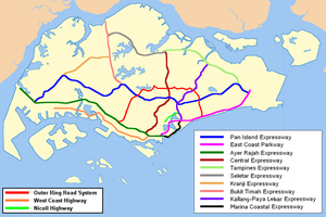
Basisdaten Betreiber: Land Transport Authority Gesamtlänge: 43 km - Jurong
- Bukit Timah
- Toa Payoh
- Eunos
- Bedok
- Tampines
- Kallang
- Tuas
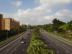
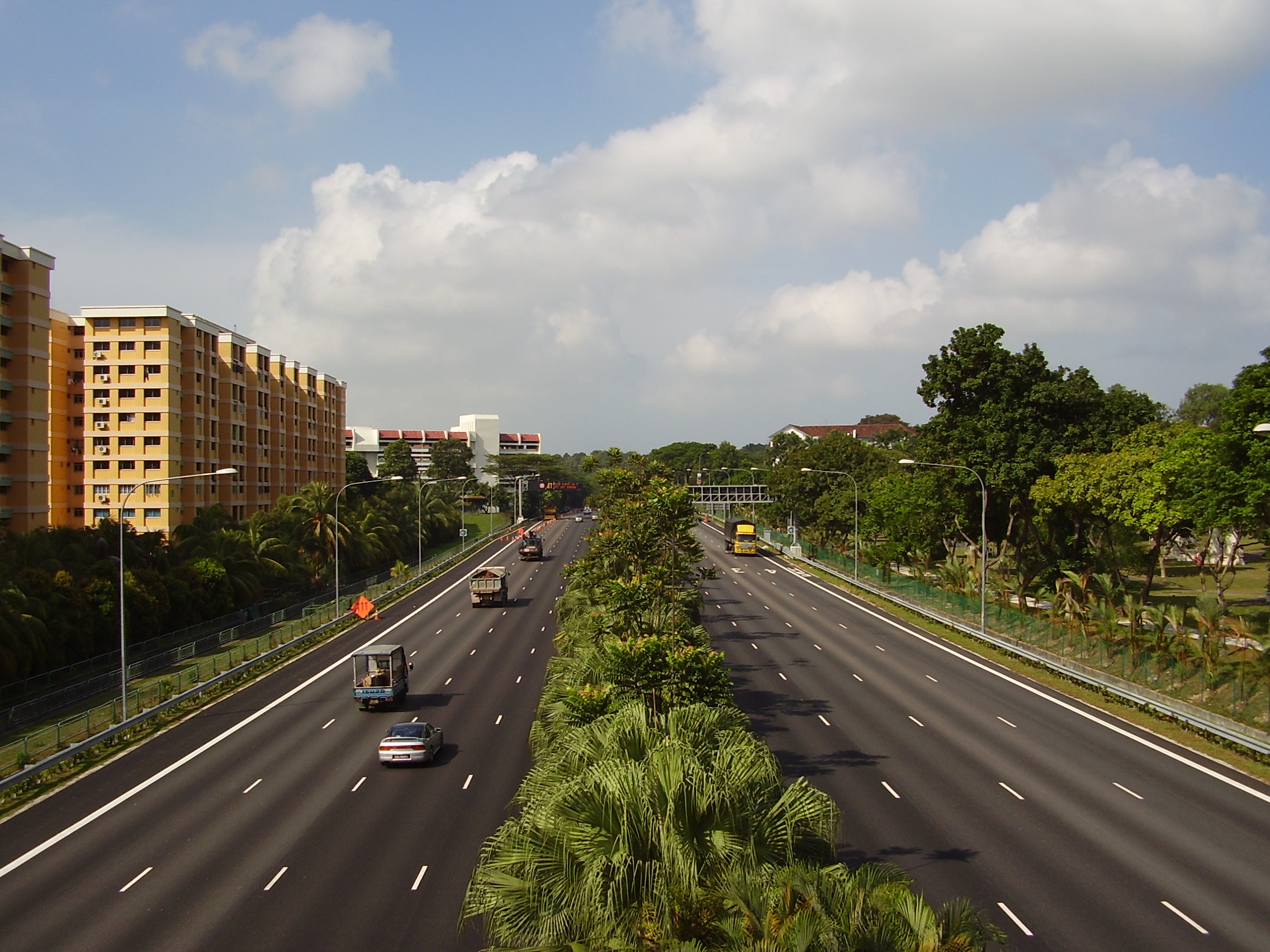
Der PIE bei der Abfahrt Nanyang IC, in Richtung Tuas. Straßenverlauf
(1) Changi IC 

Changi South Ave IC (2) Upper Changi IC 
(3AB) Simei IC (4AB) Tampines South IC 
Bedok Canal Bridge (8AB) Bedok North IC (9) Eunos IC (11) Paya Lebar IC (12) Kallang Bahru IC 
(15) Whampoa IC 
Toa Payoh Bridge (16) Kim Keat IC (17AB) Toa Payoh South IC (17CD) Thomson IC (18) Onraet Rd IC (19) Mt. Pleasant IC (20AB) Adam IC (22) Eng Neo IC (24) Chantek IC 
(26A) Anak Bukit IC (26B) Upper Bukit Timah IC (27) Clementi Ave IC (28) Toh Tuck IC (31) Bukit Batok IC (32) Jurong East Ave IC (34) Hong Kah IC (35) Tengah IC 
(36) Jalan Bahar IC (38) Nanyang IC (40) Pasir Laba IC (41) Tuas IC 

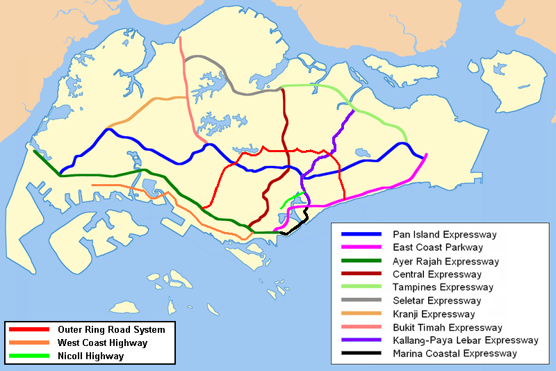
Tuas Road Der Pan Island Expressway (Abkürzung: PIE, chin.: 泛 岛 高速公路; Pinyin: Fàndǎo Gāosù Gōnglù; Tamil: தீவு விரைவுச்சாலை; malay: Lebuhraya Rentas Pulau) ist die älteste und längste Schnellstraße Singapurs. Derzeit ist sie auch Singapur längste Straße. Sie erstreckt sich fast über die gesamte Länge der Insel und verbindet Tuas im Westen mit Singapore Changi Airport im Osten. Ihre Länge beträgt 42,8 Kilometer.
Stadtteile entlang der Autobahn
- Jurong
- Bukit Timah
- Toa Payoh
- Eunos
- Bedok
- Tampines
- Kallang
- Tuas


Wikimedia Foundation.