- Calubian
-
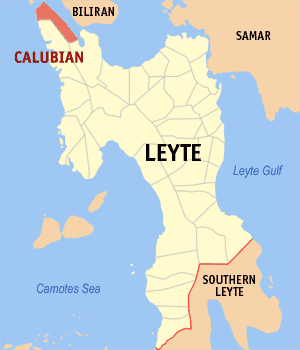
Municipality of Calubian Lage von Calubian in der Provinz Leyte 
Basisdaten Bezirk: Eastern Visayas Provinz: Leyte Barangays: 53 Distrikt: 3. Distrikt von Leyte PSGC: 083713000 Einkommensklasse: 4. Einkommensklasse Haushalte: 6450 Zensus 1. Mai 2000Einwohnerzahl: 29.945 Zensus 1. August 2007Koordinaten: 11° 27′ N, 124° 26′ O11.45124.43333333333Koordinaten: 11° 27′ N, 124° 26′ O Postleitzahl: 6534 Offizielle Webpräsenz: Calubian Geographische Lage auf den Philippinen 

Calubian Calubian ist eine philippinische Stadtgemeinde in der Provinz Leyte. Nach dem Zensus vom 1. Mai 2000 hat sie 28.421 Einwohner in 6450 Haushalten.
Baranggays
Calubian ist politisch in 53 Baranggays unterteilt.
- Abanilla
- Agas
- Anislagan
- Bunacan
- Cabalquinto
- Cabalhin
- Cabradilla
- Caneja
- Cantonghao
- Caroyocan
- Casiongan
- Cristina
- Dalumpines
- Don Luis
- Dulao
- Efe
- Enage
- Espinosa
- Garganera
- Ferdinand E. Marcos
- Garrido
- Guadalupe (Guadalupe Mendoza
- Gutosan
- Igang
- Inalad
- Jubay
- Juson
- Kawayan Bogtong
- Kawayanan
- Kokoy Romualdez
- Labtic
- Laray
- M. Veloso
- Mahait
- Malobago
- Matagok
- Nipa
- Obispo
- Pagatpat
- Pangpang
- Patag
- Pates
- Pal-ug
- Padoga
- Petrolio
- Poblacion
- Railes
- Tabla
- Tagharigue
- Tuburan
- Villahermosa
- Villalon
- Villanueva
Weblinks
Städte und Stadtgemeinden in der Provinz LeyteStädte: Baybay City | Ormoc City | Tacloban City
Stadtgemeinden: Abuyog | Alangalang | Albuera | Babatngon | Barugo | Bato | Burauen | Calubian | Capoocan | Carigara | Dagami | Dulag | Hilongos | Hindang | Inopacan | Isabel | Jaro | Javier | Julita | Kananga | La Paz | Leyte | MacArthur | Mahaplag | Matag-ob | Matalom | Mayorga | Merida | Palo | Palompon | Pastrana | San Isidro | San Miguel | Santa Fe | Tabango | Tabontabon | Tanauan | Tolosa | Tunga | Villaba
Wikimedia Foundation.
Schlagen Sie auch in anderen Wörterbüchern nach:
Calubian — Original name in latin Calubian Name in other language Calubian State code PH Continent/City Asia/Manila longitude 11.4472 latitude 124.4281 altitude 7 Population 0 Date 2011 07 31 … Cities with a population over 1000 database
Calubian, Leyte — Calubian is a 4th class municipality in the province of Leyte, Philippines. According to the 2000 census, it has a population of 28,421 people in 6,450 households.BarangaysCalubian is politically subdivided into 53 barangays.Photos External… … Wikipedia
Legislative districts of Leyte — Philippines This article is part of the series: Politics and government of the Philippines … Wikipedia
Dulag, Leyte — Dulag is a third class municipality in the province of Leyte in Eastern Visayas (Region VIII) in the Philippines. This coastal town covering 11,007 hectares of land is home to 44,143 residents. It lies 36 kilometers south of the concurrent… … Wikipedia
Dulag (Leyte) — Municipality of Dulag Lage von Dulag in der Provinz Leyte Basisdaten Bezirk: Eastern Visayas … Deutsch Wikipedia
PH-LEY — Lage der Provinz Leyte Die Provinz Leyte ist eine Provinz des Inselstaates der Philippinen. Sie erstreckt sich über den nördlichen Teil der Insel Leyte und ist eine von sechs Provinzen, die politisch dem Regierungsbezirk Eastern Visayas (Region… … Deutsch Wikipedia
Provinces of the Philippines — The provinces of the Philippines are the primary administrative divisions of the Philippines. There are 81 provinces, further subdivided into cities and municipalities. The National Capital Region is autonomous of provincial government. Each… … Wikipedia
Leyte — Infobox Philippine province name = Leyte sealfile = Ph seal leyte.png region = Eastern Visayas (Region VIII) capital = Tacloban City founded = 1543 and March 10, 1917 pop2000 = 1,592,336 pop2000rank = 14th largest popden2000 = 279 popden2000rank … Wikipedia
Dagami, Leyte — Municipality Seal … Wikipedia
Biliran Island — Infobox Islands name = Biliran Island image caption = NASA Landsat image of Biliran. native name = native name link = locator Location map|Philippines|lat=11.523|long=124.535|width=175 map custom = yes location = South East Asia coordinates=… … Wikipedia
Calubian

18+
© Academic, 2000-2026
- Kontaktieren Sie uns: Unterstützung, Werbung
Wörterbücher Export, schritte mit PHP, Joomla, Drupal, WordPress, MODx.