- Carigara
-
Municipality of Carigara Lage von Carigara in der Provinz Leyte 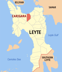
Basisdaten Bezirk: Eastern Visayas Provinz: Leyte Barangays: 49 Distrikt: 2. Distrikt von Leyte PSGC: 083715000 Einkommensklasse: 3. Einkommensklasse Haushalte: 8571 Zensus 1. Mai 2000Einwohnerzahl: 45.696 Zensus 1. August 2007Koordinaten: 11° 18′ N, 124° 41′ O11.3124.68333333333Koordinaten: 11° 18′ N, 124° 41′ O Postleitzahl: 6529 Bürgermeister: Anlie G. Apostol Offizielle Webpräsenz: Carigara Geographische Lage auf den Philippinen 

Carigara Carigara ist eine philippinische Stadtgemeinde in der Provinz Leyte. Nach dem Zensus vom 1. Mai 2000 hat sie 43.455 Einwohner in 8571 Haushalten.
Der Name Carigara bedeutet so viel, wie aufgestiegen aus der Asche.
Baranggays
Carigara ist politisch in 49 Baranggays unterteilt.
- Balilit
- Barayong
- Barugohay Central
- Barugohay Norte
- Barugohay Sur
- Baybay (Pob.)
- Binibihan
- Bislig
- Caghalo
- Camansi
- Canal
- Candigahub
- Canlampay
- Cogon
- Cutay
- East Visoria
- Guindapunan East
- Guindapunan West
- Hiluctogan
- Jugaban (Pob.)
- Libo
- Lower Hiraan
- Lower Sogod
- Macalpi
- Manloy
- Nauguisan
- Pangna
- Parag-um
- Parina
- Piloro
- Ponong (Pob.)
- Sagkahan
- San Mateo (Pob.)
- Santa Fe
- Sawang (Pob.)
- Tagak
- Tangnan
- Tigbao
- Tinaguban
- Upper Hiraan
- Upper Sogod
- Uyawan
- West Visoria
- Paglaum
- San Juan
- Bagong Lipunan
- Canfabi
- Rizal (Tagak East)
- San Isidro
Regelmäßige Veranstaltungen
Jährlich im Juli findet ein Gemeindefest in Erinnerung an die erste Ankunft der Spanier am 16. Juli 1569 statt.
Städte und Stadtgemeinden in der Provinz LeyteStädte: Baybay City | Ormoc City | Tacloban City
Stadtgemeinden: Abuyog | Alangalang | Albuera | Babatngon | Barugo | Bato | Burauen | Calubian | Capoocan | Carigara | Dagami | Dulag | Hilongos | Hindang | Inopacan | Isabel | Jaro | Javier | Julita | Kananga | La Paz | Leyte | MacArthur | Mahaplag | Matag-ob | Matalom | Mayorga | Merida | Palo | Palompon | Pastrana | San Isidro | San Miguel | Santa Fe | Tabango | Tabontabon | Tanauan | Tolosa | Tunga | Villaba
Wikimedia Foundation.
Schlagen Sie auch in anderen Wörterbüchern nach:
Carigara — Original name in latin Carigara Name in other language Carigara, Garigara State code PH Continent/City Asia/Manila longitude 11.29917 latitude 124.67556 altitude 7 Population 17495 Date 2011 07 31 … Cities with a population over 1000 database
Carigara, Leyte — Carigara is a 3rd class municipality in the province of Leyte, Philippines. According to the 2000 census, it has a population of 43,455 people in 8,571 households.BarangaysCarigara is politically subdivided into 49 barangays.HistoryCarigara has a … Wikipedia
Battle of Leyte — Infobox Military Conflict conflict=Battle of Leyte caption=Gen. Douglas MacArthur and staff land at Palo Beach, Leyte, 20 October 1944. partof=the Pacific Theatre of World War II date=20 October – 31 December 1944 place=Leyte Island, Philippines… … Wikipedia
Barugo, Leyte — Barugo is a 4th class municipality in the province of Leyte, Philippines. According to the 2000 census, it has a population of 26,919 people in 5,108 households.Elected Municipal Officials (2007 to Present):MayorHon. Atty. Alden AvestruzVice… … Wikipedia
Schlacht um Leyte — Teil von: Pazifikkrieg, Zweiter Weltkrieg Gener … Deutsch Wikipedia
Babatngon, Leyte — Babatngon is a 4th class municipality in the province of Leyte, Philippines. According to the 2000 census, it has a population of 20,946 people in 4,081 households.Babatngon is located in the northern part of the island of Leyte, along the shore… … Wikipedia
Barangays of Barugo, Leyte — There are 37 barangays in the municipality of Barugo, Leyte. In the Philippines, a barangay is the smallest local government unit.AbangoBarangay Abango is located in the southwest of Barugo, sharing boundaries with the Leyte municipalities of… … Wikipedia
Legislative districts of Leyte — Philippines This article is part of the series: Politics and government of the Philippines … Wikipedia
1st Division (Imperial Japanese Army) — Infobox Military Unit unit name= 1st Infantry Division caption=Rebel 1st Division troops in the February 26 Incident dates= 1888 1945 country=Empire of Japan allegiance= branch=Imperial Japanese Army type=Infantry role= size= command structure=… … Wikipedia
PH-08 — Karte des Bezirks Eastern Visayas Eastern Visayas (Tagalog: Silangang Kabisayaan) ist, neben dem Bezirk MIMAROPA, einer von zwei Regierungsbezirk der Philippinen, die keine Festlandgrenze zu einem anderen Bezirk besitzen. Der Bezirk umfasst die… … Deutsch Wikipedia
Carigara


18+
© Academic, 2000-2026
- Kontaktieren Sie uns: Unterstützung, Werbung
Wörterbücher Export, schritte mit PHP, Joomla, Drupal, WordPress, MODx.