- Cache la Poudre River
-
Cache la Poudre River 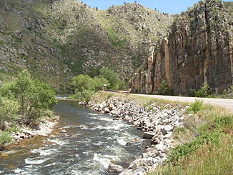
Cache la Poudre River im Poudre Canyon
Daten Gewässerkennzahl US: 205018 Lage Colorado (USA) Flusssystem Mississippi River Abfluss über South Platte → Platte → Missouri → Mississippi → Golf von Mexiko Quelle im Rocky Mountain National Park
40° 25′ 29″ N, 105° 48′ 24″ W40.424722-105.8066673278Quellhöhe 3.278 m Mündung in den South Platte River 40.421389-104.6008331402Koordinaten: 40° 25′ 17″ N, 104° 36′ 3″ W
40° 25′ 17″ N, 104° 36′ 3″ W40.421389-104.6008331402Mündungshöhe 1.402 m Höhenunterschied 1.876 m Länge 203 km Großstädte Greeley, Fort Collins Kleinstädte Laporte, Timnath Schiffbar Nein 
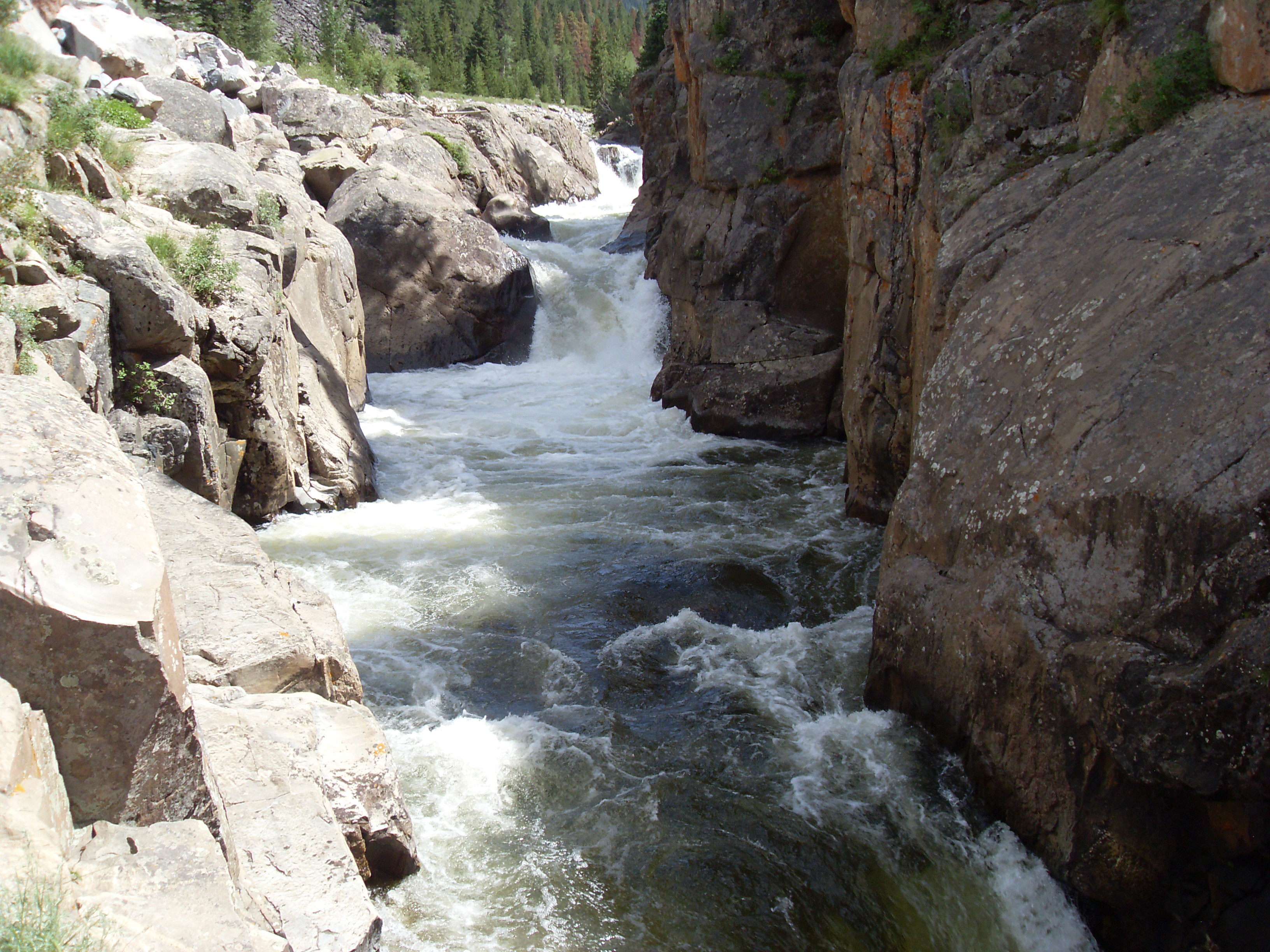
Poudre Falls im westlichen Teil des Poudre Canyon
Der Cache la Poudre River oder auch einfach Poudre River befindet sich im nördlichen Teil des Staates Colorado in den USA.
Inhaltsverzeichnis
Verlauf
Die Quellregion befindet sich im Front Range Gebirge im Larimer County, im nördlichen Teil des Rocky Mountain National Park, nahe der nordamerikanischen kontinentalen Wasserscheide. Der Fluss verläuft ostwärts in den Rocky Mountains und fließt durch den Roosevelt National Forest und durch den Poudre Canyon. Ein Teil des Wassers soll zukünftig bei Hochwasser, während der Schneeschmelze hinter dem Poudre Canyon in das Glade Reservoir, nordwestlich von Fort Collins abgeleitet werden, um es für Bewässerungsprojekte und die Versorgung der umliegenden Städte zu nutzen.[1] Nachdem der Fluss den Canyon verlassen hat, fließt er durch die Stadt Fort Collins, durchquert die relativ flache Landschaft in Richtung Osten bis er etwa 8 Kilometer östlich von Greeley in den South Platte River mündet. Der Fluss hat eine Länge von etwa 203 Kilometern und überwindet einen Höhenunterschied von 1867 Metern.[2]
Name
Der Name des Flusses bedeutet auf französisch „Versteck für das Pulver“. Dies bezieht sich auf ein Vorfall in den 1820er Jahren als französische Trapper, von einem schweren Schneesturm überrascht, einen Teil ihres Schwarzpulvers (Poudre) am Fluss verstecken (Cache) mussten, um es so in Sicherheit zu bringen.
Aktivitäten
Die Verwaltung des Gebiets obliegt dem United States Forest Service. Im Jahr 1986 wurde der Fluss unter Schutz gestellt und zu einem National Wild and Scenic River erklärt. Mit dieser Maßnahme sollte dieses ursprüngliche und landschaftlich reizvolle Flussgebiet vor menschlichem Eingriff geschützt werden. Die im Poudre Canyon parallel zum Fluss verlaufende Straße der Poudre Canyon Highway (Colorado State Highway 14) wurde als National Scenic Byway ausgewiesen. Die hier geplante Eisenbahnstrecke ist nie fertig gestellt worden. Der Fluss ist ein beliebtes Ziel für Angler, bei genügend Wasser bietet er die Möglichkeit zum Rafting und zum Kajak fahren.[3] Im Tal des Cache la Poudre River befinden sich zahlreiche Camping- und Picknickplätze, ausgewiesene Trailheads ermöglichen das Wandern in der Umgebung.
Einzelnachweise
- ↑ http://www.gladereservoir.org/ Northern Water, Northern Integrated Supply Project
- ↑ http://www.gorp.com/parks-guide/travel-ta-cache-la-poudre-river-colorado-sidwcmdev_068903.html Beschreibung des Flusses bei GORP (Great Outdoor Recreation Pages)
- ↑ http://www.nps.gov/cala U.S. National Park Service
 Commons: Cache la Poudre River – Sammlung von Bildern, Videos und AudiodateienKategorien:
- Flusssystem Platte River
- Fluss in Colorado
- National Wild and Scenic River
- Fluss in Nordamerika

Wikimedia Foundation.