Channel Islands National Marine Sanctuary

Channel Islands National Marine Sanctuary
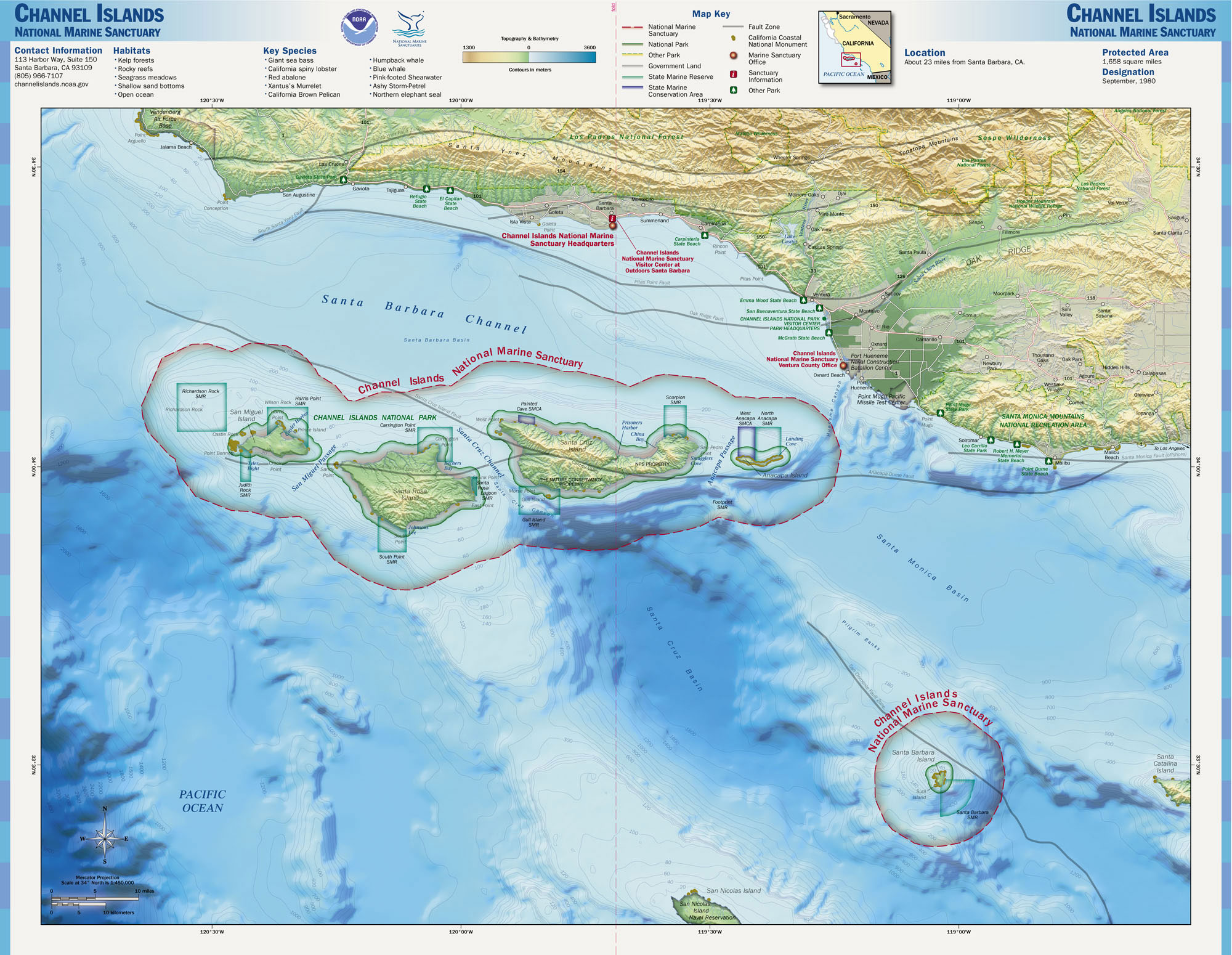
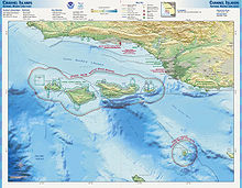
Karte des Channel Islands National Marine Sanctuarys

Das Channel Islands National Marine Sanctuary ist ein Schutzgebiet an der Pazifikküste in den Vereinigten Staaten nahe Kalifornien.
Gegründet 1980 ist das 4.294 km² große Gebiet Teil des Santa-Barbara-Kanals und wegen seiner außergewöhnlichen Schönheit und seinen außergewöhnlichen Schätzen von nationaler Bedeutsamkeit. Es umfasst Wasser, das die Inseln Anacapa, Santa Cruz, Santa Rosa, San Miguel und Santa Barbara (fünf der acht Channel Islands) umgibt, und dehnt sich von der Küste bei Flut sechs nautische Meilen rund um jede der fünf Inseln aus. Die Hauptaufgabe des Schutzgebietes ist der Schutz der Natur- und Kulturschätze, die in seinen Grenzen enthalten sind.
Das National Marine Sanctuary-Programm wird von der National Oceanic and Atmospheric Administration (NOAA) betrieben.

Siehe auch

Weblinks


Wikimedia Foundation.

Игры ⚽ Поможем решить контрольную работу

Schlagen Sie auch in anderen Wörterbüchern nach:

  • Channel Islands National Marine Sanctuary — Lichen encrusted rocks adorn the cliffs of Santa Cruz Island …   Wikipedia

  • National Marine Sanctuary — Ein National Marine Sanctuary ist ein vom Bund ausgewiesenen Gebiet in der Gewässern der USA, dass Gebiete der Meeresumwelt mit speziellen Erhaltungs , Erholungs , Ökologie , Geschichts , Kultur , Archäologie , Wissenschafts , Bildungs oder… …   Deutsch Wikipedia

  • Monterey Bay National Marine Sanctuary — The Monterey Bay National Marine Sanctuary (MBNMS) is a US Federally protected marine area offshore of California s central coast around Monterey Bay. Supporting one of the world’s most diverse marine ecosystems, it is home to numerous mammals,… …   Wikipedia

  • United States National Marine Sanctuary — A U.S. National Marine Sanctuary is a federally designated area within United States waters that protects areas of the marine environment with special conservation, recreational, ecological, historical, cultural, archeological, scientific,… …   Wikipedia

  • Channel Islands of California — Geography Location …   Wikipedia

  • Channel Islands — de Californie Channel Islands Carte des Channel Islands. Géographie Pays …   Wikipédia en Français

  • Channel Islands De Californie — Channel Islands Carte des Channel Islands. Géographie Pays …   Wikipédia en Français

  • Channel Islands de Californie — Channel Islands Carte des Channel Islands. Géographie Pays …   Wikipédia en Français

  • Channel islands de californie — Channel Islands Carte des Channel Islands. Géographie Pays …   Wikipédia en Français

  • Cordell Bank National Marine Sanctuary — Area map of the sanctuary. The coast of California is to the upper right, and the administrative centre, located on the granite outcropping, adjacent to it. The actual sanctuary is further left, and colored darker blue. Cordell Bank National… …   Wikipedia

Share the article and excerpts

Direct link
Do a right-click on the link above
and select “Copy Link”