- Canegrate
-
Canegrate 
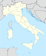

Staat: Italien Region: Lombardei Provinz: Mailand (MI) Lokale Bezeichnung: Canegraa / Canegràà Koordinaten: 45° 34′ N, 8° 56′ O45.5666666666678.9333333333333196Koordinaten: 45° 34′ 0″ N, 8° 56′ 0″ O Höhe: 196 m s.l.m. Fläche: 5 km² Einwohner: 12.431 (31. Dez. 2010)[1] Bevölkerungsdichte: 2.486 Einw./km² Postleitzahl: 20010 Vorwahl: 0331 ISTAT-Nummer: 015046 Demonym: Canegratesi Schutzpatron: S.Maria Assunta-S.Rocco Website: Canegrate Canegrate ist eine Gemeinde mit 12.431 Einwohnern (Stand 31. Dezember 2010) in der Provinz Mailand, Region Lombardei.
Die Nachbarorte von Canegrate sind Legnano, San Vittore Olona, San Giorgio su Legnano, Parabiago und Busto Garolfo.
Demografie
Canegrate zählt 4.730 Privathaushalte. Zwischen 1991 und 2001 stieg die Einwohnerzahl von 11.213 auf 11.810. Dies entspricht einem prozentualen Zuwachs von 5,3 %.

Einzelnachweise
- ↑ Statistiche demografiche ISTAT. Bevölkerungsstatistiken des Istituto Nazionale di Statistica vom 31. Dezember 2010.
 Gemeinden in der Provinz Mailand in der Region Lombardei (A–M)
Abbiategrasso | Albairate | Arconate | Arese | Arluno | Assago | Baranzate | Bareggio | Basiano | Basiglio | Bellinzago Lombardo | Bernate Ticino | Besate | Binasco | Boffalora sopra Ticino | Bollate | Bresso | Bubbiano | Buccinasco | Buscate | Bussero | Busto Garolfo | Calvignasco | Cambiago | Canegrate | Carpiano | Carugate | Casarile | Casorezzo | Cassano d’Adda | Cassina de' Pecchi | Cassinetta di Lugagnano | Castano Primo | Cernusco sul Naviglio | Cerro Maggiore | Cerro al Lambro | Cesano Boscone | Cesate | Cinisello Balsamo | Cisliano | Cologno Monzese | Colturano | Corbetta | Cormano | Cornaredo | Corsico | Cuggiono | Cusago | Cusano Milanino | Dairago | Dresano | Gaggiano | Garbagnate Milanese | Gessate | Gorgonzola | Grezzago | Gudo Visconti | Inveruno | Inzago | Lacchiarella | Lainate | Legnano | Liscate | Locate di Triulzi | Magenta | Magnago | Marcallo con Casone | Masate | Mediglia | Melegnano | Melzo | Mesero | Mailand | Morimondo | Motta Visconti
Wikimedia Foundation.
Schlagen Sie auch in anderen Wörterbüchern nach:
Canegrate — Administration Pays Italie Région … Wikipédia en Français
Canegrate — Infobox CityIT img coa = official name = Canegrate name = Canegrate region = Lombardy province = Province of Milan (MI) elevation m = 196 area total km2 = 5.3 population as of = Dec. 2004 population total = 12059 population density km2 = 2275… … Wikipedia
Canegrate — Original name in latin Canegrate Name in other language Canegrate, kanegurate State code IT Continent/City Europe/Rome longitude 45.56927 latitude 8.92844 altitude 196 Population 11810 Date 2012 02 15 … Cities with a population over 1000 database
Canegrate culture — The Canegrate culture was a civilization of Prehistoric Italy whom developed from the recent Bronze Age (13th century BC) until the Iron Age, in the Pianura Padana of what are now western Lombardy, eastern Piedmont and Canton Ticino.[1] The name… … Wikipedia
Cisalpine Gaul — This article is about the Roman province. For other uses of the word Cisalpine , see Cisalpine (disambiguation). Map of the Cisalpine Gaul Cisalpine Gaul, in Latin: Gallia Cisalpina or Citerior, also called Gallia Togata,[1] was a Roman province… … Wikipedia
Histoire Du Valais — Articles principaux : Canton du Valais et Histoire de la Suisse. Carte du Valais de 1756 Occupé dès la préhistoire, le territoire du canton du Valais voit se développer une civilisation originale lors de l Âge du Bronze. Dès le … Wikipédia en Français
Histoire du Valais — Articles principaux : Canton du Valais et Histoire de la Suisse. Carte du Valais de 1756 Occupé dès la préhistoire, le territoire du canton du Valais voit se développer une civilisation originale lors de l Âge du bronze. Dès le… … Wikipédia en Français
Histoire du valais — Articles principaux : Canton du Valais et Histoire de la Suisse. Carte du Valais de 1756 Occupé dès la préhistoire, le territoire du canton du Valais voit se développer une civilisation originale lors de l Âge du Bronze. Dès le … Wikipédia en Français
Ur- und Frühgeschichte Italiens — Die ältesten menschlichen Spuren reichen in Italien etwa 1,3 bis 1,7 Millionen Jahre zurück und sind damit die ältesten Europas. Sie fanden sich an der Fundstätte Pirro Nord im Norden Apuliens. Bis dahin galten die 1983 am Monte Poggiolo am… … Deutsch Wikipedia
Bronze Age — For other uses, see Bronze Age (disambiguation). Diffusion of metallurgy in western Europe. The darkest areas are the oldest. Bronze Age … Wikipedia
- Kontaktieren Sie uns: Unterstützung, Werbung
Canegrate


18+
© Academic, 2000-2026
Wörterbücher Export, schritte mit PHP, Joomla, Drupal, WordPress, MODx.