Cape Barren Island

Cape Barren Island
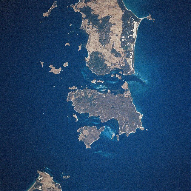
Cape Barren Island
Satellitenaufnahme von Cape Barren Island (Mitte)
Gewässer Bass-Straße
Inselgruppe Furneaux-Gruppe
Geographische Lage 40° 24′ S, 148° 15′ O-40.4148.25687Koordinaten: 40° 24′ S, 148° 15′ O
Cape Barren Island (Tasmanien)
Cape Barren Island
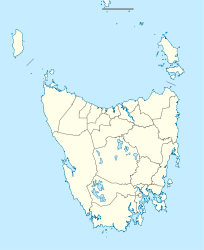
Länge 42,3 km
Breite 22,7 km
Fläche 464 km²
Höchste Erhebung Mount Munro
687 m
Einwohner 268 (2006)
<1 Einw./km²
Hauptort The Corner

Cape Barren Island ist eine Insel der Furneaux-Gruppe in der Bass Strait zwischen Tasmanien und Australien. Sie hat eine Fläche von 464 km². Die größte Insel der Gruppe, Flinders Island, liegt nördlich, die kleinere Insel Clarke Island südlich.

Der höchste Punkt der Insel ist Mount Munro mit 687 m. Dieser wurde möglicherweise nach James Munro (ca. 1779-1845), einem früheren Sträfling und späteren Robbenfänger und Strandläufer benannt, der seit den 1820er Jahren für mehr als 20 Jahren auf der nahe gelegenen Insel Preservation Island lebte und dort mehrere Frauen hatte.

Australiens einzige einheimische Gans, die Hühnergans, wurde erstmals hier entdeckt.

Auf der Insel leben 268 Menschen (Stand 2006) die meisten davon in der Ansiedlung The Corner an der Nordostküste [1]. Hier gibt es auch eine Post, eine anglikanische Kirche, einen Hubschrauberlandeplatz für Notfälle und in 3 km Entfernung einen Flugzeuglandeplatz. Im Ort gibt es auch einen Laden, eine Krankenstation und eine kleine Grundschule mit 2005 nur 8 Schülern und einem Lehrer.

Die Insel wird einmal im Monat von einem Versorgungsschiff angefahren.

Die meisten Einwohner sind Abkömmlinge europäischer Walfänger mit Tasmanierinnen, die von Tasmanien hierher entführt wurden.

Am 10. Mai 2005 übergab die Regierung Kronland auf Cape Barren und Clarke Island in die Verwaltung der lokalen Aboriginal-Gemeinde. Das war der erste Fall einer Übereignung von Kronland an die Aboriginal-Gemeinde in Tasmanien.

Die Insel kann vom benachbarten Flinders Island mit einer kurzen Bootsfahrt oder dem Flugzeug erreicht werden. Flinders Island wird von Melbourne in Australien und Launceston auf Tasmanien angeflogen.

Cape Barren ist wie auch die anderen Inseln der Furneaux-Gruppe ein beliebtes Ziel für Seekayak-Fahrer, die die Bass Strait von Wilsons Promontory in Australien nach Tasmanien überqueren.

Vor 12.000 Jahren war die Inselgruppe wegen des aufgrund der Eiszeit abgesunkenen Meeresspiegels eine Landbrücke, die Australien und Tasmanien verband.

Quellen

  1. http://www.nma.gov.au/exhibitions/community/snapshots_of_remote_communities/cape_barren_island/

Wikimedia Foundation.

Игры ⚽ Поможем решить контрольную работу

Schlagen Sie auch in anderen Wörterbüchern nach:

  • Cape Barren Island — is located off the north east coast of Tasmania, Australia, and is one of the islands of the Furneaux Group in Bass Strait. The largest island of the group, Flinders Island, lies to the north, with the smaller Clarke Island to the south. The… …   Wikipedia

  • Cape Barren Island — Archipel Furneaux L archipel Furneaux …   Wikipédia en Français

  • Cape Barren Island — noun an island off the north eastern tip of Tasmania in Bass Strait, the second largest of the Furneaux Group; its lagoons form a Ramsar wetland site …  

  • Cape Barren Goose — Conservation status Least Concern …   Wikipedia

  • Barren Island — may refer to:Andaman Islands * Barren Island (Andaman Islands)Australia * Barren Island (Tasmania) * Cape Barren Island, TasmaniaCanada * Barren Island (Nova Scotia) * Barren Island (Ontario)Falkland Islands * Barren Island (Falkland Islands)USA… …   Wikipedia

  • Barren Island — kann sich beziehen auf: Barren Island (Andamanen), eine Insel der Andamanen Barren Island (Falklandinseln), eine der Falklandinseln Barren Island (New York), eine ehemalige Insel und jetziges Stadtviertel von New York Barren Island (Ontario),… …   Deutsch Wikipedia

  • Cape Barren goose — noun a large goose, Cereopsis novaehollandiae, endemic to southern Australia, greyish in colour with pink legs and a black bill with prominent greenish cere; breeds on off shore islands. {named after Cape Barren Island, where the geese were first …  

  • Cape Breton Island — Infobox Islands name = Cape Breton image caption = Cape Breton Island, Nova Scotia, Canada image size = locator Location map|Canada Nova Scotia|lat=46.166667|long= 60.75|marksize=16 map custom = yes native name = native name link = nickname =… …   Wikipedia

  • Barren — as a place name can refer to: *Barren County, Kentucky *Barren Island (Andaman Islands) *Barren Island, Brooklyn *Barren River LakeBarren can also refer to: *Barren County (album) *Barren County Progress *Barren Realms Elite *Barren Strawberry… …   Wikipedia

  • Clarke Island (Tasmania) — Clarke Island Lying below Flinders Island (the large land mass at the top of the image) and Cape Barren Island (the centre large island) is Clarke Island, roughly a quarter of the size of Cape Barren Island. The large land mass at the bottom left …   Wikipedia

Share the article and excerpts

Direct link
Do a right-click on the link above
and select “Copy Link”