- Fanal Island
-
Fanal Island Gewässer Pazifischer Ozean Inselgruppe Mokohinau Islands Geographische Lage 35° 56′ 28,29″ S, 175° 8′ 47,9″ O-35.9411908175.14664Koordinaten: 35° 56′ 28,29″ S, 175° 8′ 47,9″ O 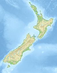

Fläche 0,73 km² Fanal Island, auch Motukino Island genannt, ist die größte und am südlichsten gelegene Insel der neuseeländischen Mokohinau Islands.
Die 0,73 km² große, heute unbewohnte Insel im Hauraki-Golf liegt etwa 20 km nordwestlich von Great Barrier Island, 4 Kilometer südöstlich von Burgess Island und etwa 15 km östlich der Mündung des Waipu River an der Ostküste der Nordinsel Neuseelands.
Fanal Island ist Teil des Mokohinau Islands Nature Reserve, das vom Department of Conservation verwaltet wird. Es ist auch ein Naturschutzgebiet im Rahmen des Wildlife Act 1953.
Die Pazifische Ratte (Rattus exulans), polynesisch kiore, hatte vermutlich mit den Māori die Insel zwischen 1100 und 1800 n. Chr. erreicht. Die Insel wurde auch durch Brandrodung der Māori verändert.
Gegen die Rattenplage wurde seitens der neuseeländischen Regierung 1997 ein Ausrottungsprojekt gestartet, wie es auf den anderen Inseln des Archipels bereits im Jahr 1900 erfolgt war. Aus der Luft wurde ein Aerosol mit 20 ppm Brodifacoum in einer Menge von 10 kg/ha ausgebracht. Trotz heftiger Regenfälle unmittelbar nach der Aktion gelang die Ausrottung der Nager.
Weblinks
- Fanal Island / Motukino in Hauraki Gulf Rodent Invasion Project
- C. R. Veitch, Michael Norman Clout: Turning the tide: The Eradication of Invasive Species. Proceedings of the International Conference on Eradication of Island Invasives. IUCN, 2002, ISBN 2-8317-0682-3 S. 358 Google Books
- C. R.Veitch: Eradication of Pacific rats (Rattus exulans) from Fanal Island, New Zealand. (PDF, 51 KB)
Kategorien:- Insel (Neuseeland)
- Insel (Australien und Ozeanien)
- Insel (Pazifischer Ozean)
- Auckland

Wikimedia Foundation.