Mokohinau Islands

Mokohinau Islands
Mokohinau Islands
Gewässer Pazifischer Ozean
Geographische Lage 35° 54′ S, 175° 7′ O-35.9175.11666666667Koordinaten: 35° 54′ S, 175° 7′ O
Mokohinau Islands (Neuseeland)
Mokohinau Islands
Anzahl der Inseln
Gesamtfläche dep1

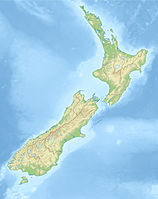
Die Mokohinau Islands sind eine kleine Inselgruppe vor der Nordostküste der Nordinsel Neuseelands.

Die Inseln liegen 21 km nordwestlich von Great Barrier Island und etwa 52 km östlich von Bream Head. Die meisten werden vom Department of Conservation als Naturschutzgebiete verwaltet und dürfen nur mit Genehmigung betreten werden.

Große Teile von Burgess Island wurden durch Department of Conservation hingegen als Country Park ausgewiesen, was eine Nutzung zu Erholungszwecken erlaubt. Der Rest der Insel ist Kronland und wird vom Verkehrsministerium verwaltet.

Auf Burgess Island steht seit 1883 der Leuchtturm Mokohinau Islands Lighthouse, einer der Leuchttürme Neuseelands mit der größten Entfernung zu den Hauptinseln. Seit 1980 ist der Leuchtturm vollautomatisiert.

Die Inselhauptgruppe besteht neben Burgess Island aus zahlreichen kleinen Inseln, von denen die größeren Atihau Island und Hokoromea Island sind. Etwa 6 km südöstlich liegt die Insel Fanal Island, 7 km westlich das kleine Groper Island.

Quellen

Mokohinau Islands Scenic & Nature Reserves (Department of Conservation Website)


Wikimedia Foundation.

Игры ⚽ Нужна курсовая?

Schlagen Sie auch in anderen Wörterbüchern nach:

  • Mokohinau Islands — Maori: Mokohinau Geography Coordinates …   Wikipedia

  • Mokohinau Islands Lighthouse — Location Mokohinau Islands, North Island, New Zealand Coordinates 35°54′S 175°07′E /  …   Wikipedia

  • Mokohinau skink — Scientific classification Kingdom: Animalia Phylum …   Wikipedia

  • List of islands of New Zealand — New Zealand consists of a large number of islands. The two main islands, which are much larger than the rest and where most of the population lives, are the North Island and the South Island. The latter is often a little ironically referred to as …   Wikipedia

  • Poor Knights Islands — Infobox Islands name = Poor Knights Islands location = Northland, New Zealand coordinates = coord|35|30|S|174|45|E area = 24 km² country = New Zealand The Poor Knights Islands are a group of islands off the east coast of the Northland Region of… …   Wikipedia

  • Мокохинау — англ. Mokohinau Islands Координаты: Координаты …   Википедия

  • Fanal Island — Vorlage:Infobox Insel/Wartung/Bild fehltVorlage:Infobox Insel/Wartung/Höhe fehlt Fanal Island Gewässer Pazifischer Ozean Inselgruppe Mokohinau Islands Geographische Lage …   Deutsch Wikipedia

  • Liste neuseeländischer Inseln — Diese Liste führt die Inseln Neuseelands auf. Neben den zwei Hauptinseln gehören eine Reihe von Inseln in der Hauptkette, Binneninseln und die von Neuseeland teils sehr weit entfernten Outlying Islands zu Neuseeland. Außerdem sind einige… …   Deutsch Wikipedia

  • Auckland City — This article is about the former local government area. For the football team, see Auckland City FC. For the greater metropolitan area, see Auckland. Auckland City   Territorial authority of New Zealand   …   Wikipedia

  • Ornate skink — Conservation status Vulnerable (IUCN 2.3) Scientific classification Kingdom …   Wikipedia

Share the article and excerpts

Direct link
Do a right-click on the link above
and select “Copy Link”