Fort William (Ontario)

Fort William (Ontario)
Fort William
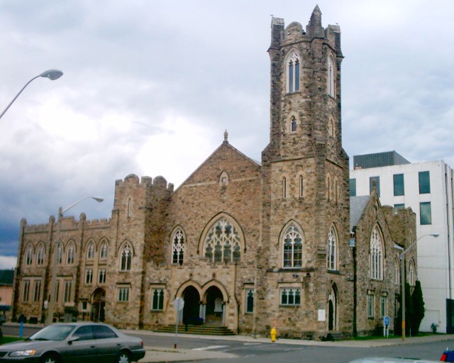
Presbyterianerkirche St. Andrew’s in Fort William
Lage in Ontario
Fort William (Ontario)
Fort William
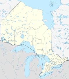
Fort William
Staat: Kanada
Provinz: Ontario
Koordinaten: 48° 23′ N, 89° 17′ W48.38-89.28Koordinaten: 48° 23′ N, 89° 17′ W

Fort William ist ein Stadtteil von Thunder Bay in Ontario und liegt an der Mündung des Flusses Kaministiquia in den Oberen See. Er besteht aus den Stadtbezirken McKellar und Westford wards. Bis Januar 1970 war Fort William eine eigenständige Stadt und schloss sich dann mit der Stadt Port Arthur und den Gemeinden Neebing und McIntyre zur Stadt Thunder Bay zusammen. Zu dieser Zeit war Fort William die größte Stadt in Nordwest-Ontario. Heute leben dort etwa 2000 Menschen.

Der Stadtteil wird heute als Downtown Fort William bezeichnet, wobei auch die Bezeichnungen Thunder Bay South oder The South Core gebräuchlich sind. Er ist der städtische Kern der südlichen Hälfte von Thunder Bay und Sitz des Thunder Bay City Councils.

Persönlichkeiten

Weblinks


Wikimedia Foundation.

Игры ⚽ Поможем решить контрольную работу

Schlagen Sie auch in anderen Wörterbüchern nach:

  • Fort William, Ontario — Fort William was a city in Northern Ontario, located on the Kaministiquia River, at its entrance to Lake Superior. It amalgamated with Port Arthur and the townships of Neebing and McIntyre to form the City of Thunder Bay in January 1970. At that… …   Wikipedia

  • Fort William (Ontario) — Thunder Bay (Ontario) Pour les articles homonymes, voir Thunder Bay. Thunder Bay Vue du port de Thunder Bay …   Wikipédia en Français

  • Downtown Fort William, Ontario — This article is about a neighbourhood in the city of Thunder Bay, Ontario. For the Former city that was amalgamated in 1970 see Fort William, Ontario Downtown Fort William Cuthbertson Block built 1908[1] …   Wikipedia

  • Fort William — may refer to placesIn Canada: *Fort William, Ontario, a Canadian city which, together with Port Arthur, became part of Thunder Bay in 1970 **Fort William (electoral district), a related Canadian federal electoral district **Fort William… …   Wikipedia

  • Fort William — ist oder war der Name folgender Orte und Festungen: in Deutschland Fort William (Bremerhaven), ehemaliges Fort, von 1830 bis 1834 vom Königreich Hannover an die Mündung der Geeste gebaut und 1869 abgebrochen; benannt nach König William IV. von… …   Deutsch Wikipedia

  • Fort Albany (Ontario) — 52°15′04″N 81°30′04″O / 52.25111, 81.50111 …   Wikipédia en Français

  • Fort William Historical Park — Established 1973 Location Thunder Bay, Ontario, Canada. Type Historical Park Websit …   Wikipedia

  • Fort William First Nation — is an Ojibway First Nation south of and adjacent to Thunder Bay, Ontario, Canada. As of January 2008, the First Nation had a registered population of 1,798 people, of which their on Reserve population was 832 people. Fort William First Nation has …   Wikipedia

  • Fort William (electoral district) — Fort William was a federal electoral district represented in the Canadian House of Commons from 1925 to 1979. It was located in the province of Ontario. This riding was created in 1924 from parts of Fort William and Rainy River riding.It was… …   Wikipedia

  • Fort William — 〚after William McGillivray, a director of the North West Co.〛 see THUNDER BAY * * * a town in the southern Highlands of Scotland. It takes its name from a fort built in 1655 and destroyed in 1866. It is now an important tourist centre. * * *… …   Universalium

Share the article and excerpts

Direct link
Do a right-click on the link above
and select “Copy Link”