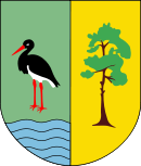
- Gmina Gostynin
-
Gmina Gostynin 
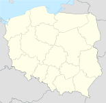
Basisdaten Staat: Polen Woiwodschaft: Masowien Landkreis: Gostyniński Geographische Lage: 52° 25′ N, 19° 28′ O52.41666666666719.466666666667Koordinaten: 52° 25′ 0″ N, 19° 28′ 0″ O Einwohner: -
(31. Dez. 2010)[1]Postleitzahl: 09-500 Telefonvorwahl: (+48) 24 Kfz-Kennzeichen: WGS Wirtschaft und Verkehr Nächster int. Flughafen: Warschau Gemeinde Gemeindeart: Landgemeinde Gemeindegliederung: 56 Schulzenämter Fläche: 270,7 km² Einwohner: 12.414
(31. Dez. 2010) [2]Bevölkerungsdichte: 46 Einw./km² Gemeindenummer (GUS): 1404022 Verwaltung Bürgermeister: Edmund Zieliński Adresse: ul. Rynek 26
09-500 GostyninWebpräsenz: gminagostynin.pl Die Gmina Gostynin ist eine Landgemeinde in der Woiwodschaft Masowien in der östlichen Mitte Polens. Hauptort ist die Stadt Gostynin, obwohl die Stadt nicht Teil des Hoheitsgebiets der gleichnamigen Landgemeinde ist.
Die Gemeinde hat eine Fläche von 270,69 Quadratkilometern[3] und die Gesamtbevölkerung beträgt 12.414 Einwohner (2010)[4].
Inhaltsverzeichnis
Dörfer
Zur Gmina Gostynin gehören folgende Dörfer und Siedlungen (ggf. angegebene deutsche Ortsnamen galten 1943-1945[5]):
- Aleksandrynów
- Anielin
- Antoninów
- Baby Dolne
- Baby Górne
- Belno
- Białe
- Białotarsk (Weißenmarkt)
- Bielawy
- Bierzewice
- Bolesławów (Friedenslust)
- Budy Kozickie
- Budy Lucieńskie
- Choinek
- Dąbrówka
- Emilianów
- Feliksów
- Gaśno
- Górki Drugie
- Górki Pierwsze
- Gorzewo
- Gulewo
- Halinów
- Helenów
- Huta Zaborowska
- Jaworek (Donnersruh)
- Józefków
- Kazimierzów
- Kiełpieniec
- Kleniew
- Klusek
- Kozice
- Krzywie
- Legarda
- Leśniewice
- Lipa
- Lisica
- Łokietnica
- Lucień
- Marianka
- Marianów
- Marianów Sierakowski
- Mysłownia Nowa
- Nagodów
- Niecki
- Nowa Huta
- Nowa Jastrzębia
- Nowa Wieś
- Nowy Zaborów
- Osada
- Osiny
- Podgórze (Heinleben)
- Pomorzanki
- Rębów
- Rogożewek
- Rumunki
- Ruszków
- Rybne
- Sałki
- Sieraków (Sirkenhauland)
- Sierakówek
- Skrzany
- Sokołów (Aargrund)
- Solec
- Stanisławów
- Stanisławów Skrzański
- Stary Zaborów
- Stefanów (Stedingen)
- Strzałki
- Wrząca
- Zieleniec
- Zuzinów
- Zvolen
Benachbarte Gemeinden
Die Landgemeinde Gostynin grenzt an die Stadt Gostynin und die Gemeinden Baruchowo, Łąck, Łanięta, Kujawski, Nowy Duninów, Strzelce und Szczawin Kościelny.
Weblinks
- Offizielle Webseite der Gmina Gostynin (polnisch)
- Liste der Schulzenämter von Gmina Gostynin (polnisch)
Einzelnachweise
- ↑ Population. Size and Structure by Territorial Division. As of December 31, 2010. Główny Urząd Statystyczny (GUS), abgerufen am 22. Juli 2011.
- ↑ Population. Size and Structure by Territorial Division. As of December 31, 2010. Główny Urząd Statystyczny (GUS), abgerufen am 22. Juli 2011.
- ↑ Gmina Gostynin, regioset.pl
- ↑ Baza Demografia, Stan ludności, 2010, Ludność według płci i gmin, Mazowieckie
- ↑ Deutsche Heereskarte, 1: 300 000, Blatt Nr. Q 53 Schröttersburg, Stand VI 1944
Kategorie:- Gmina in der Woiwodschaft Masowien
Wikimedia Foundation.

