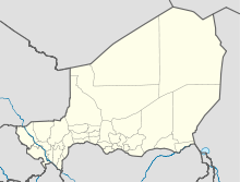
Gueskérou

Gueskérou
13.48194444444412.843055555556
Gueskérou (Niger)
Gueskérou
Gueskérou

Gueskérou ist eine Landgemeinde im Departement Diffa der gleichnamigen nigrischen Region Diffa. Sie hat 39.553 Einwohner (2010).[1]

Gueskérou liegt in der Sahelzone im Süden des Departements. Das Ortszentrum befindet sich direkt am Fluss Komadugu Yobe, der hier die Staatsgrenze zu Nigeria bildet. Unmittelbar westlich von Gueskérou liegt die Regionalhauptstadt Diffa. Bedingt durch die Lage am Fluss erstrecken sich rund um das Ortszentrum mehrere Gärten, bei einem sonst überwiegend trockenen Gemeindegebiet. Gueskérou besteht aus 61 traditionellen Dörfern, 59 administrativen Dörfern, zwei Lagern und 22 Wasserstellen.[2] Durch das Gemeindegebiet führt die Nationalstraße 1. Gueskérou wurde im Jahr 1933 der Hauptort des neu geschaffenen Kantons Komadougou.[3] Bei der Verwaltungsreform von 2002 wurden alle Kantone Nigers aufgelöst und Gueskérou hat seitdem nur noch den Status einer einfachen Landgemeinde (französisch: commune rurale).

Einzelnachweise

  1. Institut national de la statistique (Hrsg.): Annuaire statistique des cinquante ans d’indépendence du Niger. Niamey 2010 (Online-Version), S. 53.
  2. Répertoire National des Communes (RENACOM). Website des Institut National de la Statistique, abgerufen am 22. Januar 2011.
  3. Edmond Séré de Rivières: Histoire du Niger. Berger-Levrault, Paris 1965, S. 253.

Wikimedia Foundation.

Игры ⚽ Поможем сделать НИР

Schlagen Sie auch in anderen Wörterbüchern nach:

  • Gueskerou — is a town in southeastern Niger …   Wikipedia

  • List of cities in Niger — Map of Niger Niamey, Capital of Niger …   Wikipedia

  • Diffa —   Urban Commune   …   Wikipedia

  • N'guigmi — Nguigmi, Ngigmi Camel riders line up outside the residence of the traditional chief of Nguigmi …   Wikipedia

  • Dosso, Niger — Dosso Officials at the opening of the Regional Maternity hospital, 2008 …   Wikipedia

  • Djado Plateau — The ruined city of Djado, with nomadic women gathered in the foreground. October 1989. The Djado Plateau lies in the Sahara, in north eastern Niger. It is known for its cave art (often of large mammals long since absent from the area), but is now …   Wikipedia

  • Diffa Region — Diffa   Region   Location within Niger Coordinates …   Wikipedia

  • Dakoro — is a town and commune located in the Maradi Region of Niger. Coordinates: 14°30′N 6°45′E /  …   Wikipedia

  • Dogondoutchi — Dogondoutchi …   Wikipedia

  • Mayahi — (var. Mayaki) is a town located in the Maradi Region of Niger. It is the seat of Mayahi Department and a Commune about 45km from Tessaoua. In the mid 1990s it had a population of 2,200.[1] The name Mayaki is also a rulers title among the Sudié… …   Wikipedia

Share the article and excerpts

Direct link
Do a right-click on the link above
and select “Copy Link”