- Hoseason Island
-
Hoseason Island Gewässer Bransfieldstraße (Südlicher Ozean) Inselgruppe Palmer-Archipel Geographische Lage 63° 45′ 50″ S, 61° 39′ 50″ W-63.763915-61.663971Koordinaten: 63° 45′ 50″ S, 61° 39′ 50″ W 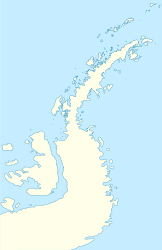

Länge 9 km Breite 4,5 km Einwohner (unbewohnt) Hoseason Island ist eine subantarktische Insel, ca. 9 km lang und 4,5 km breit. Sie ist etwa 20 km nordnordöstlich von Liège Island und 30 km westlich von Trinity Island gelegen. Sie liegt im Norden des Palmer-Archipels. Von der zur Südgruppe der Südlichen Shetlandinseln gehörenden Low Island ist sie durch die Bransfield-Straße getrennt. Sie wurde nach James Hoseason benannt, einem britischen Seefahrer, der 1824–25 die umliegenden Gewässer befuhr.
Weblinks
- Hoeason Island (Englisch). Geographic Names Information System. United States Geological Survey. Abgerufen am 30. Juli 2011.
Inseln im Palmer-ArchipelAnvers-Insel | Brabant-Insel | Doumer-Insel | Goudier-Insel | Hoseason Island | Liège Island | Melchior-Inseln | Ohlin Island | Tower Island | Trinity Island | Two Hummock Island | Wiencke-Insel
Wikimedia Foundation.
Schlagen Sie auch in anderen Wörterbüchern nach:
Ohlin Island — Vorlage:Infobox Insel/Wartung/Bild fehltVorlage:Infobox Insel/Wartung/Fläche fehltVorlage:Infobox Insel/Wartung/Höhe fehlt Ohlin Island Gewässer Bransfieldstraße (Südlicher Ozean) Inselgruppe Palmer Archipel … Deutsch Wikipedia
Tower Island — Vorlage:Infobox Insel/Wartung/Bild fehltVorlage:Infobox Insel/Wartung/Fläche fehlt Tower Island Gewässer Bransfieldstraße (Südlicher Ozean) Inselgruppe Palmer Archipel Geograp … Deutsch Wikipedia
Trinity Island — Vorlage:Infobox Insel/Wartung/Bild fehltVorlage:Infobox Insel/Wartung/Höhe fehlt Trinity Island Gewässer Südlicher Ozean Inselgruppe Palmer Archipel Geographische Lage … Deutsch Wikipedia
Liège Island — Vorlage:Infobox Insel/Wartung/Bild fehltVorlage:Infobox Insel/Wartung/Fläche fehltVorlage:Infobox Insel/Wartung/Höhe fehlt Liège Island Gewässer Südlicher Ozean Inselgruppe Palmer Archipel … Deutsch Wikipedia
Two Hummock Island — Vorlage:Infobox Insel/Wartung/Bild fehltVorlage:Infobox Insel/Wartung/Fläche fehlt Two Hummock Island Gewässer Südlicher Ozean Inselgruppe Palmer Archipel Geographische Lage … Deutsch Wikipedia
Chanticleer Island — (63°43′S 61°48′W / 63.717°S 61.8°W / 63.717; 61.8) is a nearly snow free island, 1 mile (1.6 km) long, lying off the northwest end of Hoseason Island in the Palmer Archipelago … Wikipedia
Brabant-Insel — Vorlage:Infobox Insel/Wartung/Bild fehlt Brabant Island Gewässer Südlicher Ozean Inselgruppe Palmer Archipel Geographische Lage … Deutsch Wikipedia
Wiencke-Insel — Blick auf die Sierra DuFief im Süden der Insel von Nordwesten. Links Luigi Peak … Deutsch Wikipedia
Anvers-Insel — Gewässer Südlicher Ozean Inselgruppe … Deutsch Wikipedia
Melchior-Inseln — Gewässer Südpolarmeer Archipel Palmer Archipel Geographische Lage … Deutsch Wikipedia
Hoseason Island

18+
© Academic, 2000-2026
- Kontaktieren Sie uns: Unterstützung, Werbung
Wörterbücher Export, schritte mit PHP, Joomla, Drupal, WordPress, MODx.