Jones-Confluence Point State Park
- Jones-Confluence Point State Park
-
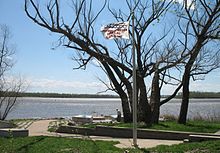
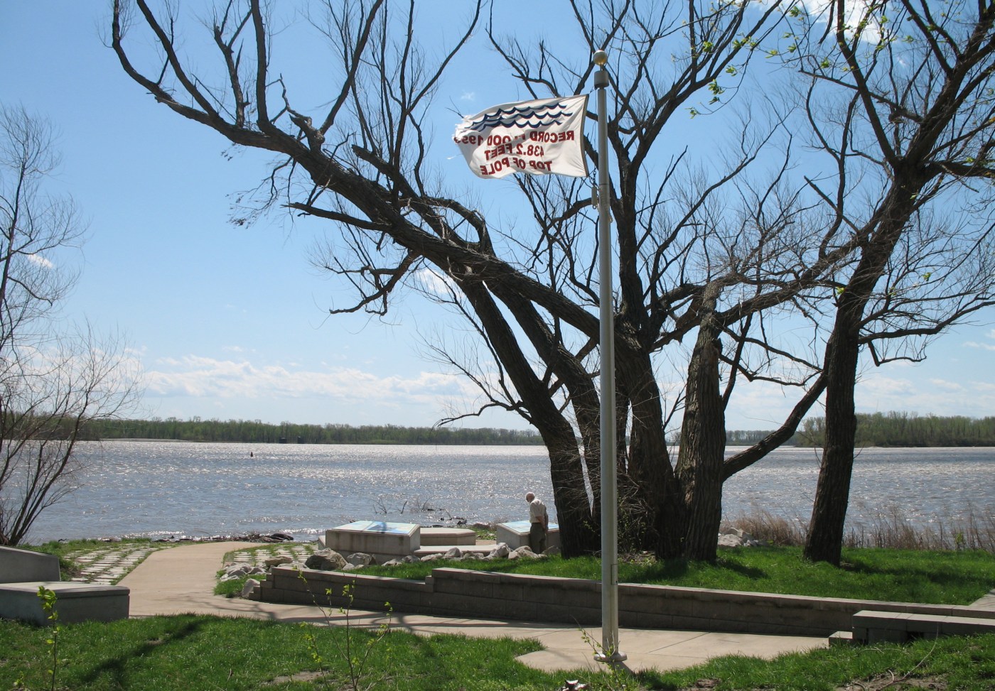
Fahnenmast mit Hochwassermarkierung der großen Flut von 1993

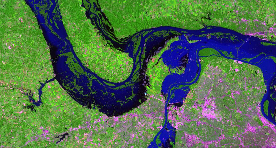
Satellitenfoto während der großen Flut 1993
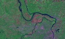
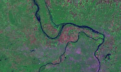
Satellitenfoto 2002 im "Normalzustand"
Im Edward "Ted" and Pat Jones-Confluence Point State Park fließen die beiden großen Ströme Missouri River und Mississippi River zusammen. Der 454 ha große State Park liegt 15 km nördlich von St. Louis im St. Charles County des US-Bundesstaates Missouri.
Bereits 1721 erwähnte der Forscher Pierre François Xavier de Charlevoix schwärmerisch die Vereinigung der beiden Flüsse. Am 14. Mai 1804 begannen die Pioniere und Forscher Meriwether Lewis und William Clark ihre Expedition den Missouri flussaufwärts auf der Suche nach einer Passage zur Pazifikküste.
Seither haben die Flussbetten ihren Lauf immer wieder variiert und die konkrete Stelle des Zusammenflusses ist 2 km weiter flussabwärts anzutreffen als noch Jahrhunderte zuvor. Landschaftlich sind in der Gegend Auenwälder, Schwemmland, Hochwassergebiete und Prärie anzutreffen. Kanadareiher und Weißkopfseeadler, Pelikane, Gänse, Möven und viele Singvogelarten bevölkern den Park. Zahlreiche Zugvögel können im Frühjahr und Herbst beobachtet werden. Den Mississippi-Korridor nutzen 60% aller nordamerikanischen Zugvögel inklusive 40% der Wasservögel.
Der seit 2001 bestehende State Park wurde nach Edward “Ted” und Pat Jones benannt, die Spenden in Millionenhöhe für den Ausbau des Katy Trail State Park zur Verfügung gestellt haben. Beide Parks sind mit weiteren im Confluence Greenway vernetzt.
Am 20. Mai 2009 wurde der Park ebenso wegen Hochwasser geschlossen wie während der Mississippiflut 2011. [1][2]
Einzelnachweise
- ↑ http://www.mostateparks.com/confluence.htm
- ↑ http://www.mostateparks.com/confluence/geninfo.htm
Weblinks
38.8175-90.119722222222
Wikimedia Foundation.
Schlagen Sie auch in anderen Wörterbüchern nach:
Jones-Confluence Point State Park — is a Missouri state park located on the north side of the Missouri River at its confluence with the Mississippi River, approximately 8 miles north of the St. Louis Arch. The park was opened May 9, 2004, and includes 1,118 acres (4.5 km sup2;) of… … Wikipedia
Dash Point State Park — in King and Pierce Counties, Washington, is one of the Washington State Parks.[1] It consists of 398 acres (161 ha) including 3,301 feet (1,006 m) of saltwater shoreline on Puget Sound. Available activities include camping, beachcombing … Wikipedia
Damon Point State Park — in Grays Harbor County, Washington is one of the Washington State Parks.[1] It consists of 61 acres (25 ha) at the southeastern tip of Ocean Shores Peninsula and consists of a 1 mile (1.6 km) by 0.5 miles (0.80 km) piece of land… … Wikipedia
State Parks in Missouri — Dies ist eine Liste der State Parks und Historic Sites im US Bundesstaat Missouri. Sowohl State Parks als auch Historic Sites werden von der Division of State Parks of the Missouri Department of Natural Resources verwaltet. Elephant Rock State… … Deutsch Wikipedia
Confluence Greenway — The Confluence Greenway is a 200 square mile (520 km2) system of parks, conservation and recreation areas located in the St. Louis, Missouri metropolitan area. Various parks, trails, and attractions are located along forty miles of both the… … Wikipedia
Onondaga Cave State Park — Coordinates: 38°3′40″N 91°13′38″W / 38.06111°N 91.22722°W / 38.06111; 91.22722 … Wikipedia
Crowder State Park — Coordinates: 40°5′32″N 93°39′33″W / 40.09222°N 93.65917°W / 40.09222; 93.65917 … Wikipedia
Meramec State Park — Coordinates: 38°12′24″N 91°6′9″W / 38.20667°N 91.1025°W / 38.20667; 91.1025 … Wikipedia
Babler State Park — Coordinates: 38°37′12″N 90°41′40″W / 38.62°N 90.69444°W / 38.62; 90.69444 … Wikipedia
Cuivre River State Park — Coordinates: 39°2′6″N 90°55′58″W / 39.035°N 90.93278°W / 39.035; 90.93278 … Wikipedia