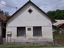
- Klenovec
-
Klenovec
Wappen Karte  Basisdaten
Kraj: Banskobystrický kraj Okres: Rimavská Sobota Region: Gemer Fläche: 99,996 km² Einwohner: 3.199 (31. Dez. 2010) Bevölkerungsdichte: 31,99 Einwohner je km² Höhe: 358 m n.m. Postleitzahl: 980 55 Telefonvorwahl: 0 47 Geographische Lage: 48° 36′ N, 19° 53′ O48.619.883333333333358Koordinaten: 48° 36′ 0″ N, 19° 53′ 0″ O Kfz-Kennzeichen: RS Gemeindekennziffer: 515043 StrukturGemeindeart: Gemeinde Verwaltung (Stand: Februar 2011)Bürgermeister: Zlata Kaštanová Adresse: Obecný úrad Klenovec
Námestie Karola Salvu 1
980 55 KlenovecWebpräsenz: www.klenovec.sk Gemeindeinformation
auf portal.gov.skStatistikinformation
auf statistics.skKlenovec (deutsch Klenowetz, ungarisch Klenóc) ist eine große Gemeinde in der Mittelslowakei.
Inhaltsverzeichnis
Geographie
Die Gemeinde liegt in den Veporské vrchy, einem Gebirge des Slowakischen Erzgebirge und liegt am Flüsschen Klenovská Rimava, einem Zufluss von Rimava. Oberhalb der Gemeinde befindet sich ein kleiner Stausee (vodná nádrž Klenovec) und durch das große Katastralgebiet reicht die Gemeinde zum Berg Klenovský Vepor (1.338 m n.m.), 15 km nordwestlich des Ortszentrums. Die Stadt Hnúšťa befindet sich 6 km nach Osten, die Bezirksstadt Rimavská Sobota liegt 30 km nach Süden, während die Regionalhauptstadt Banská Bystrica etwa 70 km nach Westen gelegen ist.
Geschichte
Klenovec wurde zum ersten Mal im Jahre 1340 erwähnt. Der Ort gehörte im Mittelalter zum Herrschaftsgut von Burg Pirsenstein (Hajnáčka), danach gehörte er von 1591 bis zur Abschaffung der Leibeigenschaft im 19. Jahrhundert der Familie Kubínyi. Die Gemeinde wird außerdem mit dem slowakischen Räuberführer Juraj Jánošík verbindet, da er hier im Frühling 1713 mit seinem Kumpel Tomáš Uhorčík gefasst wurde und am 18. März 1713 in Liptovský Mikuláš hingerichtet.
Bis 1918 gehörte der Ort Komitat Gemer und Kleinhont zum Königreich Ungarn und wurde danach Teil der neu entstandenen Tschechoslowakei.
Bevölkerung
Die Bevölkerung ist laut der Volkszählung 2001 zu 93,1 % slowakisch; daneben gibt es auch einige Roma (5,9 %). Mehr als Hälfte (52,9 %) der Einwohner sind evangelisch, daneben 26,6 % gaben ihre Konfession als katholisch an und 15,6 % bezeichneten sich als Atheisten.
Persönlichkeiten
- Vladimír Mináč (1922–1996), slowakischer Schriftsteller und Essayist.
Weblinks
 Commons: Klenovec – Sammlung von Bildern, Videos und AudiodateienGemeinden im Okres Rimavská Sobota
Abovce | Babinec | Barca | Bátka | Belín | Blhovce | Bottovo | Budikovany | Cakov | Čerenčany | Čierny Potok | Číž | Dolné Zahorany | Dražice | Drienčany | Drňa | Dubno | Dubovec | Dulovo | Figa | Gemerček | Gemerské Dechtáre | Gemerské Michalovce | Gemerský Jablonec | Gortva | Hajnáčka (Pirsenstein) | Hnúšťa (Nusten) | Hodejov | Hodejovec | Horné Zahorany | Hostice | Hostišovce | Hrachovo | Hrušovo | Hubovo | Husiná | Chanava | Chrámec | Ivanice | Janice | Jesenské | Jestice | Kaloša | Kesovce | Klenovec (Klenowetz) | Kociha | Konrádovce | Kráľ | Kraskovo | Krokava | Kružno | Kyjatice | Lehota nad Rimavicou | Lenartovce | Lenka | Lipovec | Lukovištia | Martinová | Neporadza | Nižný Skálnik | Nová Bašta | Orávka | Ožďany | Padarovce | Pavlovce | Petrovce | Poproč | Potok | Radnovce | Rakytník | Ratkovská Lehota | Ratkovská Suchá | Riečka | Rimavská Baňa | Rimavská Seč | Rimavská Sobota (Großsteffelsdorf) | Rimavské Brezovo | Rimavské Janovce | Rimavské Zalužany | Rovné | Rumince | Slizké | Stará Bašta | Stránska | Studená | Sútor | Šimonovce | Širkovce | Španie Pole | Štrkovec | Tachty | Teplý Vrch | Tisovec (Theißholz) | Tomášovce | Uzovská Panica | Valice | Včelince | Večelkov | Veľké Teriakovce | Veľký Blh | Vieska nad Blhom | Vlkyňa | Vyšné Valice | Vyšný Skálnik | Zacharovce | Zádor | Žíp
Wikimedia Foundation.
Schlagen Sie auch in anderen Wörterbüchern nach:
Klenovec — (Village) Administration Pays Slovaquie … Wikipédia en Français
Klenovec — is a village and municipality in the Rimavská Sobota District of the Banská Bystrica Region of southern Slovakia. External links*http://www.statistics.sk/mosmis/eng/run.html … Wikipedia
Mitropapokal 1936 — Der Mitropapokal 1936 war die 10. Auflage des internationalen Cupwettbewerbs des mitteleuropäischen Vereinsfußballs. Es nahmen die besten Mannschaften Österreichs, Ungarns, der Tschechoslowakei, Italiens und der Schweiz teil. Es handelte sich… … Deutsch Wikipedia
Mitropapokal 1935 — Der Mitropapokal 1935 war die 9. Auflage des internationalen Cupwettbewerbs. Es nahmen wiederum die besten Mannschaften Österreichs, Ungarns, der Tschechoslowakei und Italiens teil. Es handelte sich zumeist um die Meister, Vizemeister und… … Deutsch Wikipedia
Juraj Jánošík — (first name also Juro or Jurko , modern pronunciation: IPA|/ juraj jaːnʃiːk/, modern pronunciation: IPA|/ jɛʒɨ ja nɕik/, hu. György Jánosik, pl. Juraj Janosik), baptised January 25, 1688, died March 17, 1713, was a famous Slovak outlaw, also… … Wikipedia
Banská Bystrica Region — Geobox | Region name = Banská Bystrica other name = category = Region image caption = image caption = symbol = symbol type = Coat of arms etymology = official name = motto = nickname = country = Slovakia country state = region = district =… … Wikipedia
Rimavská Sobota District — District Country Slovakia Re … Wikipedia
Čerenčany — Rimavska Sobota District in the Banská Bystrica region Čerenčany (earlier Cšerencšány, is a village and municipality in the Rimavská Sobota District of the Banská Bystrica Region of southern Slovakia. During the past years village recorded… … Wikipedia
Čierny Potok — Rimavska Sobota District in the Banská Bystrica region Čierny Potok is a village and municipality in the Rimavská Sobota District of the Banská Bystrica Region of southern Slovakia. History It arose in 1955 by separation from Hodejov. During… … Wikipedia
Číž — Ciz redirects here. For the footballer, see Diego Ciz. Coordinates: 48°19′N 20°17′E / 48.317°N 20.283°E / 48.317; 20.28 … Wikipedia


