- Kováčovce
-
Kováčovce
Wappen Karte 
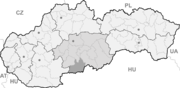

Kováčovce BasisdatenKraj: Banskobystrický kraj Okres: Veľký Krtíš Region: Poiplie Fläche: 11,625 km² Einwohner: 371 (31. Dez. 2010) Bevölkerungsdichte: 31,91 Einwohner je km² Höhe: 150 m n.m. Postleitzahl: 991 06 (Postamt Želovce) Telefonvorwahl: 0 47 Geographische Lage: 48° 6′ N, 19° 27′ O48.09444444444419.458333333333150Koordinaten: 48° 5′ 40″ N, 19° 27′ 30″ O Kfz-Kennzeichen: VK Gemeindekennziffer: 516147 StrukturGemeindeart: Gemeinde Gliederung Gemeindegebiet: 2 Gemeindeteile Verwaltung (Stand: Juni 2011)Bürgermeister: Jozef Filip Adresse: Obecný úrad Kováčovce
č. 52
991 06 ŽelovceWebpräsenz: www.kovacovce.ocu.sk Gemeindeinformation
auf portal.gov.skStatistikinformation
auf statistics.skKováčovce (ungarisch Szécsénykovácsi, nach 1945 auch Ipoly-Kovácsi) ist eine kleine Gemeinde im Süden der Slowakei, mit 371 Einwohnern (Stand 31. Dezember 2010). Sie gehört zum Okres Veľký Krtíš, einem Kreis des übergeordneten Bezirks Banskobystrický kraj.
Geographie
Die Gemeinde liegt im Talkessel Ipeľská kotlina, einem Unterteil der Juhoslovenská kotlina, an einer Schleife des Grenzflusses Ipeľ (ung. Ipoly), als der Fluss seine Richtung vom Süden nach Westen ändert. Kováčovce ist acht Kilometer vom ungarischen Szécsény und 23 Kilometer von Veľký Krtíš entfernt.
Verwaltungstechnisch gliedert sich die Gemeinde in Gemeindeteile Kováčovce und Peťov (1898 eingemeindet, ungarisch Pető).
Geschichte
Der Ort wurde zum ersten Mal 1295 als Koachy schriftlich erwähnt. Der Name leitet sich von der Tatsache, dass die ersten Einwohner Schmiede (slow. kováč = ung. kovács) waren, ab. Kováčovce gehörte zum Herrschaftsgut der nahen Stadt Szécsény, daher auch der ungarische Prädikat. Die Einwohner waren vor allem in Landwirtschaft, Gemüseanbau und Weinbau beschäftigt, was bis heute der Fall ist.
Bis 1919 gehörte der Ort im Komitat Neograd zum Königreich Ungarn und kam danach zur Tschechoslowakei. 1938–45 lag er auf Grund des Ersten Wiener Schiedsspruchs noch einmal in Ungarn.
Der slowakische Ort Fiľakovské Kováče trug bis 1927 ebenfalls den offiziellen Namen Kováčovce.
Weblinks
 Commons: Kováčovce – Sammlung von Bildern, Videos und AudiodateienGemeinden im Okres Veľký Krtíš
Balog nad Ipľom | Bátorová | Brusník | Bušince | Čebovce | Čeláre | Čelovce | Červeňany | Dačov Lom (Lam) | Dolinka | Dolná Strehová | Dolné Plachtince (Unterplachtintz) | Dolné Strháre | Ďurkovce | Glabušovce | Horná Strehová | Horné Plachtince (Oberplachtintz) | Horné Strháre | Hrušov | Chrastince | Chrťany | Ipeľské Predmostie | Kamenné Kosihy | Kiarov | Kleňany (Kleinen) | Koláre | Kosihovce | Kosihy nad Ipľom | Kováčovce | Lesenice (Lesenitz) | Ľuboriečka | Malá Čalomija | Malé Straciny | Malé Zlievce (Kleinzellowitz) | Malý Krtíš | Modrý Kameň (Blauenstein) | Muľa | Nenince (Luka-Ninitz) | Nová Ves | Obeckov | Olováry | Opatovská Nová Ves | Opava | Pôtor | Pravica | Príbelce | Sečianky | Seľany | Senné | Sklabiná | Slovenské Ďarmoty | Slovenské Kľačany | Stredné Plachtince (Mitterplachtintz) | Sucháň | Suché Brezovo | Širákov | Šuľa | Trebušovce | Veľká Čalomija | Veľká Ves nad Ipľom | Veľké Straciny | Veľké Zlievce (Großzellowitz) | Veľký Krtíš | Veľký Lom | Vieska | Vinica (Ninik) | Vrbovka | Záhorce | Závada | Zombor | Želovce
Wikimedia Foundation.
Schlagen Sie auch in anderen Wörterbüchern nach:
Kováčovce — (Village) Administration Pays Slovaquie … Wikipédia en Français
Kováčovce — ( hu. Szécsénykovácsi) is a village and municipality in the Veľký Krtíš District of the Banská Bystrica Region of southern Slovakia.External links*http://www.statistics.sk/mosmis/eng/run.html … Wikipedia
Banská Bystrica Region — Geobox | Region name = Banská Bystrica other name = category = Region image caption = image caption = symbol = symbol type = Coat of arms etymology = official name = motto = nickname = country = Slovakia country state = region = district =… … Wikipedia
Veľký Krtíš District — District Country Slovakia Region ( … Wikipedia
Veľký Krtíš — Coordinates: 48°12′54″N 19°20′17″E / 48.215°N 19.33806°E / 48.215; 19.33806 … Wikipedia
Dolinka — See also: Dolinka, Człuchów County Veľký Krtíš District in the Banská Bystrica region Dolinka (Hungarian: Inám) is a village and municipality in the Veľký Krtíš District of the Banská Bystrica Region of southern Slovakia … Wikipedia
Opava, Veľký Krtíš District — Veľký Krtíš District in the Banská Bystrica region Opava is a village and municipality in the Veľký Krtíš District of the Banská Bystrica Region of southern Slovakia … Wikipedia
Chrastince — Veľký Krtíš District in the Banská Bystrica region Chrastince (Hungarian: Ipolyharaszti) is a village and municipality in the Veľký Krtíš District of the Banská Bystrica Region of southern Slovakia. History The village was fi … Wikipedia
Obeckov — Veľký Krtíš District in the Banská Bystrica region Obeckov is a village and municipality in the Veľký Krtíš District of the Banská Bystrica Region of southern Slovakia … Wikipedia
Dolná Strehová — Veľký Krtíš District in the Banská Bystrica region Dolná Strehová (Hungarian: Alsósztregova) is a village and municipality in the Veľký Krtíš District of the Banská Bystrica Region of southern Slovakia. History In … Wikipedia
Kováčovce


18+
© Academic, 2000-2026
- Kontaktieren Sie uns: Unterstützung, Werbung
Wörterbücher Export, schritte mit PHP, Joomla, Drupal, WordPress, MODx.