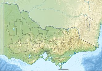
Lake Glenmaggie

Lake Glenmaggie
Lake Glenmaggie

Photo-request.svg

Bild gesucht 

BW

Geographische Lage östliches Gippsland
Zuflüsse Macalister River, Glenmaggie Creek, Stony Creek
Abfluss Macalister River
Orte am Ufer Glenmaggie, Coongulla
Orte in der Nähe Heyfield, Maffra
Daten
Koordinaten 37° 54′ 37″ S, 146° 46′ 33″ O-37.9102146.7759Koordinaten: 37° 54′ 37″ S, 146° 46′ 33″ O
Lake Glenmaggie (Victoria)
Lake Glenmaggie
Fläche 17 km²f5
Länge 9 kmf6
Breite 4,5 kmf7

Der Lake Glenmaggie ist ein Stausee im Verlauf des Macalister River im östlichen Gippsland im australischen Bundesstaat Victoria.

Lage

Der Lake Glenmaggie liegt am Macalister River zwischen den Kleinstädten Glenmaggie am Westufer und Coongulla am Ostufer. Von Westen fließen der Glenmaggie Creek und der Stony Creek zu[1].

Zweck

Der Stausee dient der Bereitstellung von Trinkwasser für die nahegelegenen Städte Heyfield und Maffra.

Einzelnachweise

  1. Map of Lake Glenmaggie, VIC. Bonzle.com

Wikimedia Foundation.

Игры ⚽ Поможем сделать НИР

Schlagen Sie auch in anderen Wörterbüchern nach:

  • Glenmaggie, Victoria — Infobox Australian Place | type = town name = Glenmaggie state = vic caption = Glenmaggie Church lga = Shire of Wellington postcode = 3858 est = pop = 405 elevation= maxtemp = mintemp = rainfall = stategov = Gippsland East fedgov = Gippsland… …   Wikipedia

  • Macalister River — Macallister River Macalister Brücke bei Licola über den Macalister RiverVorlage:Infobox Fluss/KARTE fehlt …   Deutsch Wikipedia

  • Coongulla, Victoria — Coongulla Victoria …   Wikipedia

  • Shire of Wellington — Lage des Wellington Shire in Victoria Basisdaten Bundesstaat: Victoria Hauptort: Sale Fläche: 10.4 …   Deutsch Wikipedia

  • Wellington Shire — Shire of Wellington Lage des Wellington Shire in Victoria Gliederung …   Deutsch Wikipedia

  • Heyfield, Victoria — Infobox Australian Place | type = town name = Heyfield state = vic caption = lga = Shire of Wellington postcode = 3858 est = pop = 1579 (2006)Census 2006 AUS | id = SSC25765 | name = Heyfield (State Suburb) | accessdate = 2007 10 01 | quick = on] …   Wikipedia

  • Heyfield — Temple Street in Heyfield Staat …   Deutsch Wikipedia

  • Shaw Neilson — John Shaw Neilson (February 22, 1872 ndash; 12 May 1942), was an Australian poet.AncestryHe was born at Penola, South Australia. He was of purely Scottish ancestry; his grandparents were John Neilson and Jessie MacFarlane of Cupar, Neil Mackinnon …   Wikipedia

  • Grevillea lanigera — taxobox name = Woolly Grevillea image caption = Grevillea lanigera Coastal Gem regnum = Plantae unranked divisio = Angiosperms unranked classis = Eudicots ordo = Proteales familia = Proteaceae genus = Grevillea species = G. fililoba binomial =… …   Wikipedia

  • List of localities in Victoria (Australia) — Map of Local Government Areas in Victoria This is a list of locality names and populated place names in the state of Victoria, Australia, outside the Melbourne metropolitan area. It is organised by region from the south west of the state to the… …   Wikipedia

Share the article and excerpts

Direct link
Do a right-click on the link above
and select “Copy Link”