- Shire of Wellington
-
Shire of Wellington 
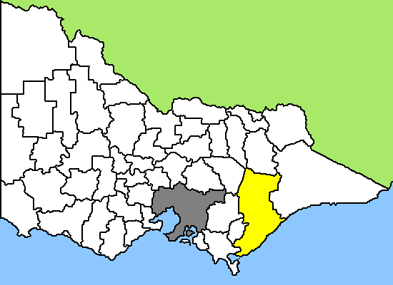
Lage des Wellington Shire in Victoria Basisdaten Bundesstaat: Victoria Hauptort: Sale Fläche: 10.400 km² Einwohner: 42.147 (Juni 2006) Wards: − Wellington Shire ist ein lokales Verwaltungsgebiet (LGA) im australischen Bundesstaat Victoria. Das Gebiet ist 10.400 km² groß und hat etwa 42.000 Einwohner.
Wellington liegt im Südosten Victorias in der Region Gippsland etwa 230 km östlich der Hauptstadt Melbourne und schließt unter anderem folgende Ortschaften ein: Alberton, Balook, Boisdale, Briagalong, Cowwarr, Dargo, Glenmaggie, Coongulla, Golden Beach, Paradise Beach, Gormandale, Heyfield, Hollands Landing, Licola, Loch Sport, Longford, Maffra, Munro, Newry, Port Albert, Rosedale, Sale, Seaspray, Stratford, Tinamba, Woodside, Woodside Beach und Yarram. Der Sitz des City Councils befindet sich in Sale in der Südhälfte der LGA.
Erste Siedlungen entstanden in Wellington in den 30er Jahren des 19. Jahrhunderts. Ortschaften wuchsen in den Jahren des Goldrausches im östlichen Gippsland, als sie insbesondere in den Zeiten vor der Eisenbahn als Zwischenstationen auf dem Weg nach Melbourne fungierten.
Wellington verfügt über viele landschaftliche und touristische Attraktionen. So liegen die Küstenstädte Seaspray, Golden Beach und Lochsport am Ninety Mile Beach von Victoria, dem mit über 151 km längsten zusammenhängenden Sandstrand Australiens. Mehrere Nationalparks liegen im Gebiet der Area, so der Lakes National Park mit den Gippsland-Seen, zu denen Lake Guthridge, Lake Guyatt, der Stausee Lake Glenmaggie und Lake Wellington, der größte der Seen, gehören. Nach Norden folgen die Südausläufer der Great Dividing Range und ein Teil des Alpine National Parks von Victoria, dem größten Nationalpark des Staates. Hier gibt es vor allem bergiges und waldreiches Land.
Bei Longford befindet sich außerdem das Zentrum der Erdöl- und Erdgasgewinnung in Victoria, das in der Bass-Straße vor der Küste gefördert wird. Eine Explosion im zentralen Bereich der Raffinerie bei Langford und ein zwei Tage andauernder Brand legte 1998 die Gasversorgung in Victoria lahm und führte zu wochenlangen Ausfällen in Industrie und Wirtschaft und den Privathaushalten im ganzen Staat.[1]
Verwaltung
Der Wellington Shire Council hat neun Mitglieder, die von den Bewohnern der LGA gewählt werden. Wellington ist nicht in Bezirke untergliedert. Aus dem Kreis der Councillor rekrutiert sich auch der Mayor (Bürgermeister) des Councils.
Quellen
- ↑ http://www.megos.ch/Allgemein/t2000w41.htm#Mittwoch, 7. Oktober 1998
Weblinks
- Offizielle Seite der LGA (engl.)
- Tourism Wellington (engl.)
Ländliche Gebiete: Alpine | Ararat | Ballarat | Bass Coast | Baw Baw | Benalla | Buloke | Campaspe | Central Goldfields | Colac Otway | Corangamite | East Gippsland | Gannawarra | Glenelg | Golden Plains | Greater Bendigo | Greater Geelong | Greater Shepparton | Hepburn | Hindmarsh | Horsham | Indigo | Latrobe | Loddon | Macedon Ranges | Mansfield | Mildura | Mitchell | Moira | Moorabool | Mount Alexander | Moyne | Murrindindi | Northern Grampians | Pyrenees | Queenscliffe | South Gippsland | Southern Grampians | Strathbogie | Surf Coast | Swan Hill | Towong | Wangaratta | Warrnambool | Wellington | West Wimmera | Wodonga | Yarriambiack
Greater Melbourne: Banyule | Bayside | Boroondara | Brimbank | Cardinia | Casey | Darebin | Frankston | Glen Eira | Greater Dandenong | Hobsons Bay | Hume | Kingston | Knox | Manningham | Maroondah | Maribyrnong | Melbourne | Melton | Monash | Moonee Valley | Moreland | Mornington Peninsula | Nillumbik | Port Phillip | Stonnington | Whitehorse | Whittlesea | Wyndham | Yarra | Yarra Ranges
Wikimedia Foundation.