- Lanhelas
-
Lanhelas Wappen Karte 
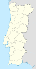

Basisdaten Region: Norte Unterregion: Minho-Lima Distrikt: Viana do Castelo Concelho: Caminha Koordinaten: 41° 55′ N, 8° 47′ W41.909-8.786975Koordinaten: 41° 55′ N, 8° 47′ W Einwohner: 1.080 (Stand: 2001) Fläche: 5,2 km² Bevölkerungsdichte: 208 Einwohner pro km² Politik Webseite: www.lanhelas.pt Lanhelas ist eine Gemeinde (Freguesia) im nordportugiesischen Kreis Caminha. In ihr leben 1080 Einwohner (Stand: 2001).[1]
Einzelnachweise
- ↑ Daten zu Lanhelas (en). alea.pt. Abgerufen am 10. Mai 2011.
Weblinks
- Karte der Freguesia Lanhelas beim Instituto Geográfico do Exército
 Freguesias im Concelho Caminha
Âncora | Arga de Baixo | Arga de Cima | Arga de São João | Argela | Azevedo | Caminha | Cristelo | Dem | Gondar | Lanhelas | Moledo | Orbacém | Riba de Âncora | Seixas | Venade | Vila Praia de Âncora | Vilar de Mouros | Vilarelho | Vile
Wikimedia Foundation.
Schlagen Sie auch in anderen Wörterbüchern nach:
Lanhelas — Freguesia de Portugal Entidad Freguesia • País … Wikipedia Español
Районы округа Виана-ду-Каштелу — Это служеб … Википедия
Ланьелаш — Район Ланьелаш Lanhelas Страна ПортугалияПортугалия … Википедия
Районы округа Вьяна-ду-Каштелу — … Википедия
Monuments of Portugal — The Monuments of Portugal were constructed throughout the Portuguese territory, and date back to the period of pre historic settlement of occupation. Subsequently, the region that is today Portugal has been colonized by many civilizations, which… … Wikipedia
List of postal codes in Portugal — Aveiro districtMealhada municipality*3050 Antes *3050 Barcouço *3050 Casal Comba *3050 Luso *3050 Mealhada *3050 Pampilhosa *3050 Vacariça *3050 Ventosa do BairroMurtosa municipality*3870 Bunheiro *3870 Monte *3870 Murtosa *3870 TorreiraOliveira… … Wikipedia
Caminha — Infobox Municipality pt official name = Caminha image coat of arms = CMN.png Region = Norte Subregion = Minho Lima District = Viana do Castelo Mayor name = Júlia Costa Mayor party = PSD area total = 137.4 population total = 16,839 (2006)… … Wikipedia
Caminha — Wappen Karte … Deutsch Wikipedia
Linha do Minho — Porto–Valença Streckenlänge: 134,2 km Spurweite: 1668 mm (Iberische Spur) Legende … Deutsch Wikipedia
Autoroute Portugaise A28 — Autoroute Porto Valença A 28 Longueur 92 km De Matosinhos Intersections … Wikipédia en Français
Lanhelas


18+
© Academic, 2000-2026
- Kontaktieren Sie uns: Unterstützung, Werbung
Wörterbücher Export, schritte mit PHP, Joomla, Drupal, WordPress, MODx.