Lubanie

Lubanie
Lubanie
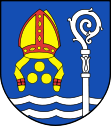
Wappen von Lubanie
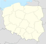
Lubanie (Polen)
Lubanie
Lubanie
Basisdaten
Staat: Polen
Woiwodschaft: Kujawien-Pommern
Landkreis: Włocławek
Geographische Lage: 52° 45′ N, 18° 55′ O52.74805555555618.919722222222Koordinaten: 52° 44′ 53″ N, 18° 55′ 11″ O
Einwohner:

810 (2006)

Postleitzahl: 87-732
Telefonvorwahl: (+48) 54
Kfz-Kennzeichen: CWL
Gemeinde
Gemeindeart: Landgemeinde
Gemeindegliederung: 19 Ortschaften
Fläche: 69,3 km²
Einwohner:

4638
(31. Dez. 2010) [1]

Bevölkerungsdichte: 67 Einw./km²
Gemeindenummer (GUS): 0418102
Verwaltung
Gemeindevorsteher: Sławomir Piernikowski
Webpräsenz: www.lubanie.com

Lubanie (deutsch 1943–1945 Liebingen) ist ein Dorf und Sitz der gleichnamigen Landgemeinde in Polen. Der Ort liegt im Powiat Włocławski der Wojewodschaft Kujawien-Pommern.

Gemeinde

Zur Landgemeinde Lubanie gehören 19 Ortschaften:

  • Barcikowo
  • Bodzia
  • Dąbrówka
  • Gąbinek
  • Janowice (1939-45 Jähnewitz)
  • Kałęczynek
  • Kaźmierzewo
  • Kocia Górka
  • Kolonia Ustrońska
  • Kucerz
  • Lubanie
  • Mikanowo A
  • Mikanowo B
  • Mikorzyn
  • Probostwo Dolne
  • Probostwo Górne
  • Przywieczerzyn
  • Przywieczerzynek
  • Sarnówka
  • Siutkówek
  • Tadzin
  • Ustronie
  • Włoszyca Lubańska
  • Zapomianowo
  • Zosin

Fußnoten

  1. Population. Size and Structure by Territorial Division. As of December 31, 2010. Główny Urząd Statystyczny (GUS), abgerufen am 9. Juli 2011.

Wikimedia Foundation.

Игры ⚽ Нужна курсовая?

Schlagen Sie auch in anderen Wörterbüchern nach:

  • Lubanie — Infobox Settlement name = Lubanie settlement type = Village total type = image shield = subdivision type = Country subdivision name = POL subdivision type1 = Voivodeship subdivision name1 = Kuyavian Pomeranian subdivision type2 = County… …   Wikipedia

  • Lubanie — Original name in latin Lubanie Name in other language Ljubane, Lubanie, Любане State code PL Continent/City Europe/Warsaw longitude 52.74689 latitude 18.9194 altitude 77 Population 810 Date 2010 09 16 …   Cities with a population over 1000 database

  • Gmina Lubanie — Infobox Settlement name = Gmina Lubanie other name = Lubanie Commune settlement type = Gmina total type = Total image shield = POL Lubanie COA.jpg subdivision type = Country subdivision name = POL subdivision type1 = Voivodeship subdivision name1 …   Wikipedia

  • Dąbrówka, Gmina Lubanie — For other uses, see Dąbrówka (disambiguation). Dąbrówka   Village   Country  Poland Voivodeship …   Wikipedia

  • Mikanowo A —   Village   Country  Poland Voivodeship Kuyavian Pomeranian …   Wikipedia

  • Mikanowo B —   Village   Country  Poland Voivodeship Kuyavian Pomeranian …   Wikipedia

  • Гмина Любане — Gmina Lubanie Герб Страна:  Польша Повят:  Влоцлавский повят Глава:  Славомир Перниковский Площадь:  69,3 км² …   Википедия

  • Bodzia — Infobox Settlement name = Bodzia settlement type = Village total type = image shield = subdivision type = Country subdivision name = POL subdivision type1 = Voivodeship subdivision name1 = Kuyavian Pomeranian subdivision type2 = County… …   Wikipedia

  • Gąbinek — Infobox Settlement name = Gąbinek settlement type = Village total type = image shield = subdivision type = Country subdivision name = POL subdivision type1 = Voivodeship subdivision name1 = Kuyavian Pomeranian subdivision type2 = County… …   Wikipedia

  • Janowice, Włocławek County — Infobox Settlement name = Janowice settlement type = Village total type = image shield = subdivision type = Country subdivision name = POL subdivision type1 = Voivodeship subdivision name1 = Kuyavian Pomeranian subdivision type2 = County… …   Wikipedia

Share the article and excerpts

Direct link
Do a right-click on the link above
and select “Copy Link”