- Mont Sébert
-
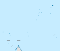
Mont Sébert Höhe 555 m Lage Mahé Geographische Lage 4° 41′ 0″ S, 55° 30′ 0″ O-4.683333333333355.5555Koordinaten: 4° 41′ 0″ S, 55° 30′ 0″ O Gestein Granit Der Mont Sébert (englisch: Mount Sebert) ist ein 555 m hoher Inselberg aus Granit auf der Ostseite der Seychellen-Insel Mahé. Die Gesamtfläche umfasst 60 Hektar. Er liegt in der Nähe der Ortschaft Cascade. In 120 m Höhe befindet sich ein Parkplatz und von dort aus führt ein unmarkierter, ziemlich steiler Pfad zum Gipfel. Das Glacis in der Nähe des Gipfels ist sehr glatt und steil. Ebenfalls am Pfad befindet sich die Ruine einer Zimt-Destillerie, die in den 1950er-Jahren aufgegeben wurde. Vom Gipfel aus kann man den internationalen Flughafen der Seychellen, die Hauptstadt Victoria und die nordwestliche Halbinsel sehen. Die Landschaft am Mont Sébert ist durch Grasland, Waldland, Glacis und Geröllfelder geprägt. Mont Sébert ist ein streng geschütztes Reservat für auf den Seychellen heimische Pflanzenarten, darunter der Quallenbaum (Medusagyne oppositifolia), Mimusops sechellarum, Excoecaria benthamiana, Toxocarpus schimperianus, Schizaea confusa sowie zahlreiche Orchideen, Palmen und Schraubenbäume. Die Fauna ist unter anderem durch Skinke der Gattung Janetaescincus und Landschneckenarten wie Stylodonta unidentata und Cyclostoma pulchrum vertreten.
Literatur
- Justin Gerlach: Key biodiversity areas of the Seychelles Islands, S. 34, Backhuys Publishers, Leiden, Netherlands, 2008, ISBN 382-361-550-5
- Rosemarie Wise: A fragile Eden: Portraits of the endemic flowering plants of the granitic Seychelles, S. 23–24, Princeton University Press, 1998, ISBN 978-069-104-817-8
Webseite
Kategorien:- Berg unter 1000 Meter
- Berg in Afrika
- Geographie (Seychellen)
- Naturschutzgebiet in Afrika
Wikimedia Foundation.

