Mount Sporli

Mount Sporli
Mount Sporli

Photo-request.svg

Bild gesucht 

BWf1

Höhe 2.255 m
Lage Westantarktis
Gebirge Heritage Range, Ellsworthgebirge
Geographische Lage 79° 32′ 39″ S, 83° 38′ 4″ W-79.544166666667-83.6344444444442255Koordinaten: 79° 32′ 39″ S, 83° 38′ 4″ W
Mount Sporli (Antarktis)
Mount Sporli

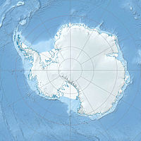
Mount Sporli ist ein 2.255 m hoher markanter Berg in der westantarktischen Heritage Range, dem südlichen Teil des Ellsworthgebirges. Er liegt an der östlichen Seite des Kopfes des Driscoll-Gletschers.[1] Von den nordwestlichen Ausläufern des Berges erstreckt sich die Mhire Spur in westlicher Richtung.[2]

Er wurde von der Geologischen Ellsworthgebirge-Expedition der University of Minnesota der Jahre 1963/64 nach Bernhard N. Sporli benannt, der als Geologe an der Expedition teilnahm.[1]

Einzelnachweise

  1. a b Mount Sporli (Englisch). Geographic Names Information System. United States Geological Survey. Abgerufen am 16. Juli 2010.
  2. Mhire Spur (Englisch). Geographic Names Information System. United States Geological Survey. Abgerufen am 16. Juli 2010.

Wikimedia Foundation.

Игры ⚽ Нужна курсовая?

Schlagen Sie auch in anderen Wörterbüchern nach:

  • Mount Sporli — (79°33′S 83°36′W / 79.55°S 83.6°W / 79.55; 83.6) is a prominent mountain, 2,255 m, standing at the east side of the head of Driscoll Glacier in the Pioneer Heights …   Wikipedia

  • Mhire Spur — 79.541666666667 83.837222222222 Koordinaten: 79° 33′ S, 83° 50′ W …   Deutsch Wikipedia

  • Mhire Spur — (79°33′S 83°50′W / 79.55°S 83.833°W / 79.55; 83.833) is a spur descending west from the heights associated with Mount Sporli to form the south limit of Larson Valley, in the Heritage Range …   Wikipedia

  • Whangarei — This article is about the city of Whangarei. For the electoral district with the same name, see Whangarei (New Zealand electorate). Whangarei Whangārei terenga paraoa Whangarei viewed from Mount Parahaki …   Wikipedia

Share the article and excerpts

Direct link
Do a right-click on the link above
and select “Copy Link”