- Oksoritod
-
Oksoritod Gewässer Pazifischer Ozean Archipel Karolinen Geographische Lage 8° 40′ N, 150° 0′ O8.6666666666667150Koordinaten: 8° 40′ N, 150° 0′ O 

Anzahl der Inseln 7 Inseln und Atolle Hauptinsel Polowat Gesamtfläche 15,05 km² Einwohner 6.219 (2000) Bundesstaat Chuuk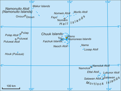
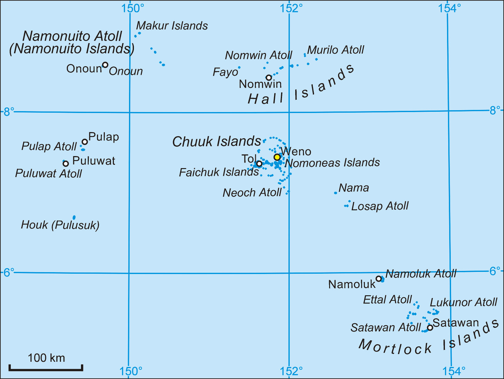
Oksoritod (auch Western Islands) ist der Name einer von fünf Inselregionen des Bundesstaates Chuuk der Föderierten Staaten von Mikronesien. Die Inseln und Atolle gehören zum Archipel der Karolinen im zentralen Pazifischen Ozean. Vom Chuuk-Atoll aus erstrecken sie sich in nördlicher und westlicher Richtung. Die Gemeinden der Inselregion werden statistisch gegliedert in die Unterregionen Halls (bestehend aus den Hall Islands und Fayu), Namonuito (ein Atoll) und Pattiw (bestehend aus den Atollen bzw. Inseln Houk oder Pulusuk, Puluwat und Pulap).[1][2] Gelegentlich wird auch für die Unterregion Pattiw der (geographisch zutreffendere) Begriff Western Islands gebraucht, womit dieser Begriff zweideutig ist.
Die Inselregion weist eine aggregierte Landfläche von 15,141 km² auf (nach anderen Angaben 15,05 km²). Zur Volkszählung 2000 lebten 6219 Einwohner auf den Atollen.[2]
Inhaltsverzeichnis
Atolle
Folgende Atolle und Einzelinseln gehören zur Region Oksoritod:
Atoll
(Insel)Land-
fläche
km²[3]Lagune
km²[3]Gesamt-
fläche
km²[4]Bevölkerung
2000Inseln Unter-
regionGemeinden Murilo 1,287 349,862 414 1076 28 Halls Murilo, Ruo Nomwin 1,854 291,564 318 1066 16 Halls Nomwin (Teil), Fananu Fayu 0,373 - 0,373 - 2 Halls Nomwin (Teil) Namonuito 4,429 1874,901 2267 1341 12 Namonuito Makur, Unanu, Onou, Pihararh, Onoun Houk 2,805 300 1) 332 1) 451 1 Pattiw Houk Polowat 3,401 300 2) 332 2) 1015 5 Pattiw Polowat Polap 0,992 31,321 43 1270 3 Pattiw Polap, Tamatam Oksoritod 15,141 3148 3706 6219 66 Oksoritod 13 1) ohne Manila Reef keine Lagunenfläche
2) ohne Uranie Bank 1,55 km² Lagunenfläche und 7 km² GesamtflächeGemeinden
Auf die Inselregion entfallen folgende 13 der insgesamt 40 Gemeinden des Bundesstaates Chuuk:
Gemeinde
(municipality)Land-
fläche[1]Bevölkerung
2000[2]Unter-
regionAtoll/
InselRuo 0,36 469 Halls Murilo (West) Murilo 0,67 607 Halls Murilo (Ost) Nomwin 2,20 711 Halls Nomwin (West)
FayuFananu 0,26 355 Halls Nomwin (Ost) Makur 0,47 156 Namonuito Namonuito (Nord) Unanu 0,26 178 Namonuito Namonuito (Ost) Onou 0,31 182 Namonuito Namonuito (Ost) Pihararh 0,80 245 Namonuito Namonuito (Südost) Onoun 2,54 580 Namonuito Namonuito (Südwest) Houk 2,80 451 Pattiw Houk Polowat 3,39 1015 Pattiw Polowat Polap 0,75 905 Pattiw Polap (Nord) Tamatam 0,23 365 Pattiw Polap (Süd) Oksoritod 15,05 6219 Oksoritod 7 Atolle/
InselnSiehe auch
Einzelnachweise
- ↑ a b Chuuk 1989 Census
- ↑ a b c Chuuk 2000 Census
- ↑ a b Otis W. Freeman, Geography of the Pacific, Wiley 1953 (auf metrisch umgerechnet) (Houk/Manila Reef und Poluwat/Uranie Bank geschätzt
- ↑ [ftp://rock.geosociety.org/pub/reposit/2001/2001075.pdf ]
Kategorie:- Chuuk nach Region

Wikimedia Foundation.