Orangozinho

Orangozinho

Vorlage:Infobox Insel/Wartung/Bild fehltVorlage:Infobox Insel/Wartung/Höhe fehlt

Orangozinho
Gewässer Atlantischer Ozean
Inselgruppe Bissagos-Archipel
Geographische Lage 11° 7′ N, 15° 56′ W11.119722222222-15.931388888889Koordinaten: 11° 7′ N, 15° 56′ W
Orangozinho (Guinea-Bissau)
Orangozinho
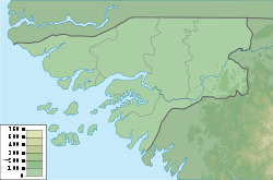
Länge 19 km
Breite 11,8 km
Fläche 107 km²

Orangozinho ist eine 107 km² große, bewohnte Insel des Bissagos-Archipels, der zu Guinea-Bissau gehört. Verwaltungsmäßig gehört sie zum Sektor Bubaque.

Sie ist von den westlich gelegenen Inseln Canogo (Nordwesten) und Meneque auf die ganze Länge von 18 Kilometern nur durch einen schmalen, 400 bis 2000 Meter breiten Meeresarm getrennt.

Weblinks


Wikimedia Foundation.

Игры ⚽ Нужен реферат?

Schlagen Sie auch in anderen Wörterbüchern nach:

  • Orangozinho — is an island in the Bissagos Islands, Guinea Bissau. Its area is 107 km². References http://islands.unep.ch …   Wikipedia

  • Orangozinho — Isla de Orangozinho Ilha de Orangozinho Localización País  Guinea Bissau Región Reg …   Wikipedia Español

  • Islas Bijagós — Archipiélago Bijagós (Bissagos) Vista de satélite (2003) Localización geográfica / administrativa …   Wikipedia Español

  • Bissagos Islands — The Bissagos Islands or Bijagós Archipelago are a group of some eighteen major islands and dozens more smaller ones in the Atlantic Ocean. They are a part of Guinea Bissau. In pre colonial times the islands were central to the trade along the… …   Wikipedia

  • Orango — is one of the Bijagós Islands, located 60 kilometers[1] (38 miles) off the coast of mainland Guinea Bissau. It is the centre of the Ilhas de Orango National Park and has one town, Eticoga. Orango is known for its saltwater hippopotamuses.[2]… …   Wikipedia

  • Archipelago dos Bijagos — Karte des Bissagos Archipels Der Bissagos Archipel (auch Bijagós Archipel oder Bissagosinseln) ist eine aus 88 Inseln bestehende Inselgruppe vor der Küste Guinea Bissaus im Atlantischen Ozean. Inhaltsverzeichnis 1 …   Deutsch Wikipedia

  • Bijagos-Archipel — Karte des Bissagos Archipels Der Bissagos Archipel (auch Bijagós Archipel oder Bissagosinseln) ist eine aus 88 Inseln bestehende Inselgruppe vor der Küste Guinea Bissaus im Atlantischen Ozean. Inhaltsverzeichnis 1 …   Deutsch Wikipedia

  • Bijagos-archipel — Karte des Bissagos Archipels Der Bissagos Archipel (auch Bijagós Archipel oder Bissagosinseln) ist eine aus 88 Inseln bestehende Inselgruppe vor der Küste Guinea Bissaus im Atlantischen Ozean. Inhaltsverzeichnis 1 …   Deutsch Wikipedia

  • Bissagos-Archipel — Karte des Bissagos Archipels Gewässer Atlantischer Ozean …   Deutsch Wikipedia

  • Bissagos-Inseln — Karte des Bissagos Archipels Der Bissagos Archipel (auch Bijagós Archipel oder Bissagosinseln) ist eine aus 88 Inseln bestehende Inselgruppe vor der Küste Guinea Bissaus im Atlantischen Ozean. Inhaltsverzeichnis 1 …   Deutsch Wikipedia

Share the article and excerpts

Direct link
Do a right-click on the link above
and select “Copy Link”