Padum

Padum
Padum
Padum (Indien)
Red pog.svg
Staat: Indien
Bundesstaat: Jammu und Kashmir
Distrikt: Kargil
Lage: 33° 28′ N, 76° 53′ O33.4776.883669Koordinaten: 33° 28′ N, 76° 53′ O
Höhe: 3669 m
Einwohner: 1.000

d1

Padum (auch Padam) ist der größte Ort und das Verwaltungszentrum des zum Kargil District gehörigen Zanskar-Tehsil im indischen Staat Jammu und Kashmir. Es ist von Kargil etwa 240 km entfernt.

Inhaltsverzeichnis

Beschreibung

Die Einwohnerzahl beträgt etwa 1000.[1] Der traditionelle Ortskern befindet sich unterhalb der Gompa, wo zwei große Chörten oberhalb großer Gebäude stehen. 1980 wurde eine Straße von Kargil über den Pensi La nach Padum gebaut. Der Ort hat mehrere Hotels und Restaurants für Touristen. Es gibt ein Postamt, Internetcafes und Telefonzellen.

Geographie

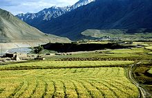
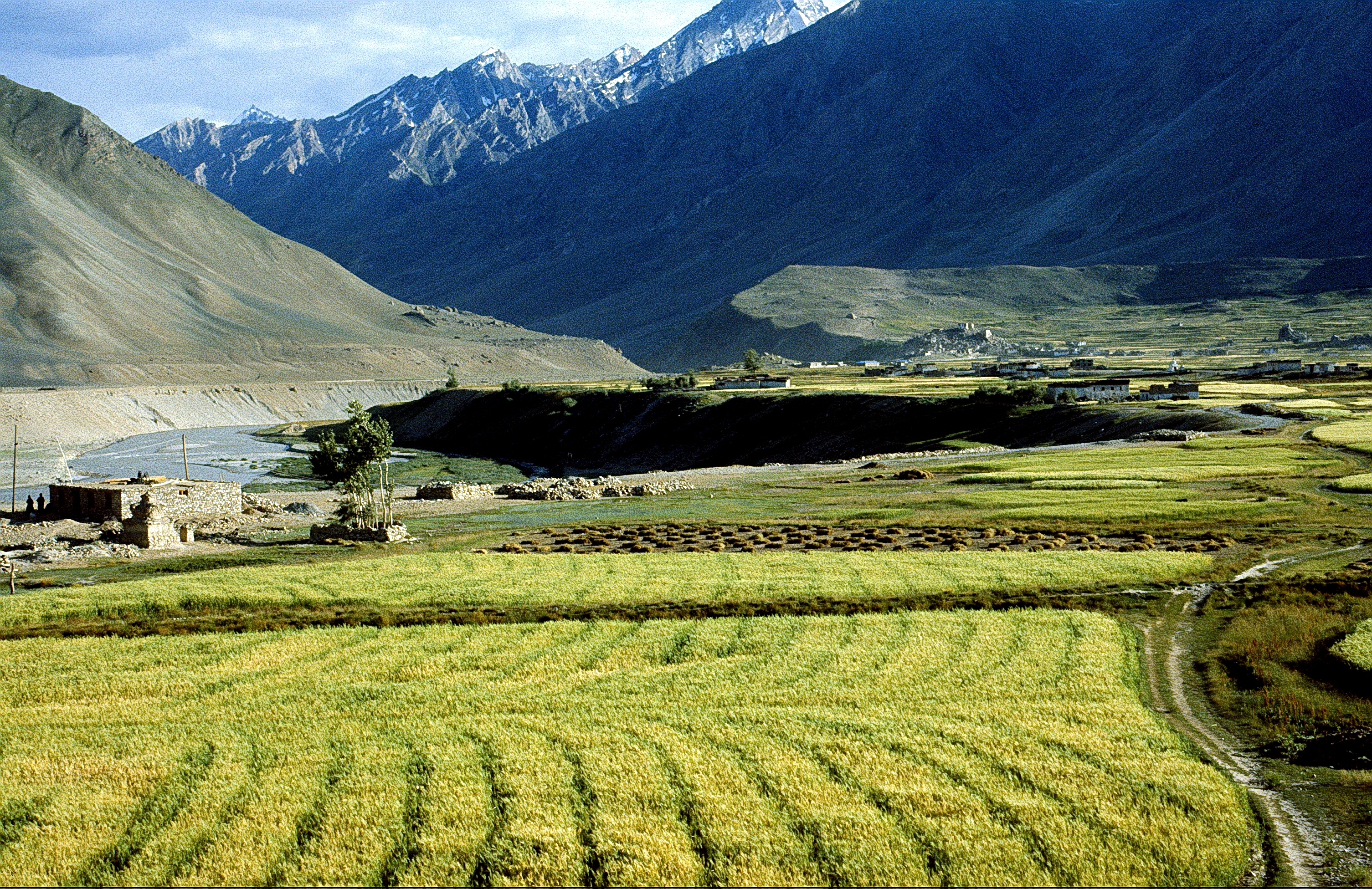
Padum liegt im Zentrum von Zanskar und hat [2] eine durchschnittliche Meereshöhe von 3669 m. Mehrere kleine Dörfer liegen rund um Padum.

Bevölkerung

Padum wird hauptsächlich von Menschen tibetischer Herkunft bewohnt, deren Religion der Tibetische Buddhismus ist. Es gibt aber eine nennenswerte muslimische Minderheit (etwa 40 % der Bevölkerung), hauptsächlich Balti, die seit dem 17. Jahrhundert in Padum leben. Vor einigen Jahren wurde eine Moschee gebaut.

Padum-Tal

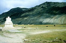
Kloster Kursha im Padum-Tal
Padum

Das Padum-Tal wird vom Fluss Doda durchflossen, dessen Quelle vom Drang-Drung-Gletscher in der Nähe des Pensi La gespeist wird. Weiter unterhalb mündet der Doda in den Zanskar-Fluss.

Einige sehenswerte buddhistische Klöster liegen in der Nähe von Padum, unter anderem Bardan und Kursha.

  1. Osada et al (2000), p. 298.
  2. Osada et al (2000), p. 298.

Wikimedia Foundation.

Игры ⚽ Нужен реферат?

Schlagen Sie auch in anderen Wörterbüchern nach:

  • Padum — Infobox Indian Jurisdiction native name = Padum | type = city | latd = 33.47| longd = 76.88 state name = Jammu and Kashmir district = Kargil leader title = leader name = altitude = 3669 population as of = population total = | population density …   Wikipedia

  • Zanskar — is a subdistrict or tehsil of the Kargil district, which lies in the eastern half of the Indian state of Jammu and Kashmir. The administrative centre is Padum. Zanskar, together with the neighbouring region of Ladakh, formerly belonged to Guge or …   Wikipedia

  • Monastère de Karsha — Vue partielle du monastère, 1991 Chemin de Padum ve …   Wikipédia en Français

  • Ladakh —   region   …   Wikipedia

  • DURIA, DORIA — Ptol fluv. Gall. Subalpinae in Pedemontana reg. geminus: unus per Salassos in Padum influens, alter per Segusium et Taurinos decurrens in eundem Padum labitur. Uterque vulgo Doria, et Doira nominatur, prior ex Graiis, alter ex Cottiis Alpibus… …   Hofmann J. Lexicon universale

  • Goundamani — Infobox actor name = Goundamani imagesize = 250px caption = Goundamini birthname = Goundamani birthplace = flagicon|India Coimbatore, India othername = KounderMani or Koundamani occupation = Actor, Comedian yearsactive = 1977 presentGoundamani is …   Wikipedia

  • Pensi La — Infobox Mountain Pass Name = Pensi La Elevation = Unit m | 4400 | 0 Location = Jammu and Kashmir, India Range = Himalaya Coordinates = coord|33.871554|76.34907 Topographic Traversed by =Pensi la is a mountain pass in the Ladakh region of Jammu… …   Wikipedia

  • Zangla — Infobox Indian Jurisdiction native name = Zangla | type = city | latd = 33.67 | longd = 76.98 locator position = right | state name = Jammu and Kashmir district = Kargil leader title = leader name = altitude = 3931 population as of = population… …   Wikipedia

  • Tourism in Ladakh — Ladakh (bo|t=ལ་དྭགས་|script=yes, Ladakhi IPA2|lad̪ɑks, Hindi: लद्दाख़, Urdu: لدّاخ; Hindi IPA2|ləd̪.d̪ɑːx) , a word which means land of high passes , is a region in the state of Jammu and Kashmir of Northern India sandwiched between the Karakoram …   Wikipedia

  • Ladakh — Mapa de Kashmir con Ladakh resaltado en rojo. Ubicación de Ladakh …   Wikipedia Español

Share the article and excerpts

Direct link
Do a right-click on the link above
and select “Copy Link”