Parengarenga Harbour

Parengarenga Harbour
Parengarenga Harbour (Neuseeland)
Red pog.svg
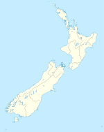
Lage des Parengarenga Harbour in Neuseeland

Der Parengarenga Harbour ist ein Naturhafen an der Ostseite des Nordens der Aupouri Peninsula auf der Nordinsel Neuseelands. Administrativ gehört er zum Northern Ward des Far North Distriktes der Region Northland. Der Hafen besteht aus mehreren verzweigten Armen, die sich nach Westen bis zur Mitte der Halbinsel und dem dort verlaufenden State Highway 1 erstrecken. Dort befinden sich etwas westlich der Bucht die Orte Waitiki Landing und am Ufer der Snipe Bay Karatia. Nördlich der Mündung des als Snipe Bay bekannten nordöstlichen Armes liegt die Siedlung Te Hapua, südlich davon auf einer Landzunge zwischen Snipe und Ngutukorari Bay die Siedlung Paua.

Die Zufahrt zum Hafen ist nur etwa 300 m breit, die Gesamtausdehnung der Arme im Landesinnere beträgt etwa 16 km in Nord-Süd-Richtung und 12 km in Ost-West-Richtung. Im südlichen Arm des Habens liegt die kleine Insel Kaipohue Island. [1]

Der leuchtendweiße Sand des Kokota Sandspit, der sich südlich der Hafenmündung erstreckt war eine Quelle für qualitativ hochwertigem Quarzsand zur Glasherstellung.[2] Ein Abbau erfolgte bis 1997. Während auch anderswo in Northland kleiner oder weniger reine Quarzsandvorkommen gefunden wurden, sind die Lagerstätten des Parengarenga Harbour die bei weitem größten der Region.[3]

Einzelnachweise

  1. New Zealand Travel Atlas, Wise Maps Auckland ISBN 0-908794-47-9
  2. Rock, limestone and clay - sources and uses in Te Ara Encyclopedia of New Zealand. Abgerufen am 29. Januar 2011.
  3. Mineral resource assessment of the Northland Region, New Zealand (PDF), 2007/06, 179, S. 123–126, Lower Hutt: GNS Science Mai 2007, ISBN 0-478-09969-X (Zugriff am 25. April 2009)
-34.5166667172.950

Wikimedia Foundation.

Игры ⚽ Нужно сделать НИР?

Schlagen Sie auch in anderen Wörterbüchern nach:

  • Parengarenga Harbour — is a natural harbour close to the northernmost point on the North Island of New Zealand. Located at the northern end of the Aupouri Peninsula, [cite encyclopedia|url=http://www.teara.govt.nz/Places/Northland/NorthlandPlaces/1/en|title=Aupōuri… …   Wikipedia

  • Kaipohue Island — Vorlage:Infobox Insel/Wartung/Bild fehltVorlage:Infobox Insel/Wartung/Höhe fehlt Kaipohue Island Gewässer Parengarenga Harbour Geographische Lage …   Deutsch Wikipedia

  • Aupouri Peninsula — The Aupouri Peninsula is a tombolo [Black, Philippa and Gregory, Murray (2002). [http://www.gsnz.org.nz/gs downloads/fieldtrips/MP112B FT9.pdf Field trip 9: Geological gems of the Far North] , in Smith, V. and Grenfell, H.R. (editors) (2002):… …   Wikipedia

  • Plagusia capense — Taxobox name = Red rock crab regnum = Animalia phylum = Arthropoda subphylum = Crustacea classis = Malacostraca ordo = Decapoda subordo = Pleocyemata infraordo = Brachyura familia = Grapsidae genus = Plagusia species = P. capense binomial =… …   Wikipedia

  • List of shipwrecks in 1971 — The list of shipwrecks in 1971 includes ships sunk, foundered, grounded, or otherwise lost during 1971.February February 22 * Endeavour II (NZ) a three masted auxiliary barque of overall length 94 feet (29 m). The ship was driven ashore in… …   Wikipedia

  • Aupouri-Halbinsel — Aupouri Peninsula NASA Satellitenaufnahme der Aupouri Peninsula Gewässer 1 Pazifischer Ozean …   Deutsch Wikipedia

  • Aupouri Peninsula — NASA Satellitenaufnahme der Aupouri Peninsula Lage der Aupouri Peninsula in Neuseeland Die Aupouri Peninsula ist ein Tombolo …   Deutsch Wikipedia

  • North Cape, New Zealand — …   Wikipedia

  • Te Hapua — Infobox Settlement name = Te Hapua subdivision type = Country subdivision name = New Zealand subdivision type1= Region subdivision name1= Northland Region subdivision type2= District subdivision name2= Far North District pushpin latd = 34 latm =… …   Wikipedia

  • North Cape — Lage des North Cape Das North Cape liegt im äußersten Nordosten der Aupouri Peninsula, des nördlichen Ausläufers der North Auckland Peninsula der Nordinsel Neuseelands. Seine Nordostspitze liegt 30 km östlich von der Nordwestspitze der Halbinsel… …   Deutsch Wikipedia

Share the article and excerpts

Direct link
Do a right-click on the link above
and select “Copy Link”