Parson’s Barn

Parson’s Barn


Parson's Barn
Gewässer Ärmelkanal

Geographische Lage

50° 38′ 27,38″ N, 1° 55′ 31,01″ W50.64094-1.92528Koordinaten: 50° 38′ 27,38″ N, 1° 55′ 31,01″ W
Parson's Barn (England)
Parson's Barn

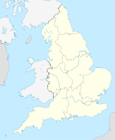
Parson's Barn ist eine große Kaverne auf Höhe des Meeresspiegels am Ärmelkanal auf der Isle of Purbeck in der Grafschaft Dorset, an der Südküste von England.

Inhaltsverzeichnis

Lage

Sie liegt unterhalb der Ballard Point Klippen, zwischen Studland Bucht und Swanage Bucht. Die Höhle Parson’s Barn befindet sich direkt östlich von Studland, ein paar hundert Meter südlich von Handfast Point und des Old Harry Rocks etwa fünf Kilometer nordöstlich von Swanage.

Beschaffenheit

Das Meer hat einst ein großes Loch in den Felsen geschwemmt. Küste und Klippen entlang Ost Devon und Dorset am Ärmelkanal gehören zu den Naturwundern der Welt. Von Orcombe Point bei Exmouth bis zu den Old Harry Rocks bei Studland Bay, erstreckt sich ein 155 Kilometer langer Küstenstreifen, der als erste Naturlandschaft in England von der UNESCO zum Weltnaturerbe erklärt wurde[1]. Die Höhle Parson’s Barn ist Teil der sogenannten Jurassic Coast. Orcombe Point ist durch eine Geo-Nadel gekennzeichnet, er zeigt den Ausgangspunkt für die World Heritage Tour. Die Steinschichten entlang der Jurassic Coast sind leicht nach Osten geneigt. Deswegen wird der älteste Teil der Küste im westlichen Bereich gefunden.

Legende

Die entstandene Kaverne wurde als Schmugglerversteck benützt. Ein Großteil ist seitdem eingestürzt und wurde vom Meer erodiert, nur einige Felsnadeln blieben stehen. Die Wellen haben Bögen in die Kreidesäulen geschnitten. Wenn die Winde während schwerer Stürme wehen, erzeugt dies Klänge wie bei einem Glockenläuten. Der Legende nach kommen diese Töne von einem Schiff, das Glocken für eine Kirche nach Poole brachte und der wegen des Gotteslästerung der Besatzung an dieser Stelle sank.

siehe auch

Einzelnachweise

  1. Dorset and East Devon Coast. UNESCO World Heritage Centre (2001). Abgerufen am 19. Oktober 2010.

Wikimedia Foundation.

Игры ⚽ Поможем решить контрольную работу

Schlagen Sie auch in anderen Wörterbüchern nach:

  • Liste der Orte entlang der Jurassic Coast — Die Geoneedle am Orcombe Point nahe Exmouth besteht aus verschiedenen Gesteinsarten, die entlang der Jurassic Coast zu finden sind. Eine Liste der Orte entlang der Jurassic Coast an der Südküste Englands, von Devon bis in die Grafschaft Dorset… …   Deutsch Wikipedia

  • Tithe — For the type of land division, see Tithing (country subdivision). The Tithe Pig, group by Derby Porcelain, c. 1770 A tithe ( …   Wikipedia

  • Earl Shilton — Infobox UK place official name= Earl Shilton country = England os grid reference= SP472980 latitude= 52.57777 longitude= 1.30491 map type= Leicestershire civil parish= population = shire district= Hinckley and Bosworth shire county=… …   Wikipedia

  • The Electric Amish — is an Indiana based parody rock band that takes well known rock standards and recasts them from a heavily tongue in cheek Amish perspective. The band consists of three fictional characters: Graeber Goodman (born in Las Vegas, Nevada, moved to… …   Wikipedia

  • National Register of Historic Places listings in Essex County, Massachusetts — Location of Essex County in Massachusetts This is a list of the National Register of Historic Places listings in Essex County, Massachusetts. This is intended to be a complete list of the properties and districts on the National Register of… …   Wikipedia

  • South Luffenham — is a village in the county of Rutland in the East Midlands of England.It once had a railway station that was located to the north of the village and also served the neighbouring village of North Luffenham. It was opened in 1848 and closed in 1966 …   Wikipedia

  • Darlington, Wisconsin — Darlington   City   …   Wikipedia

  • National Register of Historic Places listings in Kent County, Delaware — Map of all coordinates from Google Map of all coordinates from Bing …   Wikipedia

  • The History of Tom Jones, a Foundling — infobox Book | name = Tom Jones title orig = The History of Tom Jones, a Foundling translator = image caption = Title page from the 1749 edition author = Henry Fielding illustrator = cover artist = country = Britain language = English series =… …   Wikipedia

  • National Register of Historic Places listings in Washington — AD AS BE CH CM …   Wikipedia

Share the article and excerpts

Direct link
Do a right-click on the link above
and select “Copy Link”