- Port St. Johns
-
Port St. Johns 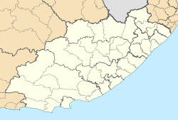

Port St. Johns Basisdaten Staat Südafrika Provinz Ostkap Distrikt O.R. Tambo Gemeinde Port St. Johns Einwohner 2.035 Gründung 1845 ISO 3166-2 ZA-EC Webauftritt www.portstjohns.org.za (englisch) -31.62222222222229.545555555556Koordinaten: 31° 37′ S, 29° 33′ OPort St. Johns (auch Port St Johns oder Umzimvubu) ist eine Stadt in der Provinz Ostkap in Südafrika. Sie liegt am Indischen Ozean und war die einzige Hafenstadt des 1994 aufgelösten, formal unabhängigen Homelands Transkei. Die Namensherkunft ist unklar.
Inhaltsverzeichnis
Geographie
Port St. Johns liegt an der Wild Coast, einem rund 270 Kilometer langen, wenig besiedelten Küstenabschnitt. Die Stadt befindet sich an der Mündung des Mzimvubu in den Indischen Ozean. Oberhalb von Port St. Johns liegen beiderseits des Flusses die Sandsteinberge Mount Thesiger (342 Meter über dem Meeresspiegel) und Mount Sullivan (304 Meter),[1] die nach zwei britischen Offizieren benannt wurden.
Der Ort liegt im Distrikt O.R. Tambo und in der Gemeinde Port St. Johns, deren Verwaltungssitz er ist. Port St. Johns hat 2.035 Einwohner (Hochrechnung).[2]
Das Klima ist subtropisch.
Geschichte
Port St. Johns wurde 1845 durch den Pondokönig Faku und seinen Sohn Ndamase gegründet. 1878 wurde Port St. Johns Teil der Kapkolonie. Thesiger und Sullivan hissten aus diesem Anlass die britische Flagge in Port St. Johns. 1884 wurde das Gebiet offiziell annektiert. Mit der Gründung des autonomen Gebiets Transkei im Zuge der Homeland-Politik wurde die Stadt eine Exklave der Kapprovinz. Mit der Bildung des formal unabhängigen Staates Transkei wurde Port St. Johns 1976 Teil dieses Gebiets. 1994 kam die Stadt wie die gesamte Transkei zur Provinz Ostkap.
Wirtschaft und Verkehr
Port St. Johns hat vor allem Bedeutung als Zentrum des Tourismus an der Wild Coast. Es gilt als beliebter Urlaubsort für Aussteiger. In der Nähe der Stadt gibt es drei Strände.
Von Mthatha im Westen und Kokstad im Norden führt die R61 bis kurz vor Port St. Johns. Von dort ist die Straße bis zur Stadt ebenfalls gut ausgebaut. Entlang der Küste führt keine Straße. Port St. Johns verfügt über einen Flugplatz.
Der Pondoland Park ist ein geplanter 500 km² großer Nationalpark, der sich von der Umzimvubumündung nordwärts bis zur Grenze der Provinz KwaZulu-Natal erstrecken soll.[3]
Flora und Fauna
Port St. Johns ist dank des subtropischen, feuchten Klimas von immergrünen Regenwäldern umgeben.
Weblinks
- Offizielle Website (englisch)
- Informationen zu Port St. Johns (englisch)
- Geschichte Port St. Johns' (englisch)
- Historische Fotos
- Landkarte von Port St. Johns und näherer Umgebung
Einzelnachweise
- ↑ Stadtplan, abgerufen am 17. Februar 2010
- ↑ Angaben auf bevoelkerungsstatistik.de, abgerufen am 30. Juli 2011
- ↑ Informationen zum geplanten Nationalpark (englisch), abgerufen am 17. Februar 2010
Kategorie:- Ort in der Provinz Ostkap

Wikimedia Foundation.