- Choptank River
-
Choptank River 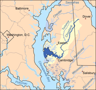
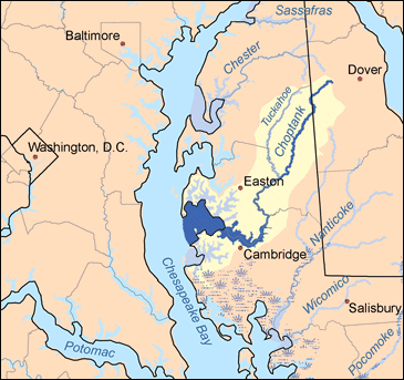
Flusssystem im östlichen Maryland. Hervorgehoben sind der Choptank River und seine Zuflüsse
Daten Gewässerkennzahl US: 583766 Lage Delaware und Maryland, USA Flusssystem Choptank River Quelle im Kent County (Delaware)
39° 4′ 3″ N, 75° 44′ 11″ W39.0676131-75.7363201Mündung in die Chesapeake Bay 38.6345644-76.3266152Koordinaten: 38° 38′ 4″ N, 76° 19′ 36″ W
38° 38′ 4″ N, 76° 19′ 36″ W38.6345644-76.3266152Einzugsgebiet 2.600 km² Der Choptank River ist ein bedeutender Zufluss der Chesapeake Bay an der Ostküste der USA. Der Fluss entspringt in Kent County in Delaware und verläuft dann durch den Bundesstaat Maryland. Der Fluss verläuft nördlich des Nanticoke River.
Das Einzugsgebiet des Choptank River umfasst rund 2.600 km². Etwa 580 km² davon sind offene Wasserflächen. 48 Prozent des vom Choptank River entwässerten Gebietes werden landwirtschaftlich genutzt.
Der Verlauf des Choptank wurde unter anderem von der Sklavereigegnerin und Angehörigen der sogenannten Underground Railroad Harriet Tubman genutzt, als sie entflohene Sklaven von Maryland nach Pennsylvania und Kanada führte.
Quellen
- United States Geological Survey. 7.5 minute series topographic quadrangles.
- Chesapeake Bay Program Watershed Profile: Choptank River
Kategorien:- Fluss in Nordamerika
- Fluss in Delaware
- Fluss in Maryland
Wikimedia Foundation.