- Zaniemyśl
-
Zaniemyśl 
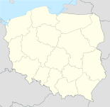
Basisdaten Staat: Polen Woiwodschaft: Großpolen Landkreis: Środa Wielkopolska Geographische Lage: 52° 9′ N, 17° 10′ O52.1517.166666666667Koordinaten: 52° 9′ 0″ N, 17° 10′ 0″ O Einwohner: 2200 (2007)
Postleitzahl: 63-020 Telefonvorwahl: (+48) 61 Kfz-Kennzeichen: PSR Wirtschaft und Verkehr Nächster int. Flughafen: Posen-Ławica Gemeinde Gemeindeart: Landgemeinde Gemeindegliederung: 18 Schulzenämter Fläche: 106,8 km² Einwohner: 6351
(31. Dez. 2010) [1]Bevölkerungsdichte: 59 Einw./km² Gemeindenummer (GUS): 3025052 Verwaltung Gemeindevorsteher: Krzysztof Urbas Adresse: ul. Średzka 9
63-020 ZaniemyślWebpräsenz: www.zaniemysl.pl Zaniemyśl (deutsch: Santomischel) ist ein Dorf und Sitz einer Gemeinde in Polen im Powiat Średzki (Großpolen) der Wojewodschaft Großpolen.
Gemeinde
Zur Landgemeinde Zaniemyśl gehören 18 Ortsteile (deutsche Namen bis 1945)[2] mit einem Schulzenamt:
- Bożydar (Bozydar)
- Brzostek
- Czarnotki (Czarnotki)
- Jaszkowo
- Jeziory Wielkie (Groß Jeziory)
- Kępa Wielka
- Luboniec
- Lubonieczek
- Łękno
- Mądre
- Pigłowice (Piglowitz)
- Płaczki
- Polesie
- Polwica
- Śnieciska (Snieciska)
- Winna
- Zaniemyśl (Santomischel)
- Zwola
Weitere Ortschaften der Gemeinde sind:
- Dębice
- Dobroczyn Drugi
- Dobroczyn Pierwszy
- Doliwiec Leśny
- Jeziorskie Huby
- Jeziory Małe
- Józefowo
- Kępa Mała
- Konstantynowo
- Kowalka
- Ludwikowo
- Majdany
- Polwica-Huby
- Potachy
- Wyszakowo
- Wyszakowskie Huby
- Zofiówka
Fußnoten
- ↑ Population. Size and Structure by Territorial Division. As of December 31, 2010. Główny Urząd Statystyczny (GUS), abgerufen am 23. Juni 2011.
- ↑ Das Genealogische Orts-Verzeichnis
Kategorien:- Gmina in der Woiwodschaft Großpolen
- Ort der Woiwodschaft Großpolen
Wikimedia Foundation.

