Serpentine-Jarrahdale Shire
- Serpentine-Jarrahdale Shire
-
-32.283333333333115.98333333333
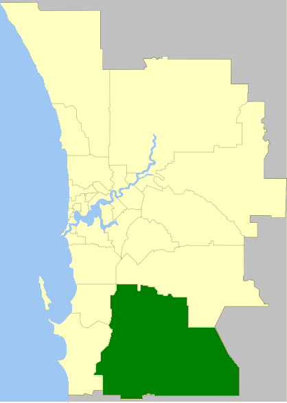
Das Shire of Serpentine-Jarrahdale ist ein lokales Verwaltungsgebiet (LGA) im australischen Bundesstaat Western Australia. Serpentine-Jarrahdale gehört zur Metropole Perth, der Hauptstadt von Western Australia. Das Gebiet ist 905 km² groß und hat etwa 13.000 Einwohner.
Serpentine-Jarrahdale liegt am Südrand des Stadtgebiets von Perth etwa 30 bis 55 km südöstlich des Stadtzentrums. Der Sitz des Shire Councils befindet sich im Stadtteil Mundijong, wo etwa 1500 Einwohner leben[2].
Verwaltung
Der Serpentine-Jarrahdale Council hat zehn Mitglieder. Sie werden von den Bewohnern der vier Wards (je drei aus Byford und Centrall Ward, je zwei aus North West und South Ward) gewählt. Aus dem Kreis der Councillor rekrutiert sich auch der Ratsvorsitzende und Shire President.
Quellen
- ↑ Australian Bureau of Statistics (25. Oktober 2007): Serpentine-Jarrahdale (S) (Local Government Area) (Englisch). 2006 Census QuickStats. Abgerufen am 24. Juli 2010.
- ↑ Australian Bureau of Statistics (25. Oktober 2007): Mundijong (State Suburb) (Englisch). 2006 Census QuickStats. Abgerufen am 24. Juli 2010.
Weblinks
Kategorie: - Local Government Area in Western Australia
Wikimedia Foundation.
Schlagen Sie auch in anderen Wörterbüchern nach:
Shire of Serpentine-Jarrahdale — Infobox Australian Place | type = lga name = Shire of Serpentine Jarrahdale state = wa imagesize= 180 caption = pop = 12,889 (2006 census) area = 905 est = 1894 seat = Mundijong mayor = Denyse L. Needham region = Peel region Rural Armadale… … Wikipedia
Electoral district of Serpentine-Jarrahdale — Infobox Australian Electorate name = Serpentine Jarrahdale state = wa caption = lifespan = 2005–2008 mp = mp party = namesake = Shire of Serpentine Jarrahdale area = 1359 class = East MetropolitanSerpentine Jarrahdale was an electoral district of … Wikipedia
Shire of Murchison — Western Australia Location in Western Australia Population … Wikipedia
Shire of Derby-West Kimberley — Western Australia Population: 7,9 … Wikipedia
Shire of Christmas Island — Population: 1,440(2009)[1] … Wikipedia
Shire of Ngaanyatjarraku — Western Australia Location in Western Australia Population … Wikipedia
Jarrahdale, Western Australia — Infobox Australian Place | type = suburb name = Jarrahdale city = state = Western Australia caption = Entering Jarrahdale from Perth lga = Shire of Serpentine Jarrahdale postcode = 6124 est = pop = 956 (2006 census) area = propval = stategov =… … Wikipedia
Shire of Murray — This article is about the Western Australian Shire of Murray. For the New South Wales shire, see Murray Shire. Shire of Murray Western Australia Location in … Wikipedia
Serpentine, Western Australia — Infobox Australian Place | type = suburb name = Serpentine city = Perth state = wa caption = D2 caterpillar on display in the Serpentine Vintage Tractor Museum lga = Shire of Serpentine Jarrahdale postcode = 6125 est = 1893 pop = 1,856 (2006… … Wikipedia
Serpentine (disambiguation) — The word serpentine may refer to:* Serpentine shape, an object or design shaped like the letter S or like a snake * The S shaped riding figure used when training horses. * Serpentine group, a common mineral group * Serpentine belt, a type of… … Wikipedia

 Australien
 Western Australia