- Skačany
-
Skačany
Wappen Karte 
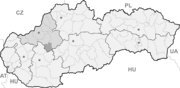

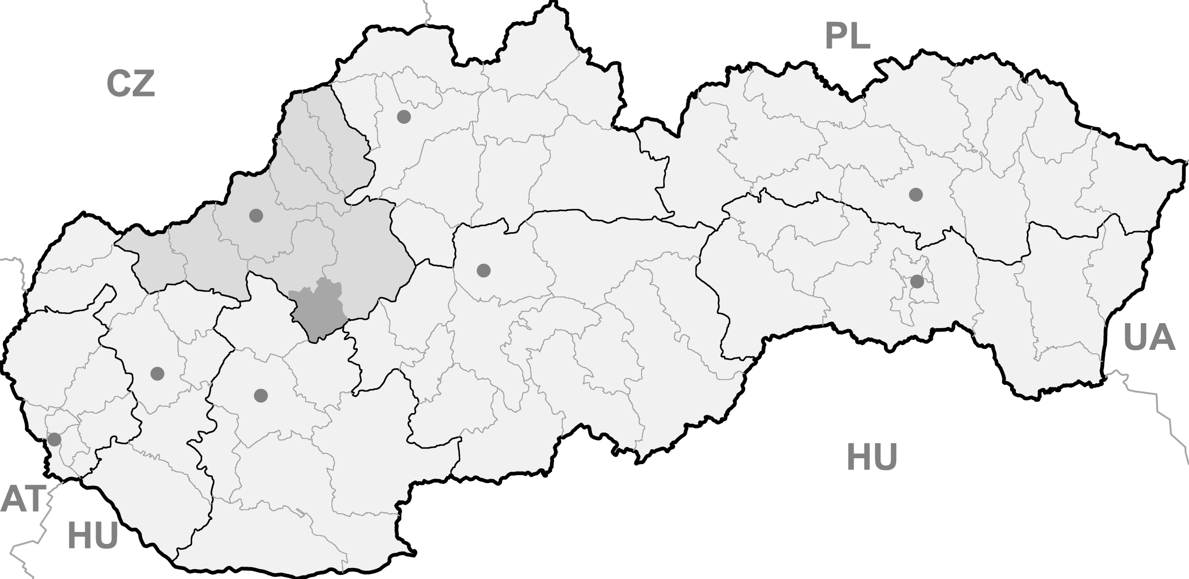
Skačany BasisdatenKraj: Trenčiansky kraj Okres: Partizánske Region: Horná Nitra Fläche: 15,378 km² Einwohner: 1.285 (31. Dez. 2010) Bevölkerungsdichte: 83,56 Einwohner je km² Höhe: 207 m n.m. Postleitzahl: 958 53 Telefonvorwahl: 0 38 Geographische Lage: 48° 40′ N, 18° 23′ O48.66111111111118.380555555556207Koordinaten: 48° 39′ 40″ N, 18° 22′ 50″ O Kfz-Kennzeichen: PE Gemeindekennziffer: 505463 StrukturGemeindeart: Gemeinde Verwaltung (Stand: Juli 2011)Bürgermeister: Ladislav Struhár Adresse: Obecný úrad Skačany
Nám. SNP 451
958 53 SkačanyWebpräsenz: www.skacany.sk Gemeindeinformation
auf portal.gov.skStatistikinformation
auf statistics.skSkačany (ungarisch Szkacsány - bis 1907 Szkacsán) ist ein Ort und eine Gemeinde im Westen der Slowakei, mit 1285 Einwohnern (Stand 31. Dezember 2010). Sie liegt im Okres Partizánske, einem Kreis der höheren Verwaltungseinheit Trenčiansky kraj.
Geographie
Skačany liegt am Fluss Nitrica am nordöstlichen Zipfel des slowakischen Donauhügellands und, sechs Kilometer von Partizánske entfernt.
Geschichte
Die Besiedlungsnachweise reichen bis in die Bronzezeit, mit Funden der Lausitzer Kultur. Der Ort wurde zum ersten Mal 1078 schriftlich erwähnt und wurde später zum Sitz eines Herrschaftsguts, die 14 Gemeinden umfasste. 1698 erhielt der Ort das Marktrecht und entwickelte sich danach als kleiner Marktflecken. Bis heute ist die Gemeinde landwirtschaftlich geprägt.
Sehenswürdigkeiten
- klassizistische römisch-katholische Pfarrkirche der Allerheiligen aus dem Jahr 1803
- Grundbau der romanischen Georgskirche, erbaut irgendwann im 13. Jahrhundert
- barocke Kapelle der hl. Barbara aus dem Jahr 1731
Gemeinden im Okres PartizánskeBošany (Boschan) | Brodzany | Hradište | Chynorany | Ješkova Ves | Klátova Nová Ves (Stockneudorf) | Kolačno | Krásno | Livina (Livina) | Livinské Opatovce (Livina-Opatowitz) | Malé Kršteňany (Kleinkresten) | Malé Uherce | Nadlice | Nedanovce (Nedanowetz) | Ostratice | Partizánske | Pažiť | Skačany | Turčianky | Veľké Kršteňany (Großkresten) | Veľké Uherce | Veľký Klíž | Žabokreky nad Nitrou
Wikimedia Foundation.
Schlagen Sie auch in anderen Wörterbüchern nach:
Skačany — (Village) Administration Pays Slovaquie … Wikipédia en Français
Skačany — is a village and municipality in Partizánske District in the Trenčín Region of western Slovakia.HistoryIn historical records the village was first mentioned in 1078.GeographyThe municipality lies at an altitude of 207 metres and covers an area of … Wikipedia
Trenčín Region — Geobox | Region name = Trenčín other name = category = Region image caption = image caption = symbol = Trencin coat of arms.gif symbol type = Coat of arms etymology = official name = motto = nickname = country = Slovakia country state = region =… … Wikipedia
Partizánske District — District Country Slovakia … Wikipedia
List of municipalities and towns in Slovakia — Slovakia This is a comprehensive list of municipalities and towns in Slovakia. For lists of towns and municipalities sorted by Regions see the individual articles on Regions. For an outdated list of towns only in Slovakia see also List of towns… … Wikipedia
Chynorany — Location of Partizánske District in the Trenčín Region Chynorany is a village and municipality in Partizánske District in the Trenčín Region of western Slovakia. History In historical records the … Wikipedia
Nedanovce — Location of Partizánske District in the Trenčín Region Nedanovce is a village and municipality in Partizánske District in the Trenčín Region of western Slovakia. History In historical records the … Wikipedia
Ostratice — Location of Partizánske District in the Trenčín Region Ostratice is a village and municipality in Partizánske District in the Trenčín Region of western Slovakia. History In historical records the … Wikipedia
Nadlice — Location of Partizánske District in the Trenčín Region Nadlice is a village and municipality in Partizánske District in the Trenčín Region of western Slovakia. History In historical records the vi … Wikipedia
Ješkova Ves — Location of Partizánske District in the Trenčín Region Ješkova Ves is a village and municipality in Partizánske District in the Trenčín Region of western Slovakia. History In historical records the … Wikipedia
Skačany

18+
© Academic, 2000-2026
- Kontaktieren Sie uns: Unterstützung, Werbung
Wörterbücher Export, schritte mit PHP, Joomla, Drupal, WordPress, MODx.